Chest opened
+${chestReward.xp} XP
Explorer
NOUVEAU ×${chestReward.collectible.quantity}
tapez pour fermer
Chest locked

Open chests in the app

Around Us is built for your phone — chests unlock when you walk, explore and capture nearby places.

Enable Location

We need your location to show you interesting places around you

Discover nearby places

Find interesting locations and hidden gems around you

Precise directions

Get accurate directions and distances to places

Your location is never shared with other users. It's only used when you tap the location button.

Log in to your account

Start exploring — it's free

Trusted by 72,885 travelers worldwide

Continue with Google
Continue with Apple
or

We will send you a code to connect

By continuing, you accept our Terms and Conditions and our Privacy Policy

Check your inbox

We've sent a pincode in your inbox. Please enter the code below.

San Jacinto River
Discussion Reviews Photo
18.2k Popularity

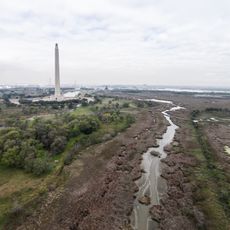
San Jacinto River, River system in Southeast Texas, United States.

The San Jacinto River is a river system in Southeast Texas that splits into two main branches, the East Fork and West Fork, merging again before flowing into Galveston Bay. The waterway has been reshaped by dams and reservoirs that now serve as important water sources for the region.

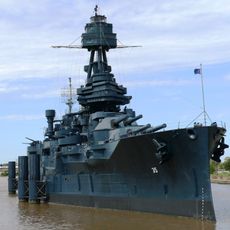
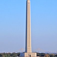
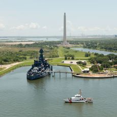
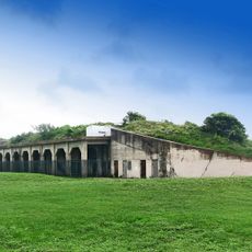
The river played a decisive role in Texas history when the Battle of San Jacinto took place near its banks in 1836, securing Texas independence from Mexico. This military victory under Sam Houston's command transformed the political future of the region.

Indigenous tribes including the Karankawa and Akokisa established their communities along the banks of the San Jacinto River before European settlement.

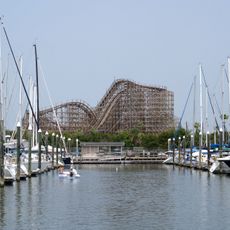
The river and its reservoirs provide opportunities for fishing, boating, and walking along the banks for visitors and residents alike. Fall through spring offers the most pleasant conditions, with moderate weather and stable water levels for outdoor activities.

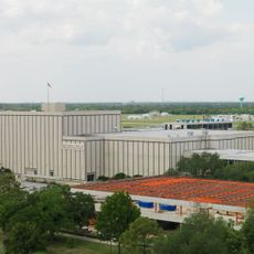
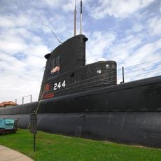
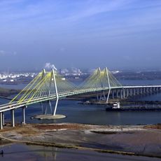
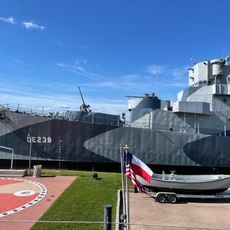
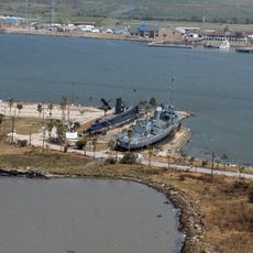
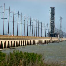
The river connects to the Houston Ship Channel, allowing commercial ships to travel from the Port of Houston directly to the Gulf of Mexico through this waterway. This link transforms the area into a crucial route for maritime commerce and regional trade.

The community of curious travelers

AroundUs brings together thousands of curated places, local tips, and hidden gems, enriched daily by 60,000 contributors worldwide.

Start exploring
Location
Elevation above the sea
0 m
GPS coordinates
29.67662,-94.97937
Latest update
December 7, 2025 19:23
Around this place
USS Texas
United States of America

USS Texas

13.8 km
Christopher C. Kraft Jr. Mission Control Center
United States of America

Christopher C. Kraft Jr. Mission Control Center

16.9 km
San Jacinto Monument
United States of America

San Jacinto Monument

12.6 km
Space Center Houston
United States of America

Space Center Houston

18 km
Houston Ship Channel
United States of America

Houston Ship Channel

4.3 km
Kemah Boardwalk
United States of America

Kemah Boardwalk

14.8 km
USS Cavalla
United States of America

USS Cavalla

42.8 km
San Jacinto Battleground State Historic Site
United States of America

San Jacinto Battleground State Historic Site

12.6 km
Fred Hartman Bridge
United States of America

Fred Hartman Bridge

4.7 km
USS Stewart
United States of America

USS Stewart

42.6 km
Seawolf Park
United States of America

Seawolf Park

42.6 km
Sam Houston Ship Channel Bridge
United States of America

Sam Houston Ship Channel Bridge

17.4 km
Galveston Causeway
United States of America

Galveston Causeway

43.3 km
Boardwalk Bullet
United States of America

Boardwalk Bullet

15 km
Bolivar Bridge
United States of America

Bolivar Bridge

41 km
Fort Travis
United States of America

Fort Travis

40.8 km
Point Bolivar Lighthouse
United States of America

Point Bolivar Lighthouse

40.2 km
NASA Mission Control Center
United States of America

NASA Mission Control Center

17 km
Space Environment Simulation Laboratory
United States of America

Space Environment Simulation Laboratory

16.7 km
Pine Gully Park, Seabrook, Texas
United States of America

Pine Gully Park, Seabrook, Texas

12.7 km
Lone Star Flight Museum
United States of America

Lone Star Flight Museum

20.5 km
George W. S. Abbey Rocket Park at Space Center Houston
United States of America

George W. S. Abbey Rocket Park at Space Center Houston

17.6 km
Robinson Stadium
United States of America

Robinson Stadium

31.3 km
The Settlement Historic District
United States of America

The Settlement Historic District

32.7 km
Strawberry Water Park
United States of America

Strawberry Water Park

21 km
Saturn V Rocket
United States of America

Saturn V Rocket

17.6 km
Saturn V Launch Vehicle
United States of America

Saturn V Launch Vehicle

17.6 km
Baytown Post Office
United States of America

Baytown Post Office

6.4 km
Show the full map
Reviews
Share your experience

No review yet

Discussions
Start a discussion...

No discussion yet

« San Jacinto River - River system in Southeast Texas, United States » is provided by Around Us (aroundus.com). Images and texts are derived from Wikimedia project under a Creative Commons license. You are allowed to copy, distribute, and modify copies of this page, under the conditions set by the license, as long as this note is clearly visible.

Discover hidden gems everywhere you go!

From secret cafés to breathtaking viewpoints, skip the crowded tourist spots and find places that match your style. Our app makes it easy with voice search, smart filtering, route optimization, and insider tips from travelers worldwide. Download now for the complete mobile experience.

Around Us App Screenshot

A unique approach to discovering new places

Le Figaro

All the places worth exploring

France Info

A tailor-made excursion in just a few clicks

20 Minutes

Around Us
Travel Guide & Maps
Download

Send to your phone

QR Code
1

Open the camera app on your mobile.

2

Point at the QR code with your camera. A notification will appear.

3

Tap the notification to open the link.