Chest opened
+${chestReward.xp} XP
Explorer
NOUVEAU ×${chestReward.collectible.quantity}
tapez pour fermer
Chest locked

Open chests in the app

Around Us is built for your phone — chests unlock when you walk, explore and capture nearby places.

Enable Location

We need your location to show you interesting places around you

Discover nearby places

Find interesting locations and hidden gems around you

Precise directions

Get accurate directions and distances to places

Your location is never shared with other users. It's only used when you tap the location button.

Log in to your account

Start exploring — it's free

Trusted by 72,889 travelers worldwide

Continue with Google
Continue with Apple
or

We will send you a code to connect

By continuing, you accept our Terms and Conditions and our Privacy Policy

Check your inbox

We've sent a pincode in your inbox. Please enter the code below.

Discussion Reviews Photo
3k Popularity

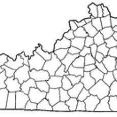
Beckham County, Former county in northeastern Kentucky, United States

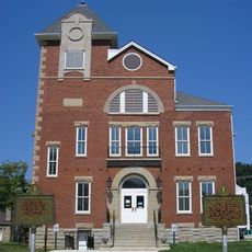
Beckham County was a short-lived county in northeastern Kentucky that extended across portions of Carter, Elliott, and Lewis counties. Olive Hill served as its administrative center during the time it existed.

The Kentucky General Assembly established the county on February 9, 1904, and named it after Governor J.C.W. Beckham. Less than three months later, on April 29, 1904, it was dissolved.

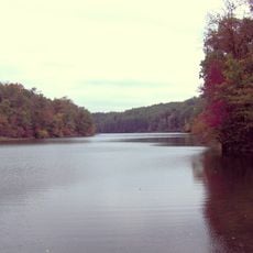
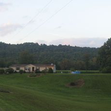
The territory reflected Kentucky's farming traditions through tobacco cultivation and livestock raising in the early twentieth century. These rural practices shaped how people in the region understood their local identity and heritage.

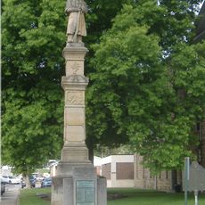
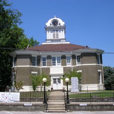
All official records from its brief existence, including marriage certificates and postal documentation, are now housed in the Carter County courthouse. Anyone interested in these historical documents can access them there.

A legal dispute over a 75-dollar debt collection led to the county's dissolution when courts determined its creation violated minimum territory requirements. This unusual outcome from a private money dispute remains the defining moment of its brief history.

The community of curious travelers

AroundUs brings together thousands of curated places, local tips, and hidden gems, enriched daily by 60,000 contributors worldwide.

Start exploring
Location
Inception
February 9, 1904
Capital city
Olive Hill
GPS coordinates
38.30000,-83.17500
Latest update
March 5, 2026 18:17
Around this place
Cave Run Lake
United States of America

Cave Run Lake

36.9 km
Carter Caves State Resort Park
United States of America

Carter Caves State Resort Park

9.4 km
Grayson Lake
United States of America

Grayson Lake

17.6 km
Jayne Stadium
United States of America

Jayne Stadium

25 km
Shawnee State Forest
United States of America

Shawnee State Forest

44 km
Grayson Lake State Park
United States of America

Grayson Lake State Park

16.6 km
Greenbo Lake
United States of America

Greenbo Lake

34.3 km
Bat Cave and Cascade Caverns State Nature Preserves
United States of America

Bat Cave and Cascade Caverns State Nature Preserves

8.3 km
Kentucky Folk Art Center
United States of America

Kentucky Folk Art Center

26.3 km
Union Monument in Vanceburg
United States of America

Union Monument in Vanceburg

35.7 km
Elliott County Kimberlite
United States of America

Elliott County Kimberlite

24.9 km
Adams County Paleo-Indian District
United States of America

Adams County Paleo-Indian District

36.4 km
Goddard Covered Bridge
United States of America

Goddard Covered Bridge

39.1 km
Saltpeter Cave
United States of America

Saltpeter Cave

9.6 km
Ringos Mill Covered Bridge
United States of America

Ringos Mill Covered Bridge

38.2 km
Bennett's Mill Covered Bridge
United States of America

Bennett's Mill Covered Bridge

42.7 km
Hillsboro Covered Bridge
United States of America

Hillsboro Covered Bridge

42.1 km
Oldtown Covered Bridge
United States of America

Oldtown Covered Bridge

28.5 km
Rowan County Courthouse
United States of America

Rowan County Courthouse

26 km
Downtown Morehead Historic District
United States of America

Downtown Morehead Historic District

26.4 km
Wurtland Union Church
United States of America

Wurtland Union Church

44.3 km
Haldeman Voting House No. 8
United States of America

Haldeman Voting House No. 8

14.4 km
Judge John E. Cooper House
United States of America

Judge John E. Cooper House

42.5 km
Greenup Masonic Lodge
United States of America

Greenup Masonic Lodge

42.7 km
Methodist Episcopal Church South
United States of America

Methodist Episcopal Church South

42.8 km
United States of America

Brushy Voting House No. 6

29.3 km
Morgan County Courthouse
United States of America

Morgan County Courthouse

42.8 km
Sheltowee Falls Splash Pad
United States of America

Sheltowee Falls Splash Pad

25.8 km
Show the full map
Reviews
Share your experience

No review yet

Discussions
Start a discussion...

No discussion yet

« Beckham County - Former county in northeastern Kentucky, United States » is provided by Around Us (aroundus.com). Images and texts are derived from Wikimedia project under a Creative Commons license. You are allowed to copy, distribute, and modify copies of this page, under the conditions set by the license, as long as this note is clearly visible.

Discover hidden gems everywhere you go!

From secret cafés to breathtaking viewpoints, skip the crowded tourist spots and find places that match your style. Our app makes it easy with voice search, smart filtering, route optimization, and insider tips from travelers worldwide. Download now for the complete mobile experience.

Around Us App Screenshot

A unique approach to discovering new places

Le Figaro

All the places worth exploring

France Info

A tailor-made excursion in just a few clicks

20 Minutes

Around Us
Travel Guide & Maps
Download

Send to your phone

QR Code
1

Open the camera app on your mobile.

2

Point at the QR code with your camera. A notification will appear.

3

Tap the notification to open the link.