Enable Location

We need your location to show you interesting places around you

Discover nearby places

Find interesting locations and hidden gems around you

Precise directions

Get accurate directions and distances to places

Your location is never shared with other users. It's only used when you tap the location button.

Fort Clark Trading Post State Historic Site

Log in to your account

Start exploring — it's free

Trusted by 61,912 travelers worldwide

Continue with Google
Continue with Apple
or

We will send you a code to connect

By continuing, you accept our Terms and Conditions and our Privacy Policy

Check your inbox

We've sent a pincode in your inbox. Please enter the code below.

Fort Clark Trading Post State Historic Site, Archaeological site in Mercer County, US.

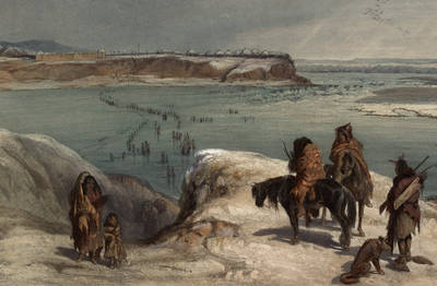
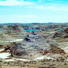
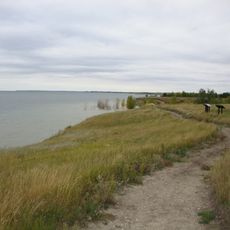
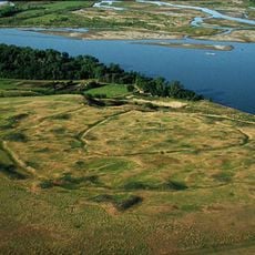
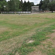
Fort Clark Trading Post State Historic Site is an archaeological location on the Missouri River bluffs containing remains of earth-covered lodges, two trading posts, and an extensive cemetery. The site displays over 2,200 surface features including house ruins and burial grounds with hundreds of graves.

The Mandan settlement was established in 1822, and the American Fur Company built their trading post nearby in 1830. These two developments made the location a key hub for early commerce along the Missouri River.

The site preserves evidence of Mandan settlements whose homes and burial grounds remain visible across the landscape. These remains tell the story of a thriving community that lived and worked here for many generations.

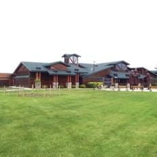
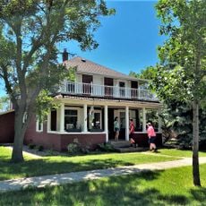
The site is managed by the North Dakota State Historical Society and offers visitors interpretive signs and self-guided tour materials at the Civilian Conservation Corps kiosk. Wearing appropriate footwear is helpful since the grounds are hilly and meant to be explored on foot.

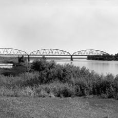
The first steamboat to travel up the upper Missouri River, the Yellowstone, reached this location in 1832 carrying important supplies and trade goods. This arrival marked a turning point for river commerce in the region.

The community of curious travelers

AroundUs brings together thousands of curated places, local tips, and hidden gems, enriched daily by 60,000 contributors worldwide.

Start exploring
Location
GPS coordinates
47.25194,-101.27528
Latest update
December 12, 2025 14:22
Around this place
Hell Creek Formation
United States of America

Hell Creek Formation

42.7 km
United States of America

Lake Sakakawea

29.3 km
North Dakota State Capitol
United States of America

North Dakota State Capitol

60.8 km
Fort Mandan
United States of America

Fort Mandan

5 km
North Dakota Governor's Residence
United States of America

North Dakota Governor's Residence

61 km
Salem Sue
United States of America

Salem Sue

45.9 km
United States of America

North Dakota Heritage Center

61.1 km
Bismarck North Dakota Temple
United States of America

Bismarck North Dakota Temple

57.8 km
Audubon National Wildlife Refuge
United States of America

Audubon National Wildlife Refuge

38.5 km
Lake Sakakawea State Park
United States of America

Lake Sakakawea State Park

33.1 km
Cross Ranch State Park
United States of America

Cross Ranch State Park

21.3 km
Cathedral of the Holy Spirit
United States of America

Cathedral of the Holy Spirit

61.2 km
Fort Stevenson State Park
United States of America

Fort Stevenson State Park

39.3 km
Double Ditch
United States of America

Double Ditch

45.1 km
United States of America

Liberty Memorial Building

61 km
North Dakota Lewis and Clark Interpretive Center
United States of America

North Dakota Lewis and Clark Interpretive Center

18.4 km
Liberty Memorial Bridge
United States of America

Liberty Memorial Bridge

58.9 km
Fred Krause House
United States of America

Fred Krause House

27.1 km
Holy Trinity Ukrainian Greek Orthodox Church
United States of America

Holy Trinity Ukrainian Greek Orthodox Church

38.1 km
Lost Lake National Wildlife Refuge
United States of America

Lost Lake National Wildlife Refuge

28.2 km
Former McLean County Courthouse
United States of America

Former McLean County Courthouse

19.1 km
Bismarck Cathedral Area Historic District
United States of America

Bismarck Cathedral Area Historic District

61.1 km
Chief Looking's Village site
United States of America

Chief Looking's Village site

57.9 km
United States of America

Ingersoll School

31 km
Missouri River High Bridge
United States of America

Missouri River High Bridge

59.1 km
Fred and Gladys Grady House
United States of America

Fred and Gladys Grady House

61.2 km
McLean County Courthouse
United States of America

McLean County Courthouse

19.3 km
North Dakota Heritage Center & State Museum
United States of America

North Dakota Heritage Center & State Museum

61.1 km
Show the full map
« Fort Clark Trading Post State Historic Site - Archaeological site in Mercer County, US » is provided by Around Us (aroundus.com). Images and texts are derived from Wikimedia project under a Creative Commons license. You are allowed to copy, distribute, and modify copies of this page, under the conditions set by the license, as long as this note is clearly visible.

Discover hidden gems everywhere you go!

From secret cafés to breathtaking viewpoints, skip the crowded tourist spots and find places that match your style. Our app makes it easy with voice search, smart filtering, route optimization, and insider tips from travelers worldwide. Download now for the complete mobile experience.

Around Us App Screenshot

A unique approach to discovering new places

Le Figaro

All the places worth exploring

France Info

A tailor-made excursion in just a few clicks

20 Minutes

Around Us
Travel Guide & Maps
Download

Send to your phone

QR Code
1

Open the camera app on your mobile.

2

Point at the QR code with your camera. A notification will appear.

3

Tap the notification to open the link.