Enable Location

We need your location to show you interesting places around you

Discover nearby places

Find interesting locations and hidden gems around you

Precise directions

Get accurate directions and distances to places

Your location is never shared with other users. It's only used when you tap the location button.

Lake Sakakawea State Park

Log in to your account

Start exploring — it's free

Trusted by 61,366 travelers worldwide

Continue with Google
Continue with Apple
or

We will send you a code to connect

By continuing, you accept our Terms and Conditions and our Privacy Policy

Check your inbox

We've sent a pincode in your inbox. Please enter the code below.

Lake Sakakawea State Park

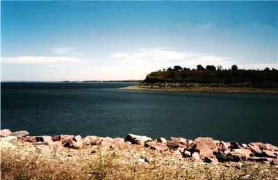
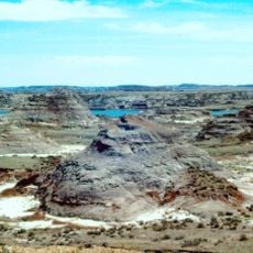
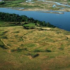
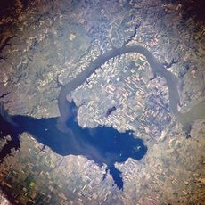
Lake Sakakawea State Park, State park on Lake Sakakawea, North Dakota, US

Description

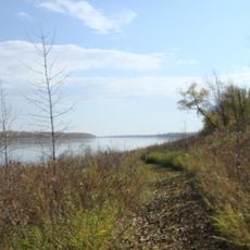
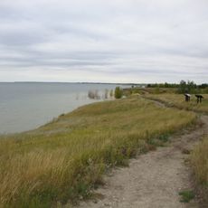
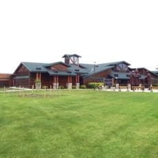
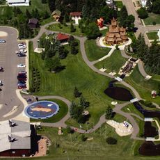
Lake Sakakawea State Park sits along the southern shore of the lake reservoir, covering 739 acres with wooded areas, sandy beaches, and multiple water access points. The park includes seasonal camping cabins, a marina with boat slips, picnic shelters, and day-use facilities spread across its grounds.

History

The area was initially developed by the U.S. Army Corps of Engineers as Garrison Lake State Park until 1965, when the North Dakota Parks and Recreation Department took over management. This transition reflected the shift from federal to state oversight of the site's future development.

Culture

The park's name honors Sakakawea, a Shoshone woman who guided the Lewis and Clark expedition, connecting visitors to Native American heritage. This recognition reflects her essential role in one of America's most important journeys of exploration.

Practical

The park has shaded areas near the camping facilities and more open spaces along the beaches where water activities concentrate. Plan to arrive early, especially on weekends, to secure good spots for picnicking and boat access.

Did you know?

The western terminus of the North Country National Scenic Trail begins here, marking the start of a long-distance hiking route that stretches across multiple states. Hikers who complete the entire trail find its other end near the Canadian border far to the north.

Location
Inception
1965
GPS coordinates
47.52390,-101.45200
Latest update
December 12, 2025 14:21

AroundUs brings together thousands of curated places, local tips, and hidden gems, enriched daily by 60,000 contributors worldwide. Discover all places nearby (Mercer County).

Around this place
Hell Creek Formation
United States of America

Hell Creek Formation

69.5 km
United States of America

Lake Sakakawea

4.1 km
Fort Mandan
United States of America

Fort Mandan

28.3 km
Salem Sue
United States of America

Salem Sue

74.7 km
Scandinavian Heritage Park
United States of America

Scandinavian Heritage Park

79 km
Maysa Arena
United States of America

Maysa Arena

77.9 km
Audubon National Wildlife Refuge
United States of America

Audubon National Wildlife Refuge

22.2 km
Fort Clark Trading Post State Historic Site
United States of America

Fort Clark Trading Post State Historic Site

33.1 km
Cross Ranch State Park
United States of America

Cross Ranch State Park

48.5 km
Fort Stevenson State Park
United States of America

Fort Stevenson State Park

7.8 km
Double Ditch
United States of America

Double Ditch

77.5 km
North Dakota Lewis and Clark Interpretive Center
United States of America

North Dakota Lewis and Clark Interpretive Center

39.6 km
Fred Krause House
United States of America

Fred Krause House

28.8 km
Holy Trinity Ukrainian Greek Orthodox Church
United States of America

Holy Trinity Ukrainian Greek Orthodox Church

64.3 km
Lost Lake National Wildlife Refuge
United States of America

Lost Lake National Wildlife Refuge

51 km
Liberty Baptist Church
United States of America

Liberty Baptist Church

78.7 km
Former McLean County Courthouse
United States of America

Former McLean County Courthouse

41.2 km
Sheridan County Courthouse
United States of America

Sheridan County Courthouse

76.2 km
Minot Carnegie Library
United States of America

Minot Carnegie Library

80 km
Bruce M. Van Sickle Federal Building and U.S. Courthouse
United States of America

Bruce M. Van Sickle Federal Building and U.S. Courthouse

80 km
United States of America

Ingersoll School

35.5 km
Alfred and Clara Sevareid House
United States of America

Alfred and Clara Sevareid House

71.4 km
Wabek Consolidated School
United States of America

Wabek Consolidated School

62.2 km
McLean County Courthouse
United States of America

McLean County Courthouse

41.3 km
Van Hook State Wildlife Management Area
United States of America

Van Hook State Wildlife Management Area

80.1 km
Ward County Courthouse
United States of America

Ward County Courthouse

79.9 km
Scandinavian Heritage Association
United States of America

Scandinavian Heritage Association

79 km
Paul Broste Rock Museum
United States of America

Paul Broste Rock Museum

70.4 km
Show the full map
« Lake Sakakawea State Park - State park on Lake Sakakawea, North Dakota, US » is provided by Around Us (aroundus.com). Images and texts are derived from Wikimedia project under a Creative Commons license. You are allowed to copy, distribute, and modify copies of this page, under the conditions set by the license, as long as this note is clearly visible.

Discover hidden gems everywhere you go!

From secret cafés to breathtaking viewpoints, skip the crowded tourist spots and find places that match your style. Our app makes it easy with voice search, smart filtering, route optimization, and insider tips from travelers worldwide. Download now for the complete mobile experience.

Around Us App Screenshot

A unique approach to discovering new places

Le Figaro

All the places worth exploring

France Info

A tailor-made excursion in just a few clicks

20 Minutes

Around Us
Travel Guide & Maps
Download

Send to your phone

QR Code
1

Open the camera app on your mobile.

2

Point at the QR code with your camera. A notification will appear.

3

Tap the notification to open the link.