Enable Location

We need your location to show you interesting places around you

Discover nearby places

Find interesting locations and hidden gems around you

Precise directions

Get accurate directions and distances to places

Your location is never shared with other users. It's only used when you tap the location button.

Log in to your account

Start exploring — it's free

Trusted by 61,909 travelers worldwide

Continue with Google
Continue with Apple
or

We will send you a code to connect

By continuing, you accept our Terms and Conditions and our Privacy Policy

Check your inbox

We've sent a pincode in your inbox. Please enter the code below.

Lake Sakakawea

Lake Sakakawea, Artificial reservoir in North Dakota, United States

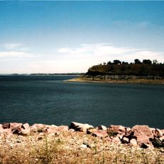
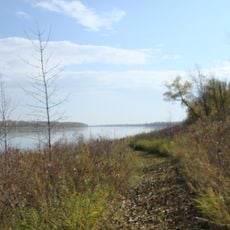
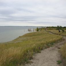
Lake Sakakawea is an artificial reservoir in North Dakota created by the Garrison Dam on the Missouri River. The shoreline winds through rolling prairie hills, forming bays, peninsulas and long arms that create thousands of kilometers of waterfront across the central part of the state.

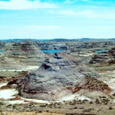
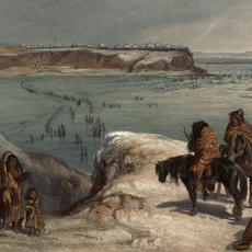
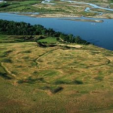
The Garrison Dam was completed in the mid-fifties of the twentieth century, creating this massive reservoir on the Missouri. Flooding displaced several Fort Berthold Indian Reservation communities, whose residents lost ancestral villages and farmland beneath the rising waters.

Named after Sakakawea, a Shoshone-Hidatsa woman from the region, the reservoir honors her role in guiding explorers through these lands. Her presence during the Lewis and Clark Expedition in the early nineteenth century connects this modern lake to the area's indigenous heritage.

Lake Sakakawea State Park offers boat ramps, campsites and fishing spots along the southern shore. Trails wind through hills above the water, giving views over the wide surface and surrounding prairie grassland.

The North Country National Scenic Trail begins at this reservoir and runs roughly 7700 kilometers (4800 miles) east to Vermont. This route crosses eight states and ranks among the longest hiking trails in the country, with its western terminus resting here at the water's edge.

The community of curious travelers

AroundUs brings together thousands of curated places, local tips, and hidden gems, enriched daily by 60,000 contributors worldwide.

Start exploring
Location
Elevation above the sea
554 m
GPS coordinates
47.49806,-101.41278
Latest update
December 17, 2025 10:02
Around this place
Hell Creek Formation
United States of America

Hell Creek Formation

66.9 km
Fort Mandan
United States of America

Fort Mandan

24.4 km
Salem Sue
United States of America

Salem Sue

71.8 km
Scandinavian Heritage Park
United States of America

Scandinavian Heritage Park

81.5 km
Maysa Arena
United States of America

Maysa Arena

80.5 km
Audubon National Wildlife Refuge
United States of America

Audubon National Wildlife Refuge

20.8 km
Fort Clark Trading Post State Historic Site
United States of America

Fort Clark Trading Post State Historic Site

29.3 km
Lake Sakakawea State Park
United States of America

Lake Sakakawea State Park

4.1 km
Cross Ranch State Park
United States of America

Cross Ranch State Park

44.4 km
Fort Stevenson State Park
United States of America

Fort Stevenson State Park

10.3 km
Double Ditch
United States of America

Double Ditch

73.5 km
North Dakota Lewis and Clark Interpretive Center
United States of America

North Dakota Lewis and Clark Interpretive Center

35.5 km
Fred Krause House
United States of America

Fred Krause House

27.9 km
Holy Trinity Ukrainian Greek Orthodox Church
United States of America

Holy Trinity Ukrainian Greek Orthodox Church

60.2 km
Lost Lake National Wildlife Refuge
United States of America

Lost Lake National Wildlife Refuge

46.9 km
Liberty Baptist Church
United States of America

Liberty Baptist Church

77.6 km
German Evangelical St. Johns Church
United States of America

German Evangelical St. Johns Church

81.7 km
Former McLean County Courthouse
United States of America

Former McLean County Courthouse

37.1 km
Westgaard Bridge
United States of America

Westgaard Bridge

82.1 km
Sheridan County Courthouse
United States of America

Sheridan County Courthouse

73.2 km
United States of America

Ingersoll School

32 km
Alfred and Clara Sevareid House
United States of America

Alfred and Clara Sevareid House

72.3 km
Wabek Consolidated School
United States of America

Wabek Consolidated School

66.3 km
McLean County Courthouse
United States of America

McLean County Courthouse

37.2 km
Ward County Courthouse
United States of America

Ward County Courthouse

82.4 km
Sims Lutheran Church
United States of America

Sims Lutheran Church

81 km
Scandinavian Heritage Association
United States of America

Scandinavian Heritage Association

81.5 km
Paul Broste Rock Museum
United States of America

Paul Broste Rock Museum

74.5 km
Show the full map
« Lake Sakakawea - Artificial reservoir in North Dakota, United States » is provided by Around Us (aroundus.com). Images and texts are derived from Wikimedia project under a Creative Commons license. You are allowed to copy, distribute, and modify copies of this page, under the conditions set by the license, as long as this note is clearly visible.

Discover hidden gems everywhere you go!

From secret cafés to breathtaking viewpoints, skip the crowded tourist spots and find places that match your style. Our app makes it easy with voice search, smart filtering, route optimization, and insider tips from travelers worldwide. Download now for the complete mobile experience.

Around Us App Screenshot

A unique approach to discovering new places

Le Figaro

All the places worth exploring

France Info

A tailor-made excursion in just a few clicks

20 Minutes

Around Us
Travel Guide & Maps
Download

Send to your phone

QR Code
1

Open the camera app on your mobile.

2

Point at the QR code with your camera. A notification will appear.

3

Tap the notification to open the link.