Enable Location

We need your location to show you interesting places around you

Discover nearby places

Find interesting locations and hidden gems around you

Precise directions

Get accurate directions and distances to places

Your location is never shared with other users. It's only used when you tap the location button.

Honey Hollow Watershed

Log in to your account

Start exploring — it's free

Trusted by 61,358 travelers worldwide

Continue with Google
Continue with Apple
or

We will send you a code to connect

By continuing, you accept our Terms and Conditions and our Privacy Policy

Check your inbox

We've sent a pincode in your inbox. Please enter the code below.

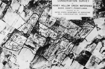
Honey Hollow Watershed, Drainage basin in Solebury Township, Pennsylvania, United States

Description

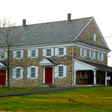
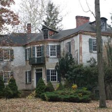
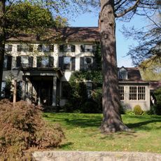
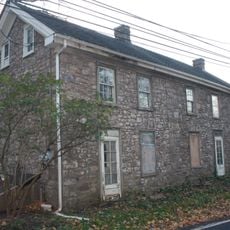
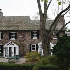
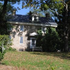
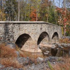
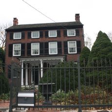
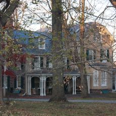
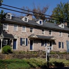
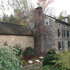
Honey Hollow Watershed is a drainage basin of roughly 650 acres northeast of Philadelphia with working agricultural land. The landscape includes farmhouses, stone fences built from fieldstone, and cultivated fields running along Creamery Road.

History

The place came into being in 1933 when five local farmers created the first privately owned soil conservation district to fight erosion. This initiative grew out of the need to protect their severely damaged agricultural lands.

Culture

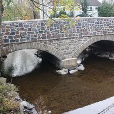
The name comes from the natural springs and streams running through the area, shaping how farming has developed here. Walking through, you notice how the fields and pastures work together as one system to protect water and soil.

Practical

The area is accessible via Creamery Road and offers walking and viewing opportunities through the fields and along the creeks. Spring through fall offers the best conditions for exploring, when paths are dry and the land is green.

Did you know?

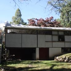
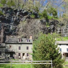
An Environmental Education Center was built in 1980 and teaches conservation methods that the original farmers developed. This center demonstrates how the farming community's solutions from the early years remain practical today.

Location
GPS coordinates
40.37389,-75.00750
Latest update
December 14, 2025 12:22

AroundUs brings together thousands of curated places, local tips, and hidden gems, enriched daily by 60,000 contributors worldwide. Discover all places nearby (Pennsylvania).

Around this place
Bucks County Playhouse
United States of America

Bucks County Playhouse

5 km
New Hope – Lambertville Bridge
United States of America

New Hope – Lambertville Bridge

5.1 km
George Nakashima House, Studio and Workshop
United States of America

George Nakashima House, Studio and Workshop

5.8 km
Lumberville – Raven Rock Bridge
United States of America

Lumberville – Raven Rock Bridge

4.5 km
Bulls Island Recreation Area
United States of America

Bulls Island Recreation Area

4.7 km
Buckingham Friends Meeting House
United States of America

Buckingham Friends Meeting House

4 km
Centre Bridge–Stockton Bridge
United States of America

Centre Bridge–Stockton Bridge

4 km
Cintra
United States of America

Cintra

4.2 km
Lambertville House
United States of America

Lambertville House

5.3 km
James W. Marshall House
United States of America

James W. Marshall House

5.4 km
Longland
United States of America

Longland

5.4 km
Lambertville Historic District
United States of America

Lambertville Historic District

5.6 km
Carversville Historic District
United States of America

Carversville Historic District

4.6 km
Phillips Mill Historic District
United States of America

Phillips Mill Historic District

3.4 km
Cuttalossa Valley Historic District
United States of America

Cuttalossa Valley Historic District

2.6 km
Center Bridge Historic District
United States of America

Center Bridge Historic District

3.8 km
Joshua Ely House
United States of America

Joshua Ely House

4.6 km
Thomas and Lydia Gilbert Farm
United States of America

Thomas and Lydia Gilbert Farm

6 km
Bridge in Solebury Township
United States of America

Bridge in Solebury Township

5 km
Atkinson Road Bridge
United States of America

Atkinson Road Bridge

5.7 km
Springdale Historic District
United States of America

Springdale Historic District

3.9 km
Rhoads Homestead
United States of America

Rhoads Homestead

4.4 km
Raven Rock Historic District
United States of America

Raven Rock Historic District

4.7 km
Holicong Village Historic District
United States of America

Holicong Village Historic District

5.5 km
Lumberville Historic District
United States of America

Lumberville Historic District

4.2 km
District No. 98 Schoolhouse
United States of America

District No. 98 Schoolhouse

4.6 km
Upper Aquetong Valley Historic District
United States of America

Upper Aquetong Valley Historic District

1.4 km
New Hope – Lambertville Toll Bridge
United States of America

New Hope – Lambertville Toll Bridge

4.5 km
Show the full map
« Honey Hollow Watershed - Drainage basin in Solebury Township, Pennsylvania, United States » is provided by Around Us (aroundus.com). Images and texts are derived from Wikimedia project under a Creative Commons license. You are allowed to copy, distribute, and modify copies of this page, under the conditions set by the license, as long as this note is clearly visible.

Discover hidden gems everywhere you go!

From secret cafés to breathtaking viewpoints, skip the crowded tourist spots and find places that match your style. Our app makes it easy with voice search, smart filtering, route optimization, and insider tips from travelers worldwide. Download now for the complete mobile experience.

Around Us App Screenshot

A unique approach to discovering new places

Le Figaro

All the places worth exploring

France Info

A tailor-made excursion in just a few clicks

20 Minutes

Around Us
Travel Guide & Maps
Download

Send to your phone

QR Code
1

Open the camera app on your mobile.

2

Point at the QR code with your camera. A notification will appear.

3

Tap the notification to open the link.