·

Enable Location

We need your location to show you interesting places around you

Discover nearby places

Find interesting locations and hidden gems around you

Precise directions

Get accurate directions and distances to places

Your location is never shared with other users. It's only used when you tap the location button.

Lafayette Square Historic District

Log in to your account

Start exploring — it's free

Trusted by 62,652 travelers worldwide

Continue with Google
Continue with Apple
or

We will send you a code to connect

By continuing, you accept our Terms and Conditions and our Privacy Policy

Check your inbox

We've sent a pincode in your inbox. Please enter the code below.

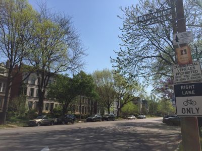
Lafayette Square Historic District, historic district in Missouri, United States

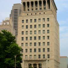
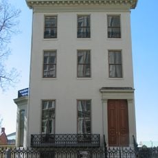
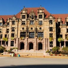
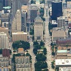
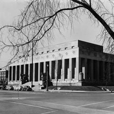
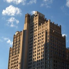
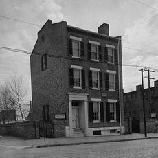
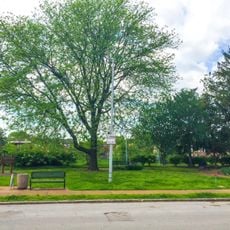
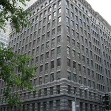
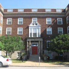
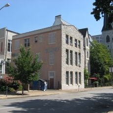
Lafayette Square Historic District is a residential neighborhood in St. Louis with Victorian-era homes and a central park dating to the 1830s. The architecture features primarily Renaissance Revival style with stone and brick buildings, mansard roofs with dormer windows, arched windows and doors, ornate stonework, and later Italianate and Germanic influences including red brick, towers, and decorative ironwork.

The neighborhood developed around 1860 as the city expanded and people moved into the previously remote area. A devastating tornado in 1896 damaged many homes and the park, after which many families relocated westward.

The neighborhood is named after Marquis de Lafayette, a French general who visited St. Louis in 1825 and became a symbol of the American Revolution. Today, residents gather on front porches, walk through the park together, and organize community events that bring neighbors closer.

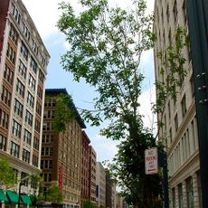
The neighborhood is easy to explore on foot since streets are close together and the central park serves as a good reference point. Wear comfortable shoes and allow time for leisurely walking, especially during daylight hours when the buildings and park are most visible.

The area was originally used as a military training ground by Colonel Thornton Grimsley and was locally known as 'Grimsley's Folly' because people thought it was too remote to settle. This backstory reveals how the location later became a desired residential neighborhood despite initial skepticism.

The community of curious travelers

AroundUs brings together thousands of curated places, local tips, and hidden gems, enriched daily by 60,000 contributors worldwide.

Start exploring
Location
Architectural style
Renaissance Revival architecture
GPS coordinates
38.61750,-90.21250
Latest update
February 9, 2026 11:07
Around this place
Busch Memorial Stadium
United States of America

Busch Memorial Stadium

1.9 km
St. Louis Public Library
United States of America

St. Louis Public Library

1.9 km
Stifel Theatre
United States of America

Stifel Theatre

1.5 km
United States of America

Ballpark Village

1.9 km
The Beacon on Chestnut
United States of America

The Beacon on Chestnut

1.9 km
Thomas F. Eagleton United States Courthouse
United States of America

Thomas F. Eagleton United States Courthouse

1.6 km
Civil Courts Building
United States of America

Civil Courts Building

1.7 km
Citygarden
United States of America

Citygarden

1.9 km
Campbell House Museum
United States of America

Campbell House Museum

1.8 km
Bank of America Plaza
United States of America

Bank of America Plaza

1.9 km
Washington Avenue Historic District
United States of America

Washington Avenue Historic District

1.9 km
City Hall
United States of America

City Hall

1.5 km
St. Louis Gateway Mall
United States of America

St. Louis Gateway Mall

1.9 km
Soldiers' Memorial
United States of America

Soldiers' Memorial

1.7 km
Southwestern Bell Building
United States of America

Southwestern Bell Building

1.9 km
Eugene Field House
United States of America

Eugene Field House

1.8 km
St. Louis Limestone
United States of America

St. Louis Limestone

1.2 km
St. Raymond Maronite Cathedral
United States of America

St. Raymond Maronite Cathedral

1.2 km
700 Market
United States of America

700 Market

1.9 km
St. John Nepomuk Parish Historic District
United States of America

St. John Nepomuk Parish Historic District

878 m
United States Court House and Custom House
United States of America

United States Court House and Custom House

1.7 km
Aloe Plaza
United States of America

Aloe Plaza

1.4 km
Aboussie Park
United States of America

Aboussie Park

1.7 km
Frisco Building
United States of America

Frisco Building

1.9 km
St. Louis Union Station
United States of America

St. Louis Union Station

1.2 km
Phyllis Wheatley Heritage Center
United States of America

Phyllis Wheatley Heritage Center

1.9 km
Plaza Square Apartments Historic District
United States of America

Plaza Square Apartments Historic District

1.6 km
St. Louis Cardinals Hall of Fame and Museum
United States of America

St. Louis Cardinals Hall of Fame and Museum

1.9 km
Show the full map
« Lafayette Square Historic District - historic district in Missouri, United States » is provided by Around Us (aroundus.com). Images and texts are derived from Wikimedia project under a Creative Commons license. You are allowed to copy, distribute, and modify copies of this page, under the conditions set by the license, as long as this note is clearly visible.

Discover hidden gems everywhere you go!

From secret cafés to breathtaking viewpoints, skip the crowded tourist spots and find places that match your style. Our app makes it easy with voice search, smart filtering, route optimization, and insider tips from travelers worldwide. Download now for the complete mobile experience.

Around Us App Screenshot

A unique approach to discovering new places

Le Figaro

All the places worth exploring

France Info

A tailor-made excursion in just a few clicks

20 Minutes

Around Us
Travel Guide & Maps
Download

Send to your phone

QR Code
1

Open the camera app on your mobile.

2

Point at the QR code with your camera. A notification will appear.

3

Tap the notification to open the link.