Chest opened
+${chestReward.xp} XP
Explorer
NOUVEAU ×${chestReward.collectible.quantity}
tapez pour fermer
Chest locked

Open chests in the app

Around Us is built for your phone — chests unlock when you walk, explore and capture nearby places.

Enable Location

We need your location to show you interesting places around you

Discover nearby places

Find interesting locations and hidden gems around you

Precise directions

Get accurate directions and distances to places

Your location is never shared with other users. It's only used when you tap the location button.

Northeast Ohio

Log in to your account

Start exploring — it's free

Trusted by 72,937 travelers worldwide

Continue with Google
Continue with Apple
or

We will send you a code to connect

By continuing, you accept our Terms and Conditions and our Privacy Policy

Check your inbox

We've sent a pincode in your inbox. Please enter the code below.

Northeast Ohio
Discussion Reviews 2 Photos
50.7k Popularity

Northeast Ohio, Geographic region in Northern Ohio, United States.

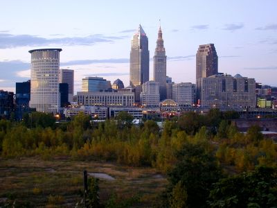
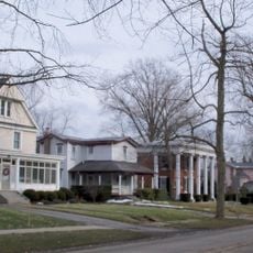
Northeast Ohio stretches from Lake Erie to the Appalachian Mountains and includes several counties with Cleveland, Akron, Canton, and Youngstown as major city centers. The area forms a connected network of urban and rural zones with distinct character and functions.

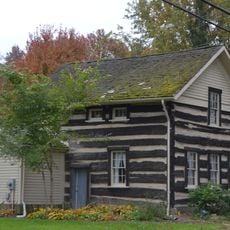
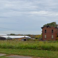
The area developed from the Connecticut Western Reserve territory and underwent major changes during industrialization. In the 20th century, the region became a significant manufacturing center that shaped national economy and labor practices.

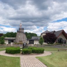
The region hosts major institutions like the Rock and Roll Hall of Fame and Cleveland Museum of Art that draw visitors from around the world. Local sports teams like the Cleveland Guardians and Browns shape community pride and are central to regional life.

The region connects through Interstate highways I-71, I-76, and I-90, offering good road links between cities. Cleveland Hopkins International Airport serves as the main transportation hub for visitors arriving from outside the area.

The region is known for its connection to early music history, particularly the blues and soul traditions that produced artists like John Lee Hooker and Tina Turner. This musical heritage remains visible today in local venues and historic sites that visitors can explore.

The community of curious travelers

AroundUs brings together thousands of curated places, local tips, and hidden gems, enriched daily by 60,000 contributors worldwide.

Start exploring
Location
GPS coordinates
41.00000,-81.00000
Latest update
March 5, 2026 18:15
Around this place
United States of America

Mill Creek Park

25.5 km
West Branch State Park
United States of America

West Branch State Park

18.3 km
Mill Creek Park Suspension Bridge
United States of America

Mill Creek Park Suspension Bridge

27.3 km
Quail Hollow State Park
United States of America

Quail Hollow State Park

26.3 km
Basilica and National Shrine of Our Lady of Lebanon
United States of America

Basilica and National Shrine of Our Lady of Lebanon

20.9 km
Cherry Valley Coke Ovens
United States of America

Cherry Valley Coke Ovens

23.3 km
Triangle Lake Bog State Nature Preserve
United States of America

Triangle Lake Bog State Nature Preserve

25.2 km
Austintown Log House
United States of America

Austintown Log House

23.5 km
Atwater Congregational Church
United States of America

Atwater Congregational Church

12.7 km
Daniel Howell Hise House
United States of America

Daniel Howell Hise House

17.9 km
Teegarden-Centennial Covered Bridge
United States of America

Teegarden-Centennial Covered Bridge

24.6 km
Newton Falls Covered Bridge
United States of America

Newton Falls Covered Bridge

20.9 km
Judge William Shaw Anderson House
United States of America

Judge William Shaw Anderson House

19.2 km
John Street House
United States of America

John Street House

16 km
Haines House
United States of America

Haines House

12.9 km
Burchfield Homestead
United States of America

Burchfield Homestead

16.5 km
First United Methodist Church
United States of America

First United Methodist Church

16.6 km
Alliance Bank Building
United States of America

Alliance Bank Building

12 km
Charles Nelson Schmick House
United States of America

Charles Nelson Schmick House

24.2 km
Middle Sandy Presbyterian Church
United States of America

Middle Sandy Presbyterian Church

19 km
South Lincoln Avenue Historic District
United States of America

South Lincoln Avenue Historic District

17.2 km
Alliance Clay Product Company
United States of America

Alliance Clay Product Company

12.8 km
Eagles Building-Strand Theater
United States of America

Eagles Building-Strand Theater

12.3 km
First Methodist Episcopal Church
United States of America

First Methodist Episcopal Church

12.3 km
Funtimes Fun Park
United States of America

Funtimes Fun Park

17.5 km
Idora Park Experience
United States of America

Idora Park Experience

18 km
Haines House Underground Railroad Museum
United States of America

Haines House Underground Railroad Museum

12.8 km
Canfield Township Hall
United States of America

Canfield Township Hall

20.3 km
Show the full map
Reviews
Share your experience

No review yet

Discussions
Start a discussion...

No discussion yet

« Northeast Ohio - Geographic region in Northern Ohio, United States » is provided by Around Us (aroundus.com). Images and texts are derived from Wikimedia project under a Creative Commons license. You are allowed to copy, distribute, and modify copies of this page, under the conditions set by the license, as long as this note is clearly visible.

Discover hidden gems everywhere you go!

From secret cafés to breathtaking viewpoints, skip the crowded tourist spots and find places that match your style. Our app makes it easy with voice search, smart filtering, route optimization, and insider tips from travelers worldwide. Download now for the complete mobile experience.

Around Us App Screenshot

A unique approach to discovering new places

Le Figaro

All the places worth exploring

France Info

A tailor-made excursion in just a few clicks

20 Minutes

Around Us
Travel Guide & Maps
Download

Send to your phone

QR Code
1

Open the camera app on your mobile.

2

Point at the QR code with your camera. A notification will appear.

3

Tap the notification to open the link.