Enable Location

We need your location to show you interesting places around you

Discover nearby places

Find interesting locations and hidden gems around you

Precise directions

Get accurate directions and distances to places

Your location is never shared with other users. It's only used when you tap the location button.

West Branch State Park

Log in to your account

Start exploring — it's free

Trusted by 64,533 travelers worldwide

Continue with Google
Continue with Apple
or

We will send you a code to connect

By continuing, you accept our Terms and Conditions and our Privacy Policy

Check your inbox

We've sent a pincode in your inbox. Please enter the code below.

West Branch State Park
Discussion Reviews 1 Photos
5.3k Popularity

West Branch State Park, State park in Portage County, US.

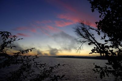
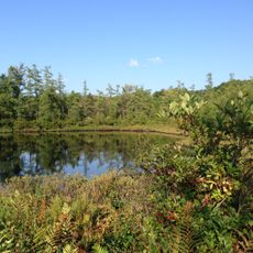
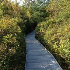
West Branch State Park is an Ohio state park in Portage County built around the Michael J. Kirwan Reservoir, a lake with several coves and water inlets. The surrounding land mixes forest, open fields, and shoreline, creating a varied landscape where water and land meet at many points.

The land around this area was long used for salt extraction, first by Native peoples and later by early settlers, a practice that influenced the naming of the Mahoning River. The river's name comes from the Delaware word 'mahonink', linking the landscape directly to the human activity that once defined it.

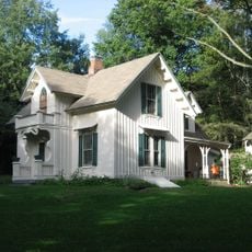
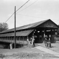
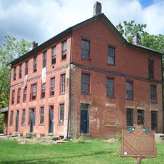
The park contains the historic land office of Captain John Campbell, a military officer from the War of 1812 who played a role in shaping early Portage County. The building stands as a tangible reminder of how closely the area's growth was tied to military and administrative activity in the early 1800s.

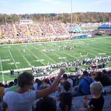
The park is open year-round and offers hiking trails, horse paths, and biking routes that work for different fitness levels. Several boat launch points are spread along the shoreline for those who want to get out on the water.

Although the park is mostly known for recreation, it also contains active hunting zones, making it one of the few Ohio state parks where hunting and outdoor leisure activities coexist in designated areas. Visitors planning a trip during hunting season should check which zones are in use before setting out on trails.

The community of curious travelers

AroundUs brings together thousands of curated places, local tips, and hidden gems, enriched daily by 60,000 contributors worldwide.

Start exploring
Location
Inception
1966
GPS coordinates
41.14310,-81.10820
Latest update
March 3, 2026 10:08
Around this place
Dix Stadium
United States of America

Dix Stadium

17.2 km
Partially Buried Woodshed
United States of America

Partially Buried Woodshed

19.4 km
Nelson Kennedy Ledges State Park
United States of America

Nelson Kennedy Ledges State Park

21.4 km
Shady Lake Park
United States of America

Shady Lake Park

23.9 km
Masonic Temple
United States of America

Masonic Temple

21.4 km
Kent Stage
United States of America

Kent Stage

20.9 km
Memorial Stadium
United States of America

Memorial Stadium

19.7 km
Triangle Lake Bog State Nature Preserve
United States of America

Triangle Lake Bog State Nature Preserve

12.7 km
Kent Industrial District
United States of America

Kent Industrial District

21.2 km
Wills Gymnasium
United States of America

Wills Gymnasium

20.2 km
Rockwell Field
United States of America

Rockwell Field

17.2 km
Kent Free Library
United States of America

Kent Free Library

21.2 km
Atwater Congregational Church
United States of America

Atwater Congregational Church

13.8 km
Tom S. Cooperrider-Kent Bog State Nature Preserve
United States of America

Tom S. Cooperrider-Kent Bog State Nature Preserve

20.6 km
Aaron Ferrey House
United States of America

Aaron Ferrey House

21.6 km
Newton Falls Covered Bridge
United States of America

Newton Falls Covered Bridge

12.4 km
John Davey House
United States of America

John Davey House

21.6 km
Charles Kent House
United States of America

Charles Kent House

21.6 km
Freedom Congregational Church
United States of America

Freedom Congregational Church

10.7 km
Hiram College Library
United States of America

Hiram College Library

18.9 km
Mantua Center School
United States of America

Mantua Center School

22 km
Franklin Township Hall
United States of America

Franklin Township Hall

21.2 km
West Main Street District
United States of America

West Main Street District

21.6 km
Ohio State Normal College At Kent
United States of America

Ohio State Normal College At Kent

20.1 km
Kent State University Center for the Performing Arts
United States of America

Kent State University Center for the Performing Arts

19.5 km
May 4, 1970, Kent State Shootings Site
United States of America

May 4, 1970, Kent State Shootings Site

19.7 km
Old Stagecoach Inn
United States of America

Old Stagecoach Inn

6.8 km
West Main Street Historic District
United States of America

West Main Street Historic District

21.4 km
Show the full map
Reviews
Share your experience

No review yet

Discussions
Start a discussion...

No discussion yet

« West Branch State Park - State park in Portage County, US » is provided by Around Us (aroundus.com). Images and texts are derived from Wikimedia project under a Creative Commons license. You are allowed to copy, distribute, and modify copies of this page, under the conditions set by the license, as long as this note is clearly visible.

Discover hidden gems everywhere you go!

From secret cafés to breathtaking viewpoints, skip the crowded tourist spots and find places that match your style. Our app makes it easy with voice search, smart filtering, route optimization, and insider tips from travelers worldwide. Download now for the complete mobile experience.

Around Us App Screenshot

A unique approach to discovering new places

Le Figaro

All the places worth exploring

France Info

A tailor-made excursion in just a few clicks

20 Minutes

Around Us
Travel Guide & Maps
Download

Send to your phone

QR Code
1

Open the camera app on your mobile.

2

Point at the QR code with your camera. A notification will appear.

3

Tap the notification to open the link.