Enable Location

We need your location to show you interesting places around you

Discover nearby places

Find interesting locations and hidden gems around you

Precise directions

Get accurate directions and distances to places

Your location is never shared with other users. It's only used when you tap the location button.

Portage County

Log in to your account

Start exploring — it's free

Trusted by 61,336 travelers worldwide

Continue with Google
Continue with Apple
or

We will send you a code to connect

By continuing, you accept our Terms and Conditions and our Privacy Policy

Check your inbox

We've sent a pincode in your inbox. Please enter the code below.

Portage County, Administrative division in Northeast Ohio, United States

Description

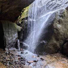
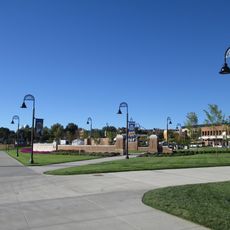
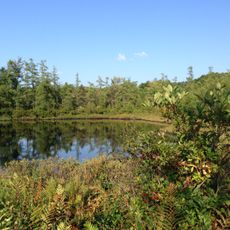
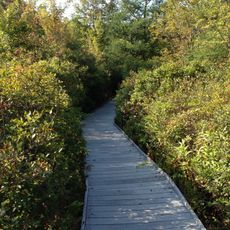
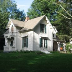
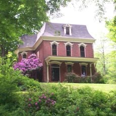
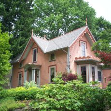
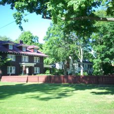
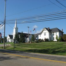
Portage County is an administrative division in Northeast Ohio that encompasses rivers, forests, and several nature reserves across its territory. The region contains multiple parks and green spaces maintained for public use.

History

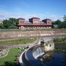
The General Assembly established the county on June 9, 1808, naming it after the portage between the Cuyahoga and Tuscarawas rivers. This geographical connection shaped early settlement patterns in the region.

Culture

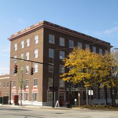
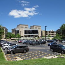
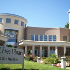
Kent State University and Hiram College provide higher education opportunities, while multiple public school districts and libraries serve the county's educational needs.

Practical

Two major highways connect the region to nearby larger cities, and several state routes run through the area. Visitors can easily navigate between communities and attractions.

Did you know?

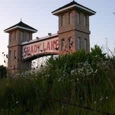
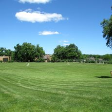
A local park operates under an unusual one-dollar annual lease arrangement with park commissioners. This creative agreement allows the property to be managed sustainably for community recreation.

Location
Inception
February 10, 1807
Capital city
Ravenna
Reference
POR
Shares border with
Summit County, Cuyahoga County, Geauga County, Trumbull County, Mahoning County, Stark County
GPS coordinates
41.17000,-81.20000
Latest update
December 17, 2025 10:20

AroundUs brings together thousands of curated places, local tips, and hidden gems, enriched daily by 60,000 contributors worldwide. Discover all places nearby (Ohio).

Around this place
Dix Stadium
United States of America

Dix Stadium

10.1 km
Partially Buried Woodshed
United States of America

Partially Buried Woodshed

12.1 km
West Branch State Park
United States of America

West Branch State Park

8.3 km
Nelson Kennedy Ledges State Park
United States of America

Nelson Kennedy Ledges State Park

22.2 km
Shady Lake Park
United States of America

Shady Lake Park

15.8 km
Masonic Temple
United States of America

Masonic Temple

13.8 km
Kent Stage
United States of America

Kent Stage

13.2 km
Memorial Stadium
United States of America

Memorial Stadium

12.3 km
United States of America

Tinkers Creek State Park

18.7 km
Franklin Hotel (Kent, Ohio)
United States of America

Franklin Hotel (Kent, Ohio)

13.5 km
Triangle Lake Bog State Nature Preserve
United States of America

Triangle Lake Bog State Nature Preserve

7.4 km
Kent Industrial District
United States of America

Kent Industrial District

13.6 km
Wills Gymnasium
United States of America

Wills Gymnasium

12.6 km
Rockwell Field
United States of America

Rockwell Field

10.1 km
United States of America

Mantua Swamp

12.3 km
Kent Free Library
United States of America

Kent Free Library

13.6 km
Atwater Congregational Church
United States of America

Atwater Congregational Church

17 km
Tom S. Cooperrider-Kent Bog State Nature Preserve
United States of America

Tom S. Cooperrider-Kent Bog State Nature Preserve

13.6 km
Aaron Ferrey House
United States of America

Aaron Ferrey House

14.7 km
John Davey House
United States of America

John Davey House

13.9 km
Kent Jail
United States of America

Kent Jail

14.3 km
Charles Kent House
United States of America

Charles Kent House

14 km
Freedom Congregational Church
United States of America

Freedom Congregational Church

8.5 km
Hiram College Library
United States of America

Hiram College Library

16.3 km
Mantua Center School
United States of America

Mantua Center School

16.2 km
Franklin Township Hall
United States of America

Franklin Township Hall

13.5 km
West Main Street District
United States of America

West Main Street District

14 km
Aurora Center Historic District
United States of America

Aurora Center Historic District

20.2 km
Show the full map
« Portage County - Administrative division in Northeast Ohio, United States » is provided by Around Us (aroundus.com). Images and texts are derived from Wikimedia project under a Creative Commons license. You are allowed to copy, distribute, and modify copies of this page, under the conditions set by the license, as long as this note is clearly visible.

Discover hidden gems everywhere you go!

From secret cafés to breathtaking viewpoints, skip the crowded tourist spots and find places that match your style. Our app makes it easy with voice search, smart filtering, route optimization, and insider tips from travelers worldwide. Download now for the complete mobile experience.

Around Us App Screenshot

A unique approach to discovering new places

Le Figaro

All the places worth exploring

France Info

A tailor-made excursion in just a few clicks

20 Minutes

Around Us
Travel Guide & Maps
Download

Send to your phone

QR Code
1

Open the camera app on your mobile.

2

Point at the QR code with your camera. A notification will appear.

3

Tap the notification to open the link.