Pachaug State Forest

Log in to your account

AroundUs is a community-driven map of interesting places, built by curious explorers like you. It grows with every review, story, and photo you share.
Connect to save your favorite spots, contribute locations, and create personalized routes.
Continue with Google
Continue with Apple
Continue with X
Continue with Facebook
Continue with email
By continuing, you accept our Terms and Conditions and our Privacy Policy
Create an account
Add to collection
Map
Suggest a change
Share

Pachaug State Forest, State forest in New London County, US

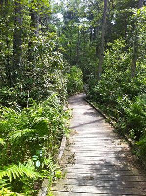
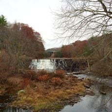
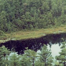
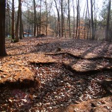
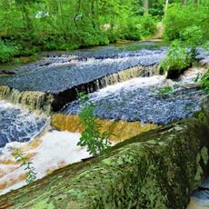
Pachaug State Forest is an expansive woodland area in Connecticut's New London County with ponds, streams, waterfalls, and ravines spread across six towns. The landscape also displays old mill ruins and glacial fields.

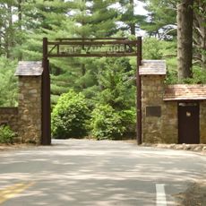
The forest was established in 1928, with major land purchases happening during the Great Depression through various government programs. These acquisitions shaped today's forest as a unified public natural area.

The name Pachaug comes from Native American language and refers to the river's distinctive bend that runs through the forest's core. Visitors experience this cultural connection today when walking along the waterway.

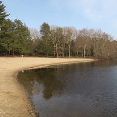
Two campgrounds offer rustic overnight options with water access for fishing and exploring. Visitors should allow time for longer hikes and wear sturdy shoes, as the terrain is uneven.

The Pachaug-Great Meadow Swamp holds one of Connecticut's largest Atlantic white cedar swamps, earning the area National Natural Landmark recognition. This wetland is notable for its ancient cedar trees.

Location: New London County

Elevation above the sea: 143 m

GPS coordinates: 41.59920,-71.87810

Latest update: December 8, 2025 19:49

Photos
Around this place
United States of America

Canterbury Female Boarding School

13.5 km
Yawgoog Scout Reservation
United States of America

Yawgoog Scout Reservation

12.1 km
Hopeville Pond State Park
United States of America

Hopeville Pond State Park

3.5 km
Moosup Valley State Park Trail
United States of America

Moosup Valley State Park Trail

11.4 km
Ell Pond
United States of America

Ell Pond

13.1 km
Central Village Historic District
United States of America

Central Village Historic District

13.5 km
Prudence Crandall House
United States of America

Prudence Crandall House

13.5 km
Butts Bridge
United States of America

Butts Bridge

9.7 km
Ashland Mill Bridge
United States of America

Ashland Mill Bridge

8.4 km
Quinebaug Trail
United States of America

Quinebaug Trail

6.6 km
Sterling Hill Historic District
United States of America

Sterling Hill Historic District

10.4 km
Anshei Israel Synagogue
United States of America

Anshei Israel Synagogue

10.2 km
Avery House
United States of America

Avery House

3.1 km
Glen Falls Bridge
United States of America

Glen Falls Bridge

13.2 km
Andrew Clark House
United States of America

Andrew Clark House

10.1 km
Slater Library and Fanning Annex
United States of America

Slater Library and Fanning Annex

8.9 km
Capt. John Clark House
United States of America

Capt. John Clark House

10.6 km
Packerville Bridge
United States of America

Packerville Bridge

9.6 km
Timothy Lester Farmstead
United States of America

Timothy Lester Farmstead

7.6 km
Lawton Mills Historic District
United States of America

Lawton Mills Historic District

9.2 km
John Wilson House
United States of America

John Wilson House

8.6 km
Lathrop-Mathewson-Ross House
United States of America

Lathrop-Mathewson-Ross House

9.7 km
Aldrich Free Public Library
United States of America

Aldrich Free Public Library

13.3 km
Mill Ridge Manor
United States of America

Mill Ridge Manor

13.6 km
Edward Cogswell House
United States of America

Edward Cogswell House

2.5 km
Plainfield Street Historic District
United States of America

Plainfield Street Historic District

10.1 km
Quinebaug River Prehistoric Archeological District
United States of America

Quinebaug River Prehistoric Archeological District

10.5 km
Stepstone Falls
United States of America

Stepstone Falls

9.9 km
Show the full map
Reviews

Visited this place? Tap the stars to rate it and share your experience / photos with the community! Try now! You can cancel it anytime.

« Pachaug State Forest - State forest in New London County, US » is provided by Around Us (aroundus.com). Images and texts are derived from Wikimedia project under a Creative Commons license. You are allowed to copy, distribute, and modify copies of this page, under the conditions set by the license, as long as this note is clearly visible.

Discover hidden gems everywhere you go!

From secret cafés to breathtaking viewpoints, skip the crowded tourist spots and find places that match your style. Our app makes it easy with voice search, smart filtering, route optimization, and insider tips from travelers worldwide. Download now for the complete mobile experience.

Around Us App Screenshot

A unique approach to discovering new places

Le Figaro

All the places worth exploring

France Info

A tailor-made excursion in just a few clicks

20 Minutes