Enable Location

We need your location to show you interesting places around you

Discover nearby places

Find interesting locations and hidden gems around you

Precise directions

Get accurate directions and distances to places

Your location is never shared with other users. It's only used when you tap the location button.

Sterling Hill Historic District

Log in to your account

Start exploring — it's free

Trusted by 63,454 travelers worldwide

Continue with Google
Continue with Apple
or

We will send you a code to connect

By continuing, you accept our Terms and Conditions and our Privacy Policy

Check your inbox

We've sent a pincode in your inbox. Please enter the code below.

Discussion Reviews 1 Photos
1.4k Popularity

Sterling Hill Historic District, Historic residential district in Sterling, Connecticut.

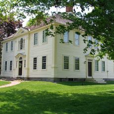
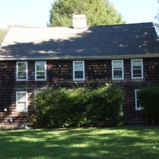
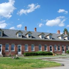
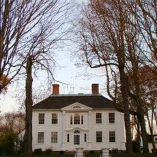
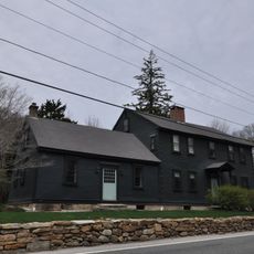
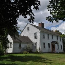
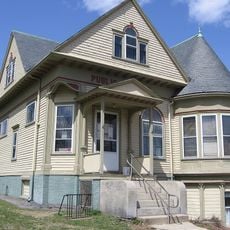
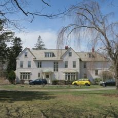
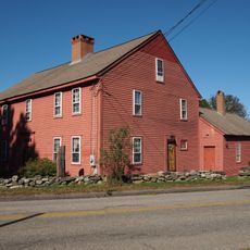
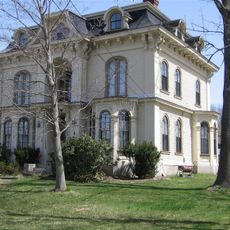
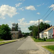
The Sterling Hill Historic District contains 14 residences alongside outbuildings and a church arranged along a ridge line at the western edge of Sterling. The collection spans architectural approaches from several centuries of New England building tradition.

The district earned National Register status in 1986, protecting a collection of structures that grew over the 1700s and 1800s. The buildings reflect the stylistic evolution from Federal and Georgian designs through Greek Revival forms.

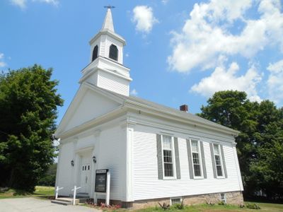
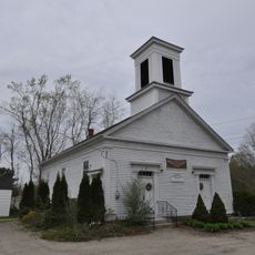
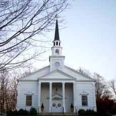
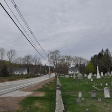
The Sterling Hill Baptist Church, founded in 1812, remains central to how the community gathers and celebrates together today. Walking through the district, you can see how the church anchored village life for generations.

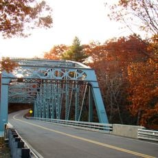
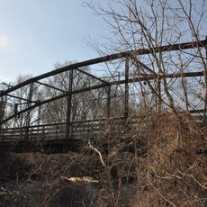
The district lies along State Route 14A and Green Lane, making it accessible to explore on foot with views from the roads. Walking slowly lets you take in the details of each building and how they relate to the open landscape.

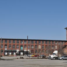
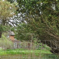
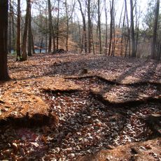
The neighborhood preserved its original character because railroads passed through nearby Plainfield instead, leaving this area untouched by industrial development. This geographical distance from major industrial centers allowed the village to maintain its quiet rural form.

The community of curious travelers

AroundUs brings together thousands of curated places, local tips, and hidden gems, enriched daily by 60,000 contributors worldwide.

Start exploring
Location
Architectural style
Greek Revival architecture, Renaissance Revival architecture
GPS coordinates
41.68972,-71.84889
Latest update
December 14, 2025 17:04
Around this place
United States of America

Canterbury Female Boarding School

10.2 km
Pachaug State Forest
United States of America

Pachaug State Forest

10.4 km
Hopeville Pond State Park
United States of America

Hopeville Pond State Park

10.8 km
Old Furnace State Park
United States of America

Old Furnace State Park

10.4 km
Moosup Valley State Park Trail
United States of America

Moosup Valley State Park Trail

4.4 km
Central Village Historic District
United States of America

Central Village Historic District

5.7 km
Prudence Crandall House
United States of America

Prudence Crandall House

10.3 km
Butts Bridge
United States of America

Butts Bridge

11 km
Quinebaug Trail
United States of America

Quinebaug Trail

4 km
Rice City Historic District
United States of America

Rice City Historic District

7.4 km
Avery House
United States of America

Avery House

10.6 km
Quinebaug Mill – Quebec Square Historic District
United States of America

Quinebaug Mill – Quebec Square Historic District

12.5 km
Glen Falls Bridge
United States of America

Glen Falls Bridge

3.2 km
Canterbury Center Historic District
United States of America

Canterbury Center Historic District

10.4 km
Capt. John Clark House
United States of America

Capt. John Clark House

10.8 km
Packerville Bridge
United States of America

Packerville Bridge

8.7 km
Mount Vernon Tavern
United States of America

Mount Vernon Tavern

12.1 km
Lawton Mills Historic District
United States of America

Lawton Mills Historic District

6.1 km
William Waterman House
United States of America

William Waterman House

12.8 km
Moosup Valley Historic District
United States of America

Moosup Valley Historic District

9.5 km
Aldrich Free Public Library
United States of America

Aldrich Free Public Library

3.9 km
Mill Ridge Manor
United States of America

Mill Ridge Manor

5.7 km
Edward Cogswell House
United States of America

Edward Cogswell House

12.4 km
Plainfield Street Historic District
United States of America

Plainfield Street Historic District

5.5 km
Capt. George Dorrance House
United States of America

Capt. George Dorrance House

7.6 km
Quinebaug River Prehistoric Archeological District
United States of America

Quinebaug River Prehistoric Archeological District

9.2 km
Wauregan Historic District
United States of America

Wauregan Historic District

8.2 km
Stepstone Falls
United States of America

Stepstone Falls

11.4 km
Show the full map
Reviews
Share your experience

No review yet

Discussions
Start a discussion...

No discussion yet

« Sterling Hill Historic District - Historic residential district in Sterling, Connecticut » is provided by Around Us (aroundus.com). Images and texts are derived from Wikimedia project under a Creative Commons license. You are allowed to copy, distribute, and modify copies of this page, under the conditions set by the license, as long as this note is clearly visible.

Discover hidden gems everywhere you go!

From secret cafés to breathtaking viewpoints, skip the crowded tourist spots and find places that match your style. Our app makes it easy with voice search, smart filtering, route optimization, and insider tips from travelers worldwide. Download now for the complete mobile experience.

Around Us App Screenshot

A unique approach to discovering new places

Le Figaro

All the places worth exploring

France Info

A tailor-made excursion in just a few clicks

20 Minutes

Around Us
Travel Guide & Maps
Download

Send to your phone

QR Code
1

Open the camera app on your mobile.

2

Point at the QR code with your camera. A notification will appear.

3

Tap the notification to open the link.