Enable Location

We need your location to show you interesting places around you

Discover nearby places

Find interesting locations and hidden gems around you

Precise directions

Get accurate directions and distances to places

Your location is never shared with other users. It's only used when you tap the location button.

Old Furnace State Park

Log in to your account

Start exploring — it's free

Trusted by 62,568 travelers worldwide

Continue with Google
Continue with Apple
or

We will send you a code to connect

By continuing, you accept our Terms and Conditions and our Privacy Policy

Check your inbox

We've sent a pincode in your inbox. Please enter the code below.

Old Furnace State Park

Old Furnace State Park, State park in Killingly, United States

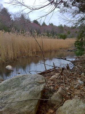
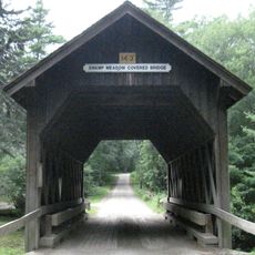
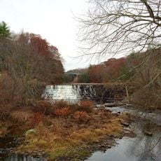
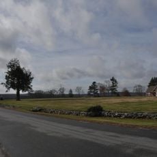
Old Furnace State Park is a forested state park in Killingly, Connecticut, covering about 367 acres with multiple trails, ponds, and wetland areas. The property offers walking routes of varying length through wooded sections and open water features scattered throughout.

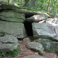
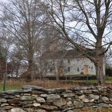
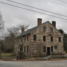
An iron furnace operated on this site during the 1700s, producing horseshoes for the Continental Army during the American Revolutionary War. The facility was part of the region's industrial activity and supported military operations through metalworking.

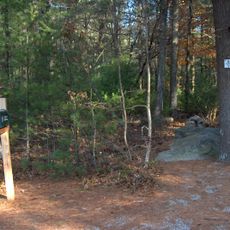
The Connecticut Forest and Park Association maintains the Blue-Blazed Old Furnace Trail, connecting visitors with regional outdoor recreation traditions.

The park entrance near U.S. Route 6 has a parking area for visitors. Hiking, fishing, and hunting are the main outdoor activities available on the grounds.

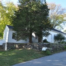
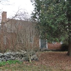
Stone foundations and walls from the old furnace remain on the property today, partially hidden within the second-growth forest. Walking through the park, you may come across these industrial remains scattered along trails and near Furnace Brook.

The community of curious travelers

AroundUs brings together thousands of curated places, local tips, and hidden gems, enriched daily by 60,000 contributors worldwide.

Start exploring
Location
Inception
1918
Elevation above the sea
119 m
GPS coordinates
41.78194,-71.86694
Latest update
December 12, 2025 17:45
Around this place
Jerimoth Hill
United States of America

Jerimoth Hill

10.4 km
Israel Putnam Wolf Den
United States of America

Israel Putnam Wolf Den

11.9 km
Dayville Historic District
United States of America

Dayville Historic District

7.3 km
United States of America

Israel Putnam Monument

6.9 km
Swamp Meadow Bridge
United States of America

Swamp Meadow Bridge

11.6 km
Moosup Valley State Park Trail
United States of America

Moosup Valley State Park Trail

9.5 km
Central Village Historic District
United States of America

Central Village Historic District

7.8 km
Putnam Farm
United States of America

Putnam Farm

8.3 km
Rice City Historic District
United States of America

Rice City Historic District

11.7 km
Sterling Hill Historic District
United States of America

Sterling Hill Historic District

10.4 km
Quinebaug Mill – Quebec Square Historic District
United States of America

Quinebaug Mill – Quebec Square Historic District

2.6 km
Broad Street – Davis Park Historic District
United States of America

Broad Street – Davis Park Historic District

3.1 km
Brooklyn Green Historic District
United States of America

Brooklyn Green Historic District

6.9 km
Glen Falls Bridge
United States of America

Glen Falls Bridge

7.2 km
Cady-Copp House
United States of America

Cady-Copp House

12.1 km
Daniel's Village Archeological Site
United States of America

Daniel's Village Archeological Site

11.3 km
Pomfret Town House
United States of America

Pomfret Town House

12.2 km
Temple Beth Israel
United States of America

Temple Beth Israel

2.6 km
Jonathan Wheeler House
United States of America

Jonathan Wheeler House

10.8 km
Danielson Main Street Historic District
United States of America

Danielson Main Street Historic District

2.9 km
Bush Hill Historic District
United States of America

Bush Hill Historic District

8.8 km
Moosup Valley Historic District
United States of America

Moosup Valley Historic District

10.3 km
Aldrich Free Public Library
United States of America

Aldrich Free Public Library

7.1 km
Mill Ridge Manor
United States of America

Mill Ridge Manor

7.6 km
Plainfield Street Historic District
United States of America

Plainfield Street Historic District

11.4 km
Capt. George Dorrance House
United States of America

Capt. George Dorrance House

8.2 km
Killingly Intermediate School
United States of America

Killingly Intermediate School

8.1 km
Wauregan Historic District
United States of America

Wauregan Historic District

5.5 km
Show the full map
« Old Furnace State Park - State park in Killingly, United States » is provided by Around Us (aroundus.com). Images and texts are derived from Wikimedia project under a Creative Commons license. You are allowed to copy, distribute, and modify copies of this page, under the conditions set by the license, as long as this note is clearly visible.

Discover hidden gems everywhere you go!

From secret cafés to breathtaking viewpoints, skip the crowded tourist spots and find places that match your style. Our app makes it easy with voice search, smart filtering, route optimization, and insider tips from travelers worldwide. Download now for the complete mobile experience.

Around Us App Screenshot

A unique approach to discovering new places

Le Figaro

All the places worth exploring

France Info

A tailor-made excursion in just a few clicks

20 Minutes

Around Us
Travel Guide & Maps
Download

Send to your phone

QR Code
1

Open the camera app on your mobile.

2

Point at the QR code with your camera. A notification will appear.

3

Tap the notification to open the link.