Enable Location

We need your location to show you interesting places around you

Discover nearby places

Find interesting locations and hidden gems around you

Precise directions

Get accurate directions and distances to places

Your location is never shared with other users. It's only used when you tap the location button.

Quinebaug Mill – Quebec Square Historic District

Log in to your account

Start exploring — it's free

Trusted by 61,560 travelers worldwide

Continue with Google
Continue with Apple
or

We will send you a code to connect

By continuing, you accept our Terms and Conditions and our Privacy Policy

Check your inbox

We've sent a pincode in your inbox. Please enter the code below.

Quinebaug Mill – Quebec Square Historic District

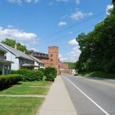
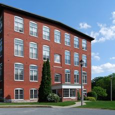
Quinebaug Mill – Quebec Square Historic District, Industrial heritage site in Brooklyn, Connecticut.

Description

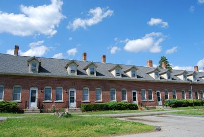
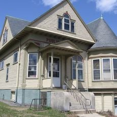
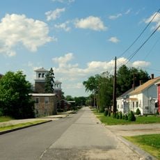
Quinebaug Mill district is an industrial heritage site with brick row houses stretching along the river and main streets that once housed mill workers. The homes display varied architectural styles from Greek Revival to Queen Anne, reflecting different periods of construction and expansion.

History

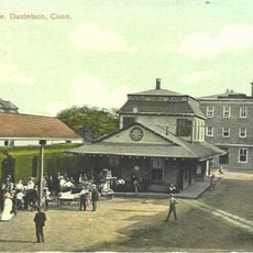
The site began in 1851 and grew into one of Connecticut's major textile factories, employing hundreds of workers in cotton production. Housing and infrastructure expanded over the decades as the mill operations increased, shaping the entire community around the factory.

Culture

The brick row houses reflect how workers lived during the mill era, with designs that changed over decades as industrial communities evolved. Walking through the streets, you see homes built for people who worked nearby, showing the practical way factories shaped residential life.

Practical

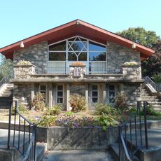
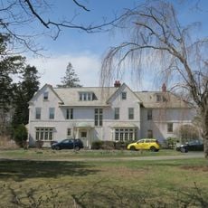
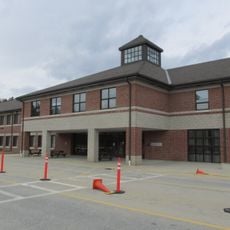
The district contains restored brick row house complexes that now serve as residences and are visible from public streets for viewing. The best time to explore is during daylight hours when you can see the architectural details and street layout clearly.

Did you know?

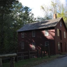
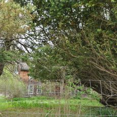
The site preserves an old weave shed and surrounding buildings that show how a complete industrial settlement operated as a functional community. This layout offers visitors a rare window into daily life and work in a 19th century factory town.

Location
GPS coordinates
41.79833,-71.88917
Latest update
December 14, 2025 18:05

AroundUs brings together thousands of curated places, local tips, and hidden gems, enriched daily by 60,000 contributors worldwide. Discover all places nearby (Brooklyn).

Around this place
Jerimoth Hill
United States of America

Jerimoth Hill

10.7 km
Israel Putnam Wolf Den
United States of America

Israel Putnam Wolf Den

9.4 km
Dayville Historic District
United States of America

Dayville Historic District

5.3 km
United States of America

Israel Putnam Monument

5.2 km
Old Furnace State Park
United States of America

Old Furnace State Park

2.6 km
Mashamoquet Brook State Park
United States of America

Mashamoquet Brook State Park

9.9 km
Moosup Valley State Park Trail
United States of America

Moosup Valley State Park Trail

11 km
Central Village Historic District
United States of America

Central Village Historic District

9 km
Putnam Farm
United States of America

Putnam Farm

5.8 km
Abington Congregational Church
United States of America

Abington Congregational Church

11.9 km
Pomfret Street Historic District
United States of America

Pomfret Street Historic District

11.8 km
Broad Street – Davis Park Historic District
United States of America

Broad Street – Davis Park Historic District

1.2 km
Brooklyn Green Historic District
United States of America

Brooklyn Green Historic District

5.1 km
Glen Falls Bridge
United States of America

Glen Falls Bridge

9.3 km
Cady-Copp House
United States of America

Cady-Copp House

10.5 km
Daniel's Village Archeological Site
United States of America

Daniel's Village Archeological Site

10 km
Pomfret Town House
United States of America

Pomfret Town House

9.6 km
Temple Beth Israel
United States of America

Temple Beth Israel

1.1 km
Jonathan Wheeler House
United States of America

Jonathan Wheeler House

9.9 km
Danielson Main Street Historic District
United States of America

Danielson Main Street Historic District

839 m
Bush Hill Historic District
United States of America

Bush Hill Historic District

6.4 km
Elliottville Lower Mill
United States of America

Elliottville Lower Mill

6 km
Aldrich Free Public Library
United States of America

Aldrich Free Public Library

8.9 km
Mill Ridge Manor
United States of America

Mill Ridge Manor

8.8 km
Plainfield Woolen Company Mill
United States of America

Plainfield Woolen Company Mill

8.9 km
Capt. George Dorrance House
United States of America

Capt. George Dorrance House

10.7 km
Killingly Intermediate School
United States of America

Killingly Intermediate School

5.9 km
Wauregan Historic District
United States of America

Wauregan Historic District

6.2 km
Show the full map
« Quinebaug Mill – Quebec Square Historic District - Industrial heritage site in Brooklyn, Connecticut » is provided by Around Us (aroundus.com). Images and texts are derived from Wikimedia project under a Creative Commons license. You are allowed to copy, distribute, and modify copies of this page, under the conditions set by the license, as long as this note is clearly visible.

Discover hidden gems everywhere you go!

From secret cafés to breathtaking viewpoints, skip the crowded tourist spots and find places that match your style. Our app makes it easy with voice search, smart filtering, route optimization, and insider tips from travelers worldwide. Download now for the complete mobile experience.

Around Us App Screenshot

A unique approach to discovering new places

Le Figaro

All the places worth exploring

France Info

A tailor-made excursion in just a few clicks

20 Minutes

Around Us
Travel Guide & Maps
Download

Send to your phone

QR Code
1

Open the camera app on your mobile.

2

Point at the QR code with your camera. A notification will appear.

3

Tap the notification to open the link.