Enable Location

We need your location to show you interesting places around you

Discover nearby places

Find interesting locations and hidden gems around you

Precise directions

Get accurate directions and distances to places

Your location is never shared with other users. It's only used when you tap the location button.

Zoar Trail

Log in to your account

Start exploring — it's free

Trusted by 62,949 travelers worldwide

Continue with Google
Continue with Apple
or

We will send you a code to connect

By continuing, you accept our Terms and Conditions and our Privacy Policy

Check your inbox

We've sent a pincode in your inbox. Please enter the code below.

Zoar Trail
Discussion Reviews 1 Photos
2.8k Popularity

Zoar Trail, Weg in den Vereinigten Staaten

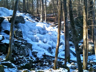
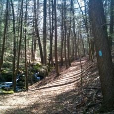
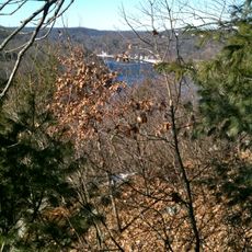
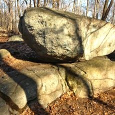
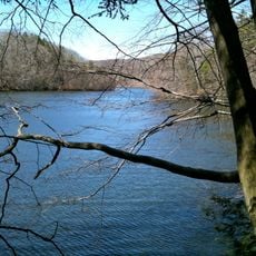
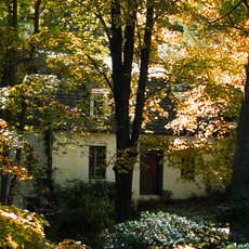
Zoar Trail is a hiking path in Paugussett State Forest stretching about 6.5 miles with sections running alongside the Housatonic River and Lake Zoar. The route passes through rocky terrain, stream crossings, dense forests of pine and hemlock trees, and includes a side path to Prydden Falls waterfall.

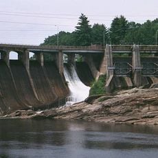
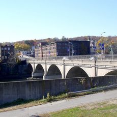
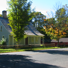
The town of Zoar once existed in this valley but was flooded in 1919 when a dam was constructed, submerging the entire settlement beneath what is now a reservoir. The lost village remains underwater as a reminder of how the landscape changed due to development.

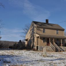
The Zoar Trail follows paths that once connected a settlement now submerged beneath the reservoir, keeping the memory of the lost town alive through the landscape. Local marks and carvings along the route reflect the quirky character of those who know these woods well.

The trail is accessed from a parking area at the end of Great Quarter Road in Sandy Hook; driving to the very end of the road offers the best spot. Sturdy footwear is essential as the path is rocky and becomes slippery when wet, and carrying a trail map or downloading route information beforehand helps with navigation.

Beneath the reservoir waters lie the submerged remains of the old town of Zoar, which some divers and swimmers explore to see the underwater foundations. This hidden element below the surface surprises many hikers and adds an unexpected layer to the visit.

The community of curious travelers

AroundUs brings together thousands of curated places, local tips, and hidden gems, enriched daily by 60,000 contributors worldwide.

Start exploring
Location
GPS coordinates
41.38000,-73.16000
Latest update
February 9, 2026 08:23
Around this place
Indian Well State Park
United States of America

Indian Well State Park

5.8 km
Southford Falls State Park
United States of America

Southford Falls State Park

8.3 km
Sterling Opera House
United States of America

Sterling Opera House

8.7 km
Stevenson Dam Bridge
United States of America

Stevenson Dam Bridge

1 km
Paugussett Trail
United States of America

Paugussett Trail

0 m
Kettletown State Park
United States of America

Kettletown State Park

5.9 km
Osbornedale State Park
United States of America

Osbornedale State Park

6.6 km
Quaker Farms Historic District
United States of America

Quaker Farms Historic District

5.1 km
Paugussett State Forest
United States of America

Paugussett State Forest

5.4 km
United States of America

Pomperaug Trail

0 m
Kraus Corset Factory
United States of America

Kraus Corset Factory

8.8 km
Plumb Memorial Library
United States of America

Plumb Memorial Library

8.5 km
Derby-Shelton Bridge
United States of America

Derby-Shelton Bridge

8.9 km
Osbornedale
United States of America

Osbornedale

6.5 km
Westville Village Historic District
United States of America

Westville Village Historic District

5.6 km
Monroe Center Historic District
United States of America

Monroe Center Historic District

6.6 km
Ansonia Library
United States of America

Ansonia Library

8 km
Plaster House
United States of America

Plaster House

7.8 km
United States Post Office–Ansonia Main
United States of America

United States Post Office–Ansonia Main

7.9 km
United States of America

Upper Main Street Historic District

7.8 km
Daniel Basset House
United States of America

Daniel Basset House

4.7 km
John I. Howe House
United States of America

John I. Howe House

8.8 km
William Hurd House
United States of America

William Hurd House

8.7 km
Harcourt Wood Memorial Library
United States of America

Harcourt Wood Memorial Library

8.4 km
Richard Mansfield House
United States of America

Richard Mansfield House

8.7 km
Adin Wheeler House and Theodore F. Wheeler Wheelwright Shop
United States of America

Adin Wheeler House and Theodore F. Wheeler Wheelwright Shop

8.9 km
Sanford-Humphreys House
United States of America

Sanford-Humphreys House

6.9 km
Strand Theatre
United States of America

Strand Theatre

7.5 km
Show the full map
Reviews
Share your experience

No review yet

Discussions
Start a discussion...

No discussion yet

« Zoar Trail - Weg in den Vereinigten Staaten » is provided by Around Us (aroundus.com). Images and texts are derived from Wikimedia project under a Creative Commons license. You are allowed to copy, distribute, and modify copies of this page, under the conditions set by the license, as long as this note is clearly visible.

Discover hidden gems everywhere you go!

From secret cafés to breathtaking viewpoints, skip the crowded tourist spots and find places that match your style. Our app makes it easy with voice search, smart filtering, route optimization, and insider tips from travelers worldwide. Download now for the complete mobile experience.

Around Us App Screenshot

A unique approach to discovering new places

Le Figaro

All the places worth exploring

France Info

A tailor-made excursion in just a few clicks

20 Minutes

Around Us
Travel Guide & Maps
Download

Send to your phone

QR Code
1

Open the camera app on your mobile.

2

Point at the QR code with your camera. A notification will appear.

3

Tap the notification to open the link.