Youghiogheny River Trail

Log in to your account

AroundUs is a community-driven map of interesting places, built by curious explorers like you. It grows with every review, story, and photo you share.
Connect to save your favorite spots, contribute locations, and create personalized routes.
Continue with Google
Continue with Apple
Continue with X
Continue with Facebook
Continue with email
By continuing, you accept our Terms and Conditions and our Privacy Policy
Create an account
Add to collection
Map
Suggest a change
Share

Youghiogheny River Trail, National Recreation Trail in Allegheny County, United States.

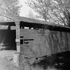
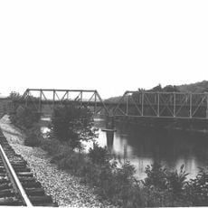
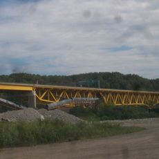
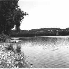
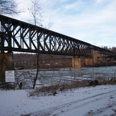
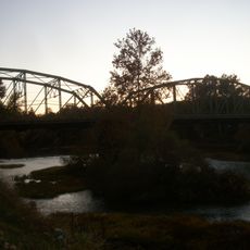
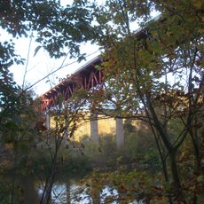
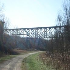
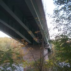
The Youghiogheny River Trail is a hiking path that runs roughly 70 miles from McKeesport to Confluence, following the river's winding course through Pennsylvania. The trail moves through forests and open areas, passing old industrial structures that line the valley floor.

The route once served as a transportation corridor for coal and goods moving through the region during its industrial years. This industrial past remains visible through the structures and landscape features along the way.

Local communities organize seasonal events near the trail, fostering connections between outdoor recreation enthusiasts and regional environmental conservation efforts.

Several access points with parking are spread along the entire route, allowing hikers to start from different locations. Rest areas and picnic tables are distributed throughout, so you can stop and take breaks easily.

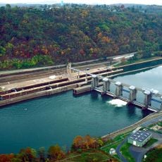
The route connects different points where you can reach the river itself, making it easy to switch activities. You can move from a simple hike to fishing or paddling, combining these pursuits during your visit.

Location: Allegheny County

GPS coordinates: 40.16100,-79.75900

Latest update: December 11, 2025 11:03

Photos
Around this place
Cement City Historic District
United States of America

Cement City Historic District

9.1 km
United States of America

Round Hill Park

11.7 km
Linden Hall at Saint James Park
United States of America

Linden Hall at Saint James Park

11.8 km
Bells Mills Covered Bridge
United States of America

Bells Mills Covered Bridge

7.7 km
Providence Quaker Cemetery and Chapel
United States of America

Providence Quaker Cemetery and Chapel

10 km
Layton Bridge
United States of America

Layton Bridge

8.4 km
Donora-Monessen Bridge
United States of America

Donora-Monessen Bridge

8.7 km
Donora-Webster Bridge
United States of America

Donora-Webster Bridge

8.3 km
Belle Vernon Bridge
United States of America

Belle Vernon Bridge

10.8 km
St. Nicholas Byzantine Catholic Church
United States of America

St. Nicholas Byzantine Catholic Church

8.8 km
Speers Railroad Bridge
United States of America

Speers Railroad Bridge

10.9 km
Alliance Furnace
United States of America

Alliance Furnace

6.5 km
Star Junction Historic District
United States of America

Star Junction Historic District

11.1 km
Charleroi-Monessen Bridge
United States of America

Charleroi-Monessen Bridge

12.4 km
Charleroi Locks & Dam
United States of America

Charleroi Locks & Dam

12.1 km
West Newton Bridge
United States of America

West Newton Bridge

5.6 km
Charleroi Historic District
United States of America

Charleroi Historic District

12.4 km
Dick Building
United States of America

Dick Building

5.5 km
Col. Edward Cook House
United States of America

Col. Edward Cook House

6.9 km
Plumer House
United States of America

Plumer House

5.4 km
Searight's Fulling Mill
United States of America

Searight's Fulling Mill

8.7 km
Matthew Smelser Memorial Bridge
United States of America

Matthew Smelser Memorial Bridge

100 m
First National Bank of Charleroi
United States of America

First National Bank of Charleroi

12.1 km
Youghiogheny Bank of Pennsylvania
United States of America

Youghiogheny Bank of Pennsylvania

8.3 km
Whitsett Historic District
United States of America

Whitsett Historic District

6.2 km
Banning Railroad Bridge
United States of America

Banning Railroad Bridge

4.2 km
Smithton Low-Level Bridge
United States of America

Smithton Low-Level Bridge

1.3 km
Karolcik Building
United States of America

Karolcik Building

8.3 km
Show the full map
Reviews

Visited this place? Tap the stars to rate it and share your experience / photos with the community! Try now! You can cancel it anytime.

« Youghiogheny River Trail - National Recreation Trail in Allegheny County, United States » is provided by Around Us (aroundus.com). Images and texts are derived from Wikimedia project under a Creative Commons license. You are allowed to copy, distribute, and modify copies of this page, under the conditions set by the license, as long as this note is clearly visible.

Discover hidden gems everywhere you go!

From secret cafés to breathtaking viewpoints, skip the crowded tourist spots and find places that match your style. Our app makes it easy with voice search, smart filtering, route optimization, and insider tips from travelers worldwide. Download now for the complete mobile experience.

Around Us App Screenshot

A unique approach to discovering new places

Le Figaro

All the places worth exploring

France Info

A tailor-made excursion in just a few clicks

20 Minutes