Nansemond River Bridge

Log in to your account

AroundUs is a community-driven map of interesting places, built by curious explorers like you. It grows with every review, story, and photo you share.
Connect to save your favorite spots, contribute locations, and create personalized routes.
By continuing, you accept our Terms and Conditions and our Privacy Policy

Nansemond River Bridge

Add to collection
Map
Suggest a change
Share

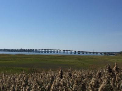
Nansemond River Bridge, Four-lane bridge in Suffolk, Virginia.

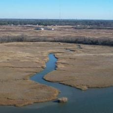
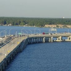
The Nansemond River Bridge is a four-lane bridge that crosses the river in Suffolk and forms part of U.S. Route 17. It carries traffic between communities on either side of the waterway, serving both through traffic and local commuters.

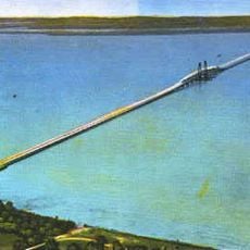
The current bridge was built in 1982 and replaced an earlier structure from 1928 that was part of a bridge system operated by the James River Bridge Corporation. This new bridge marked the end of the era when ferries were the main way to cross the river in southeastern Virginia.

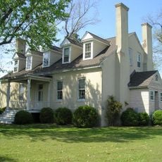
The bridge bears the name of Mills E. Godwin Jr, a former Virginia governor who represented the interests of the Chuckatuck community.

Access to the bridge is via U.S. Route 17, which forms the main traffic artery in the region and connects at interchanges in Suffolk. The best time to cross is outside rush hours when traffic flows more smoothly.

The bridge is named after Mills E. Godwin Jr., a former Virginia governor whose family represented the Chuckatuck area. This naming connects the modern infrastructure to the local political history of the region.

Location: Virginia

Inception: 1982

Official opening: 1982

GPS coordinates: 36.88694,-76.49253

Latest update: December 14, 2025 14:20

Photos
Around this place
Monitor-Merrimac Memorial Bridge-Tunnel
United States of America

Monitor-Merrimac Memorial Bridge-Tunnel

10.1 km
James River Bridge
United States of America

James River Bridge

11.6 km
Windsor Castle
United States of America

Windsor Castle

15.5 km
Virginia War Museum
United States of America

Virginia War Museum

15.2 km
Newport News Middle Ground Light
United States of America

Newport News Middle Ground Light

11.1 km
Newport News Victory Arch
United States of America

Newport News Victory Arch

11.4 km
Huntington Park
United States of America

Huntington Park

15.3 km
Nansemond National Wildlife Refuge
United States of America

Nansemond National Wildlife Refuge

9.3 km
Kings Highway Bridge
United States of America

Kings Highway Bridge

7.3 km
Newport News Public Library
United States of America

Newport News Public Library

11.6 km
Bay Point Farm
United States of America

Bay Point Farm

5.1 km
J. Thomas Newsome House
United States of America

J. Thomas Newsome House

13.8 km
Wat Pasantidhamma
United States of America

Wat Pasantidhamma

9.6 km
James A. Fields House
United States of America

James A. Fields House

12.6 km
Port Norfolk Historic District
United States of America

Port Norfolk Historic District

14.5 km
Boush-Tazewell House
United States of America

Boush-Tazewell House

16 km
Craney Island Light
United States of America

Craney Island Light

13.9 km
First Baptist Church
United States of America

First Baptist Church

11.6 km
Phillips Farm
United States of America

Phillips Farm

8.2 km
Lambert Point Light
United States of America

Lambert Point Light

14.4 km
Sunray Agricultural Historic District
United States of America

Sunray Agricultural Historic District

13.9 km
Chuckatuck Historic District
United States of America

Chuckatuck Historic District

8.2 km
Godwin-Knight House
United States of America

Godwin-Knight House

8.1 km
Fort Nelson Chapter of the Daughters of the American Revolution Chapter House
United States of America

Fort Nelson Chapter of the Daughters of the American Revolution Chapter House

12.9 km
Driver Historic District
United States of America

Driver Historic District

7 km
Virginia War Museum
United States of America

Virginia War Museum

15.1 km
Nansemond River Light
United States of America

Nansemond River Light

5.1 km
West Norfolk Bridge
United States of America

West Norfolk Bridge

13.7 km
Show the full map
Reviews

Visited this place? Tap the stars to rate it and share your experience / photos with the community! Try now! You can cancel it anytime.

« Nansemond River Bridge - Four-lane bridge in Suffolk, Virginia » is provided by Around Us (aroundus.com). Images and texts are derived from Wikimedia project under a Creative Commons license. You are allowed to copy, distribute, and modify copies of this page, under the conditions set by the license, as long as this note is clearly visible.

Discover hidden gems everywhere you go!

From secret cafés to breathtaking viewpoints, skip the crowded tourist spots and find places that match your style. Our app makes it easy with voice search, smart filtering, route optimization, and insider tips from travelers worldwide. Download now for the complete mobile experience.

Around Us App Screenshot

A unique approach to discovering new places

Le Figaro

All the places worth exploring

France Info

A tailor-made excursion in just a few clicks

20 Minutes