Enable Location

We need your location to show you interesting places around you

Discover nearby places

Find interesting locations and hidden gems around you

Precise directions

Get accurate directions and distances to places

Your location is never shared with other users. It's only used when you tap the location button.

Log in to your account

Start exploring — it's free

Trusted by 61,888 travelers worldwide

Continue with Google
Continue with Apple
or

We will send you a code to connect

By continuing, you accept our Terms and Conditions and our Privacy Policy

Check your inbox

We've sent a pincode in your inbox. Please enter the code below.

Lake Francis State Park

Lake Francis State Park, State park with lake in Coös County, United States

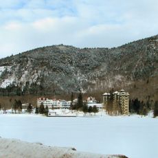
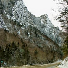
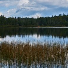
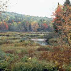
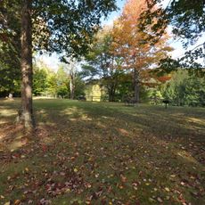
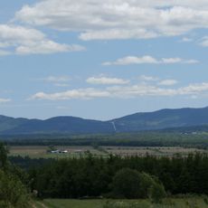
Lake Francis State Park is a 2,000-acre preserve in northern New Hampshire featuring a large lake ringed by dense forest and woodland areas. The park provides access to both the water and the forested terrain that surrounds it throughout the seasons.

The park was established to balance environmental protection with public recreation in New Hampshire's remote northern regions. Its creation reflected growing efforts to preserve forests and lake areas for ongoing community use.

The park holds strong ties to local fishing traditions, where anglers come year-round to cast their lines in summer and return when the water freezes in winter. These practices shape how people here relate to the lake across all seasons.

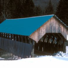
The campground offers over 40 overnight spots with some featuring water and electric connections, plus separate areas for off-road vehicle camping. Plan ahead since seasonal weather shifts significantly and facilities operate year-round with varying conditions.

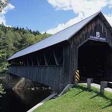
The park sits at the center of an extensive network of off-road riding trails that extend across the surrounding county. This positioning draws enthusiasts who come specifically to experience both the lake and the trail system in one visit.

The community of curious travelers

AroundUs brings together thousands of curated places, local tips, and hidden gems, enriched daily by 60,000 contributors worldwide.

Start exploring
Location
GPS coordinates
45.06000,-71.30300
Latest update
December 14, 2025 16:44
Around this place
The Balsams Grand Resort Hotel
United States of America

The Balsams Grand Resort Hotel

21.1 km
Dixville Notch State Park
United States of America

Dixville Notch State Park

22 km
Pittsburg–Clarksville Covered Bridge
United States of America

Pittsburg–Clarksville Covered Bridge

8.2 km
Coleman State Park
United States of America

Coleman State Park

13.1 km
Umbagog National Wildlife Refuge
United States of America

Umbagog National Wildlife Refuge

34.5 km
United States of America

Beaver Brook Falls Wayside

20.1 km
Columbia Bridge
United States of America

Columbia Bridge

30.2 km
Bennett-Bean Covered Bridge
United States of America

Bennett-Bean Covered Bridge

26.1 km
Androscoggin Wayside Park
United States of America

Androscoggin Wayside Park

36.7 km
Montagne des Lignes
Canada

Montagne des Lignes

23.1 km
Saint-Isidore-d'Auckland
Canada

Saint-Isidore-d'Auckland

28.3 km
Indian Stream Schoolhouse
United States of America

Indian Stream Schoolhouse

11.2 km
Alice M. Ward Library
United States of America

Alice M. Ward Library

19.9 km
Wallace Farm
United States of America

Wallace Farm

27.9 km
Benjamin Aldrich Homestead
United States of America

Benjamin Aldrich Homestead

20.1 km
Mount D'Urban
Canada

Mount D'Urban

30.5 km
Église Saint-Herménégilde de Saint-Herménégilde
Canada

Église Saint-Herménégilde de Saint-Herménégilde

29.6 km
Site du patrimoine de l'église de Saint-Venant-de-Paquette
Canada

Site du patrimoine de l'église de Saint-Venant-de-Paquette

14.5 km
Site du patrimoine du canton de Sainte-Edwidge-de-Clifton
Canada

Site du patrimoine du canton de Sainte-Edwidge-de-Clifton

33.8 km
Église de Saint-Venant-de-Paquette
Canada

Église de Saint-Venant-de-Paquette

14.7 km
Forest Access Road bridge over the Connecticut River
United States of America

Forest Access Road bridge over the Connecticut River

1.4 km
Croix de chemin Scalabrini
Canada

Croix de chemin Scalabrini

34.6 km
Croix de chemin du Village de Saint-Edwidge
Canada

Croix de chemin du Village de Saint-Edwidge

33.7 km
U.S. Route 3 Bridge over the Connecticut River
United States of America

U.S. Route 3 Bridge over the Connecticut River

16.9 km
Croix de chemin Lemire
Canada

Croix de chemin Lemire

33.8 km
Scott Brook Road bridge over the Connecticut River
United States of America

Scott Brook Road bridge over the Connecticut River

16.8 km
Magalloway Road Bridge over the Connecticut River
United States of America

Magalloway Road Bridge over the Connecticut River

9.8 km
MEC Connecticut River Bridge
United States of America

MEC Connecticut River Bridge

19 km
Show the full map
« Lake Francis State Park - State park with lake in Coös County, United States » is provided by Around Us (aroundus.com). Images and texts are derived from Wikimedia project under a Creative Commons license. You are allowed to copy, distribute, and modify copies of this page, under the conditions set by the license, as long as this note is clearly visible.

Discover hidden gems everywhere you go!

From secret cafés to breathtaking viewpoints, skip the crowded tourist spots and find places that match your style. Our app makes it easy with voice search, smart filtering, route optimization, and insider tips from travelers worldwide. Download now for the complete mobile experience.

Around Us App Screenshot

A unique approach to discovering new places

Le Figaro

All the places worth exploring

France Info

A tailor-made excursion in just a few clicks

20 Minutes

Around Us
Travel Guide & Maps
Download

Send to your phone

QR Code
1

Open the camera app on your mobile.

2

Point at the QR code with your camera. A notification will appear.

3

Tap the notification to open the link.