Enable Location

We need your location to show you interesting places around you

Discover nearby places

Find interesting locations and hidden gems around you

Precise directions

Get accurate directions and distances to places

Your location is never shared with other users. It's only used when you tap the location button.

Log in to your account

Start exploring — it's free

Trusted by travelers worldwide

Continue with Google
Continue with Apple
or

We will send you a code to connect

By continuing, you accept our Terms and Conditions and our Privacy Policy

Check your inbox

We've sent a pincode in your inbox. Please enter the code below.

State Game Lands Number 26

State Game Lands Number 26, Wildlife management area in Bedford County, United States

Description

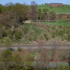
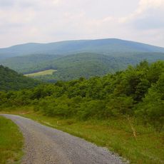
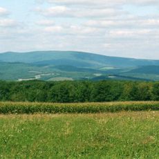
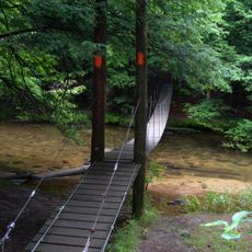
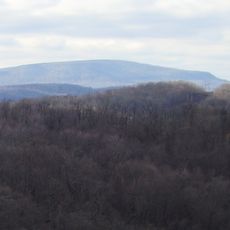
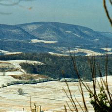
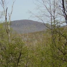
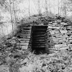
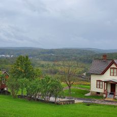
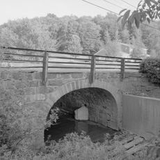
State Game Lands Number 26 is a protected wildlife area in Bedford County that consists of woodlands and open meadows across rolling terrain. The property includes sections of Bob's Creek and South Fork Little Conemaugh River, which support diverse plant and animal communities.

History

This protected land was established in 1979 by the Pennsylvania Game Commission as part of a statewide system of wildlife areas. The creation of this site reflected growing efforts to manage and preserve natural habitats across the state.

Culture

The land provides educational opportunities through organized programs that teach visitors about local wildlife species and conservation practices.

Practical

Visitors should know that this land is primarily managed for hunting with proper licenses and permits required for access. The property operates under seasonal restrictions that vary depending on the type of hunting or outdoor activity planned.

Did you know?

The property contains sections of Bob's Creek and South Fork Little Conemaugh River, supporting diverse ecosystems for native wildlife populations.

Location
Location
GPS coordinates
40.27222,-78.64306
Latest update
December 14, 2025 18:16

AroundUs brings together thousands of curated places, local tips, and hidden gems, enriched daily by 60,000 contributors worldwide. Discover all places nearby (Bedford County).

Around this place
Allegheny Portage Railroad
United States of America

Allegheny Portage Railroad

22.1 km
Johnstown Flood National Memorial
United States of America

Johnstown Flood National Memorial

14.1 km
Blue Knob
United States of America

Blue Knob

7.1 km
Blue Knob State Park
United States of America

Blue Knob State Park

5.3 km
Staple Bend Tunnel
United States of America

Staple Bend Tunnel

20.4 km
Gallitzin State Forest
United States of America

Gallitzin State Forest

9 km
Moxham Historic District
United States of America

Moxham Historic District

22.7 km
John P. Saylor Trail
United States of America

John P. Saylor Trail

11.2 km
Ritchey Knob
United States of America

Ritchey Knob

13.2 km
Pine Knob
United States of America

Pine Knob

12.8 km
Schaefer Head
United States of America

Schaefer Head

9 km
Windber Historic District
United States of America

Windber Historic District

16.5 km
New Paris Covered Bridge
United States of America

New Paris Covered Bridge

16 km
Dr. Knisley Covered Bridge
United States of America

Dr. Knisley Covered Bridge

13 km
Benjamin Franklin Jones Cottage
United States of America

Benjamin Franklin Jones Cottage

21.1 km
Ryot Covered Bridge
United States of America

Ryot Covered Bridge

14.6 km
Bridge in Portage Township
United States of America

Bridge in Portage Township

14.5 km
Cairnbrook Historic District
United States of America

Cairnbrook Historic District

22.3 km
Shade Furnace Archaeological District
United States of America

Shade Furnace Archaeological District

20.6 km
Snooks Covered Bridge
United States of America

Snooks Covered Bridge

12.7 km
Osterburg Covered Bridge
United States of America

Osterburg Covered Bridge

13.7 km
Johnstown Flood National Memorial
United States of America

Johnstown Flood National Memorial

13.9 km
Roaring Spring Historic District
United States of America

Roaring Spring Historic District

21.9 km
Portage Historic District
United States of America

Portage Historic District

12.8 km
Unger House
United States of America

Unger House

13.9 km
South Fork Fishing and Hunting Club Clubhouse
United States of America

South Fork Fishing and Hunting Club Clubhouse

13.1 km
Lilly Bridge
United States of America

Lilly Bridge

17 km
Pasquerilla Performing Arts Center
United States of America

Pasquerilla Performing Arts Center

16.2 km
Show the full map
« State Game Lands Number 26 - Wildlife management area in Bedford County, United States » is provided by Around Us (aroundus.com). Images and texts are derived from Wikimedia project under a Creative Commons license. You are allowed to copy, distribute, and modify copies of this page, under the conditions set by the license, as long as this note is clearly visible.

Discover hidden gems everywhere you go!

From secret cafés to breathtaking viewpoints, skip the crowded tourist spots and find places that match your style. Our app makes it easy with voice search, smart filtering, route optimization, and insider tips from travelers worldwide. Download now for the complete mobile experience.

Around Us App Screenshot

A unique approach to discovering new places

Le Figaro

All the places worth exploring

France Info

A tailor-made excursion in just a few clicks

20 Minutes

Around Us
Travel Guide & Maps
Download

Send to your phone

QR Code
1

Open the camera app on your mobile.

2

Point at the QR code with your camera. A notification will appear.

3

Tap the notification to open the link.