Chest opened
+${chestReward.xp} XP
Explorer
NOUVEAU ×${chestReward.collectible.quantity}
tapez pour fermer
Chest locked

Open chests in the app

Around Us is built for your phone — chests unlock when you walk, explore and capture nearby places.

Enable Location

We need your location to show you interesting places around you

Discover nearby places

Find interesting locations and hidden gems around you

Precise directions

Get accurate directions and distances to places

Your location is never shared with other users. It's only used when you tap the location button.

Darien Gap

Log in to your account

Start exploring — it's free

Trusted by 74,348 travelers worldwide

Continue with Google
Continue with Apple
or

We will send you a code to connect

By continuing, you accept our Terms and Conditions and our Privacy Policy

Check your inbox

We've sent a pincode in your inbox. Please enter the code below.

Darien Gap
Discussion Reviews 3 Photos
556k Popularity

Darien Gap, Geographic region between Panama and Colombia

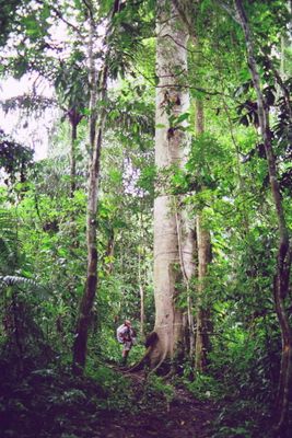
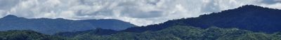
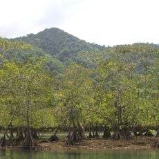
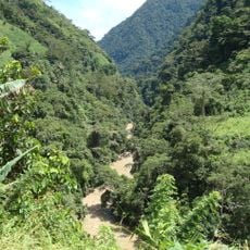
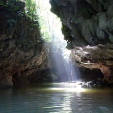
The Darién Gap lies between southern Panama and northern Colombia, covering dense rainforest, steep mountain slopes, wide swamplands, and branching river deltas. From the Pacific coast to the Caribbean shore, this terrain forms a continuous natural barrier with no paved roads or major settlements.

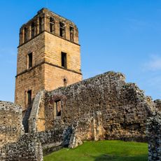
Spanish sailors reached the coast in the early sixteenth century and soon founded the first European town on the American mainland. For centuries afterward, disease, difficult terrain, and lack of infrastructure prevented any continuous road or railway from crossing through the region.

The Emberá-Wounaan and Guna live in small riverside villages, building palm-thatched homes on stilts and traveling by dugout canoe. They fish with nets, hunt in the forest, and occasionally sell baskets or woven crafts to the handful of outsiders who manage to reach their settlements.

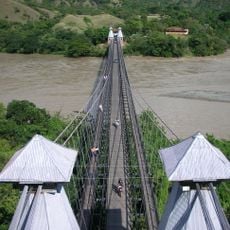
The Pan-American Highway ends at Yaviza in Panama, leaving no continuous road link between North and South America. Travelers attempting to cross must either walk through dense jungle or travel by boat along the coast, often under extremely difficult conditions.

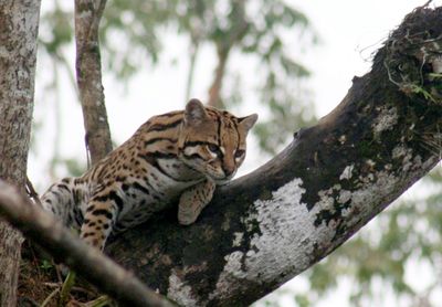
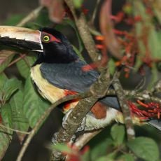
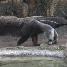
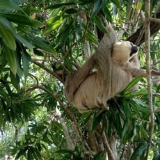
Annual rainfall ranges from 70 to 180 inches (1,800 to 4,500 millimeters), making this one of the wettest zones in the western hemisphere. That moisture sustains jaguars, harpy eagles, and giant anteaters, along with hundreds of bird species found only in this remote forest.

The community of curious travelers

AroundUs brings together thousands of curated places, local tips, and hidden gems, enriched daily by 60,000 contributors worldwide.

Start exploring
Location
GPS coordinates
7.90000,-77.46000
Latest update
March 5, 2026 18:15
Reviews
Share your experience

No review yet

Discussions
Start a discussion...

No discussion yet

« Darien Gap - Geographic region between Panama and Colombia » is provided by Around Us (aroundus.com). Images and texts are derived from Wikimedia project under a Creative Commons license. You are allowed to copy, distribute, and modify copies of this page, under the conditions set by the license, as long as this note is clearly visible.

Discover hidden gems everywhere you go!

From secret cafés to breathtaking viewpoints, skip the crowded tourist spots and find places that match your style. Our app makes it easy with voice search, smart filtering, route optimization, and insider tips from travelers worldwide. Download now for the complete mobile experience.

Around Us App Screenshot

A unique approach to discovering new places

Le Figaro

All the places worth exploring

France Info

A tailor-made excursion in just a few clicks

20 Minutes

Around Us
Travel Guide & Maps
Download

Send to your phone

QR Code
1

Open the camera app on your mobile.

2

Point at the QR code with your camera. A notification will appear.

3

Tap the notification to open the link.