Enable Location

We need your location to show you interesting places around you

Discover nearby places

Find interesting locations and hidden gems around you

Precise directions

Get accurate directions and distances to places

Your location is never shared with other users. It's only used when you tap the location button.

Log in to your account

Start exploring — it's free

Trusted by 62,056 travelers worldwide

Continue with Google
Continue with Apple
or

We will send you a code to connect

By continuing, you accept our Terms and Conditions and our Privacy Policy

Check your inbox

We've sent a pincode in your inbox. Please enter the code below.

諸磯の隆起海岸

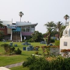
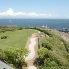
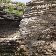
諸磯の隆起海岸, Geological formation in Miura, Japan.

The Moroiso Uplift Coast is a geological formation on the Miura Peninsula featuring limestone cliffs with ancient shells embedded in the rock face. The site spans multiple viewing areas where visitors can see ripple marks and other sedimentary patterns created by past ocean movements.

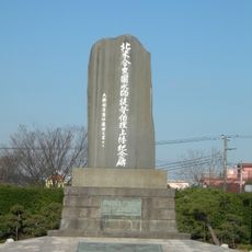
The site was designated as a national monument in 1928 because geological evidence shows multiple earthquakes occurred along this coast throughout Japanese history. The shell layers and cliff formations record tectonic movements that shaped the landscape over thousands of years.

Scientists and researchers from Waseda University conduct extensive studies of the geological formations to understand tectonic movements in Japan.

The site has walking paths and viewing points set up to explore the cliffs from different angles. Sturdy footwear is recommended since the terrain is uneven and there are steps connecting the different observation areas.

The cliff face displays four distinct rows of shell holes arranged at regular intervals, creating a kind of natural record of different earthquake events. Each row marks a separate phase of uplift and reveals how the coast gradually rose and settled over geological time.

The community of curious travelers

AroundUs brings together thousands of curated places, local tips, and hidden gems, enriched daily by 60,000 contributors worldwide.

Start exploring
GPS coordinates
35.15154,139.62309
Latest update
December 13, 2025 17:00
« 諸磯の隆起海岸 - Geological formation in Miura, Japan » is provided by Around Us (aroundus.com). Images and texts are derived from Wikimedia project under a Creative Commons license. You are allowed to copy, distribute, and modify copies of this page, under the conditions set by the license, as long as this note is clearly visible.

Discover hidden gems everywhere you go!

From secret cafés to breathtaking viewpoints, skip the crowded tourist spots and find places that match your style. Our app makes it easy with voice search, smart filtering, route optimization, and insider tips from travelers worldwide. Download now for the complete mobile experience.

Around Us App Screenshot

A unique approach to discovering new places

Le Figaro

All the places worth exploring

France Info

A tailor-made excursion in just a few clicks

20 Minutes

Around Us
Travel Guide & Maps
Download

Send to your phone

QR Code
1

Open the camera app on your mobile.

2

Point at the QR code with your camera. A notification will appear.

3

Tap the notification to open the link.