Chest opened
+${chestReward.xp} XP
Explorer
NOUVEAU ×${chestReward.collectible.quantity}
tapez pour fermer
Chest locked

Open chests in the app

Around Us is built for your phone — chests unlock when you walk, explore and capture nearby places.

Enable Location

We need your location to show you interesting places around you

Discover nearby places

Find interesting locations and hidden gems around you

Precise directions

Get accurate directions and distances to places

Your location is never shared with other users. It's only used when you tap the location button.

Log in to your account

Start exploring — it's free

Trusted by 73,105 travelers worldwide

Continue with Google
Continue with Apple
or

We will send you a code to connect

By continuing, you accept our Terms and Conditions and our Privacy Policy

Check your inbox

We've sent a pincode in your inbox. Please enter the code below.

John and Louise Seier National Wildlife Refuge
Discussion Reviews Photo
2.1k Popularity

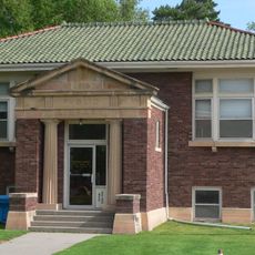
John and Louise Seier National Wildlife Refuge, National Wildlife Refuge in Rock County, Nebraska.

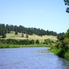
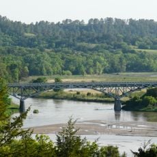
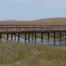
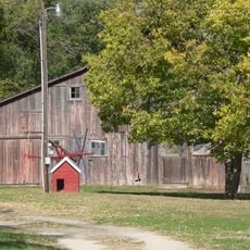
The John and Louise Seier National Wildlife Refuge is a conservation area in the Nebraska Sandhills featuring grasslands, wetlands, and wooded sections. The landscape combines different habitat types that create a diverse natural environment across the refuge.

The refuge was established when the Seier family donated their land to the federal government, continuing a homestead tradition that began in the 1800s. This gift preserved a significant portion of grassland habitat for conservation purposes.

The refuge forms part of the Sandhills National Wildlife Refuge Complex, representing one of North America's largest remaining mixed and tall grass prairie territories.

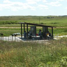
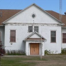
The refuge is located south of Bassett and welcomes visitors under certain conditions. Anyone planning to explore the area should check access requirements ahead of time.

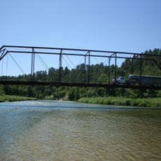
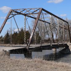
Two creeks flow through the refuge and link different waterways across the region. These streams support the variety of life that thrives in the area.

The community of curious travelers

AroundUs brings together thousands of curated places, local tips, and hidden gems, enriched daily by 60,000 contributors worldwide.

Start exploring
Location
Inception
October 1999
GPS coordinates
42.36940,-100.07400
Latest update
December 14, 2025 09:47
Around this place
Smith Falls
United States of America

Smith Falls

61 km
Niobrara National Scenic River
United States of America

Niobrara National Scenic River

60.6 km
Valentine National Wildlife Refuge
United States of America

Valentine National Wildlife Refuge

43.3 km
Fort Niobrara National Wildlife Refuge
United States of America

Fort Niobrara National Wildlife Refuge

64.4 km
St. Anselm's Catholic Church, Rectory and Parish Hall
United States of America

St. Anselm's Catholic Church, Rectory and Parish Hall

85.6 km
Niobrara Valley Preserve
United States of America

Niobrara Valley Preserve

46.2 km
United States of America

White Horse Ranch

100.4 km
Bryan Bridge
United States of America

Bryan Bridge

63.5 km
Keya Paha County High School
United States of America

Keya Paha County High School

57.4 km
Brewer Bridge
United States of America

Brewer Bridge

58.6 km
Carns State Aid Bridge
United States of America

Carns State Aid Bridge

63.3 km
Bell Bridge
United States of America

Bell Bridge

61.9 km
Sargent Bridge
United States of America

Sargent Bridge

101 km
Cherry County Courthouse
United States of America

Cherry County Courthouse

68.6 km
Valentine Public School
United States of America

Valentine Public School

68.4 km
Lewis Bridge
United States of America

Lewis Bridge

78.6 km
Adamson Bridge
United States of America

Adamson Bridge

69.1 km
St. John's Catholic Church
United States of America

St. John's Catholic Church

89 km
Borman Bridge
United States of America

Borman Bridge

65 km
Twin Bridge
United States of America

Twin Bridge

56.7 km
Berry State Aid Bridge
United States of America

Berry State Aid Bridge

63.8 km
Burwell Carnegie Library
United States of America

Burwell Carnegie Library

101.6 km
Hooker County Courthouse
United States of America

Hooker County Courthouse

88 km
Brantly Sturdevant House
United States of America

Brantly Sturdevant House

91.7 km
F.M. Walcott House
United States of America

F.M. Walcott House

68.8 km
Brenizer Library
United States of America

Brenizer Library

101.9 km
Rock County Courthouse
United States of America

Rock County Courthouse

50.2 km
Manthey Barn
United States of America

Manthey Barn

97 km
Show the full map
Reviews
Share your experience

No review yet

Discussions
Start a discussion...

No discussion yet

« John and Louise Seier National Wildlife Refuge - National Wildlife Refuge in Rock County, Nebraska » is provided by Around Us (aroundus.com). Images and texts are derived from Wikimedia project under a Creative Commons license. You are allowed to copy, distribute, and modify copies of this page, under the conditions set by the license, as long as this note is clearly visible.

Discover hidden gems everywhere you go!

From secret cafés to breathtaking viewpoints, skip the crowded tourist spots and find places that match your style. Our app makes it easy with voice search, smart filtering, route optimization, and insider tips from travelers worldwide. Download now for the complete mobile experience.

Around Us App Screenshot

A unique approach to discovering new places

Le Figaro

All the places worth exploring

France Info

A tailor-made excursion in just a few clicks

20 Minutes

Around Us
Travel Guide & Maps
Download

Send to your phone

QR Code
1

Open the camera app on your mobile.

2

Point at the QR code with your camera. A notification will appear.

3

Tap the notification to open the link.