Chest opened
+${chestReward.xp} XP
Explorer
NOUVEAU ×${chestReward.collectible.quantity}
tapez pour fermer

See the monuments around you in AR Open chests in the app

Around Us is built for your phone — point your camera at the streets and discover the monuments and places around you in augmented reality. Around Us is built for your phone — chests unlock when you walk, explore and capture nearby places.

Enable Location

We need your location to show you interesting places around you

Discover nearby places

Find interesting locations and hidden gems around you

Precise directions

Get accurate directions and distances to places

Your location is never shared with other users. It's only used when you tap the location button.

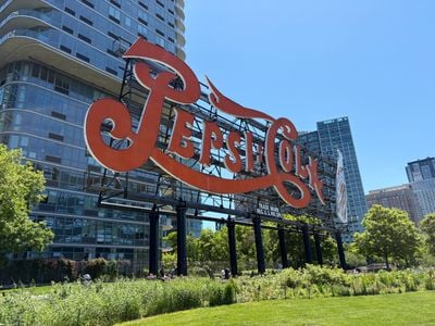
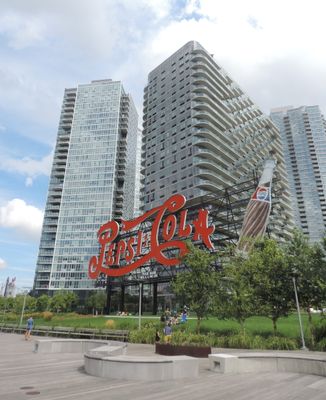
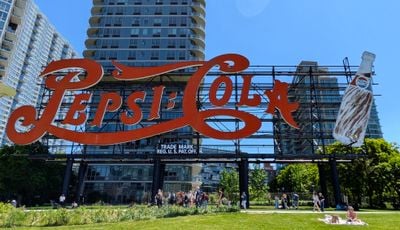
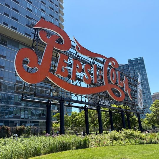
Pepsi-Cola sign

Log in to your account

Start exploring — it's free

Trusted by 86,736 travelers worldwide

Continue with Google
Continue with Apple
or

We will send you a code to connect

By continuing, you accept our Terms and Conditions and our Privacy Policy

Check your inbox

We've sent a pincode in your inbox. Please enter the code below.

Discussion Reviews 1 Photos
20.6k Popularity

Pepsi-Cola sign, Neon billboard in Long Island City, Queens, United States

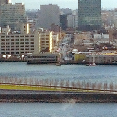
The Pepsi-Cola sign is a neon billboard on the East River waterfront in Long Island City. The structure displays a large bottle and glows at night, making it visible from both sides of the river.

The sign was built in 1940 as New York State's longest electric billboard and originally stood above a Pepsi-Cola bottling plant. The plant eventually closed, but the sign remained as a standalone landmark.

The sign became a recognized city landmark in 2016, showing how commercial advertising transformed into an important piece of urban identity. It represents how Queens' waterfront shifted from an industrial area into a place where people gather to relax and enjoy views.

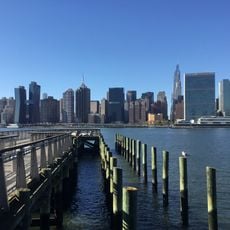
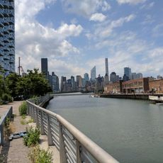
The sign is best viewed from Gantry Plaza State Park or from Manhattan across the river. Evening viewing offers the best visibility when the lights are on.

A severe storm in 1992 damaged the original sign so badly that it needed complete reconstruction. The modern version has stood in place since 1993.

The community of curious travelers

AroundUs brings together thousands of curated places, local tips, and hidden gems, enriched daily by 60,000 contributors worldwide.

Start exploring
Location
Inception
August 30, 1940
Made from material
aluminium
GPS coordinates
40.74750,-73.95778
Latest update
September 12, 2026 10:12
Around this place
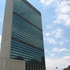
Headquarters of the United Nations
United States of America

Headquarters of the United Nations

0.5 mi
Trump World Tower
United States of America

Trump World Tower

0.6 mi
Turkish House
United States of America

Turkish House

0.6 mi
United Nations Secretariat Building
United States of America

United Nations Secretariat Building

0.5 mi
United States of America

Water Taxi Beach

0.4 mi
U Thant Island
United States of America

U Thant Island

0.4 mi
Smallpox Hospital
United States of America

Smallpox Hospital

0.3 mi
Franklin D. Roosevelt Four Freedoms Park
United States of America

Franklin D. Roosevelt Four Freedoms Park

0.3 mi
Gantry Plaza State Park
United States of America

Gantry Plaza State Park

0.2 mi
Skyline Tower
United States of America

Skyline Tower

0.7 mi
River House
United States of America

River House

0.6 mi
Pulaski Bridge
United States of America

Pulaski Bridge

0.6 mi
Dag Hammarskjöld Library
United States of America

Dag Hammarskjöld Library

0.6 mi
Japanese Peace Bell
United States of America

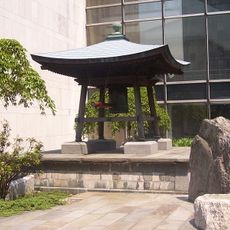
Japanese Peace Bell

0.5 mi
Ford Foundation Building
United States of America

Ford Foundation Building

0.7 mi
50 United Nations Plaza
United States of America

50 United Nations Plaza

0.6 mi
23 Beekman Place
United States of America

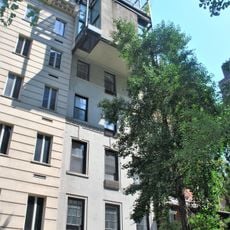
23 Beekman Place

0.5 mi
City Hospital
United States of America

City Hospital

0.4 mi
Beekman Tower
United States of America

Beekman Tower

0.6 mi
Anable Basin
United States of America

Anable Basin

0.1 mi
Strecker Memorial Laboratory
United States of America

Strecker Memorial Laboratory

0.3 mi
Edgar J. Kaufmann Conference Center
United States of America

Edgar J. Kaufmann Conference Center

0.6 mi
P.S. 135
United States of America

P.S. 135

0.7 mi
100 United Nations Plaza Tower
United States of America

100 United Nations Plaza Tower

0.7 mi
307 East 44th Street
United States of America

307 East 44th Street

0.7 mi
Hunters Point Community Library
United States of America

Hunters Point Community Library

0.2 mi
310 East 44th Street
United States of America

310 East 44th Street

0.7 mi
Windsor Tower
United States of America

Windsor Tower

0.7 mi
Show the full map
Reviews
Share your experience

No review yet

Discussions
Start a discussion...

No discussion yet

« Pepsi-Cola sign - Neon billboard in Long Island City, Queens, United States » is provided by Around Us (aroundus.com). Images and texts are derived from Wikimedia project under a Creative Commons license. You are allowed to copy, distribute, and modify copies of this page, under the conditions set by the license, as long as this note is clearly visible.

Discover hidden gems everywhere you go!

From secret cafés to breathtaking viewpoints, skip the crowded tourist spots and find places that match your style. Our app makes it easy with voice search, smart filtering, route optimization, and insider tips from travelers worldwide. Download now for the complete mobile experience.

Around Us App Screenshot

A unique approach to discovering new places

Le Figaro

All the places worth exploring

France Info

A tailor-made excursion in just a few clicks

20 Minutes

Around Us
Travel Guide & Maps
Download

Send to your phone

QR Code
1

Open the camera app on your mobile.

2

Point at the QR code with your camera. A notification will appear.

3

Tap the notification to open the link.