
Yên Minh, rural district of Ha Giang, Vietnam
Location: Hà Giang
Elevation above the sea: 539 m
GPS coordinates: 23.07083,105.17917
Latest update: March 5, 2025 05:46
Fansipan
167.6 km
Ban Gioc–Detian Falls
159.9 km
Nui Coc Lake
174.3 km
Bao Ha Temple
131.4 km
Tam Đảo
176.2 km
Ba Bể National Park
86.6 km
Hoang Lien National Park
167.6 km
牡宜遗址
68.6 km
Nguom Ngao Cave
158.5 km
Tra Linh checkpoint
119.4 km
Cốc Lếu Bridge
139.4 km
Longbang Port
119.3 km
Faux Namti Bridge
146.7 km
Cát Cát waterfall
161.3 km
Pho Lu Bridge
132.3 km
侬氏土司衙署
109.8 km
Thác Bà Lake
150.4 km
河口海关旧址
139.6 km
锦屏文笔塔
146.7 km
Guangnan Ethnological Museum
109.7 km
大王岩岩画
48.7 km
Ha Giang provincial museum
33.3 km
同盟会河口起义纪念馆
139.6 km
保兴桥
63 km
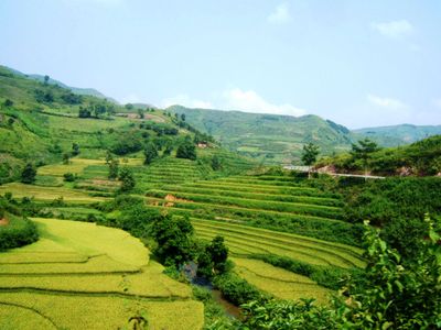
Hoang Su Phi Terraced Rice Fields
67.8 km
Muong Hoa Valley
158 km
牛羊太平桥
60.4 km
Terrace rice fields shin chai
156.6 kmReviews
Visited this place? Tap the stars to rate it and share your experience / photos with the community! Try now! You can cancel it anytime.
Discover hidden gems everywhere you go!
From secret cafés to breathtaking viewpoints, skip the crowded tourist spots and find places that match your style. Our app makes it easy with voice search, smart filtering, route optimization, and insider tips from travelers worldwide. Download now for the complete mobile experience.

A unique approach to discovering new places❞
— Le Figaro
All the places worth exploring❞
— France Info
A tailor-made excursion in just a few clicks❞
— 20 Minutes