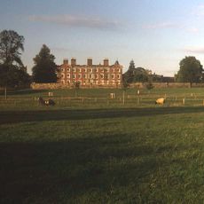
Shropshire, unitary authority (doesn't include Telford and Wrekin)
Location: Shropshire
Shares border with: Powys
Website: https://shropshire.gov.uk
GPS coordinates: 52.70806,-2.75444
Latest update: March 5, 2025 12:58
Offa's Dyke
45.2 km
The Iron Bridge
20.3 km
Pontcysyllte Aqueduct
36.8 km
Ludlow Castle
38 km
West Midland Safari Park
48.6 km
Severn Valley Railway
50.1 km
The Wrekin
14.4 km
Powis Castle
28.2 km
Royal Oak
34.9 km
Knowles Mill
45 km
Royal Air Force Museum Cosford
30.7 km
Ironbridge Gorge
21.1 km
Stokesay Castle
31.4 km
Shrewsbury Abbey
696 m
Chirk Castle
33.9 km
Weston Park
31.5 km
Offa's Dyke Path
45.1 km
Ditherington Flax Mill
1.5 km
Llangollen Railway
41.4 km
Brynkinalt Hall
31.6 km
Attingham Park
6.4 km
Lilleshall Hall
25.8 km
Shrewsbury Castle
449 m
The Mount
799 m
Castell Dinas Brân
40.6 km
Grotto At Sj 7756 0290
30 km
Hawkstone Park
18.8 km
Welshpool and Llanfair Light Railway
27.9 kmReviews
Visited this place? Tap the stars to rate it and share your experience / photos with the community! Try now! You can cancel it anytime.
Discover hidden gems everywhere you go!
From secret cafés to breathtaking viewpoints, skip the crowded tourist spots and find places that match your style. Our app makes it easy with voice search, smart filtering, route optimization, and insider tips from travelers worldwide. Download now for the complete mobile experience.
A unique approach to discovering new places❞
— Le Figaro
All the places worth exploring❞
— France Info
A tailor-made excursion in just a few clicks❞
— 20 Minutes