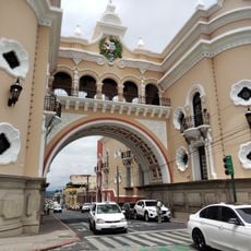
Biotopo del Quetzal, Nature reserve in Baja Verapaz, Guatemala.
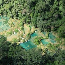
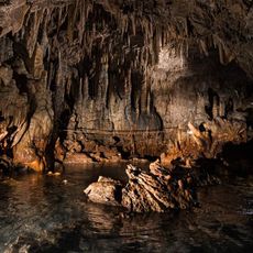
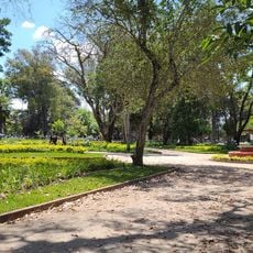
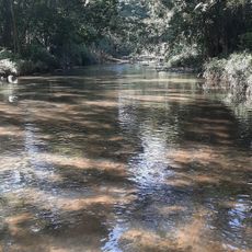
Biotopo del Quetzal is a cloud forest nature reserve featuring multiple waterfalls and dozens of tree species spread across different elevation zones. Two marked trails wind through the forest, each offering different perspectives of the terrain and vegetation.
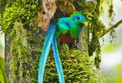
The reserve was established in 1976 as a protection initiative for the quetzal bird and its natural habitat. This action represented an important conservation step for a threatened species and its forest ecosystem.
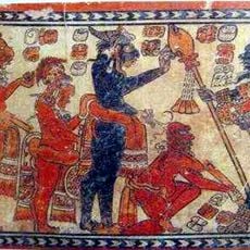
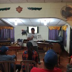
Local Q'eqchi' and Poqomchi people continue to perform Maya ceremonies and maintain their traditional customs throughout the year in this area. Their presence shapes daily life in and around the forest, reflecting a deep connection between indigenous culture and the natural environment.
The reserve can be explored on two marked walking paths that vary in length and difficulty. Plan for wet, muddy conditions typical of cloud forests, and wear sturdy footwear designed for damp terrain.
The quetzal bird, with its brilliant green plumage and red underparts, inspired the creation of this entire reserve. Visitors often come specifically hoping to spot this rare species in its natural forest home.
Location: Baja Verapaz Department
GPS coordinates: 15.19110,-90.23300
Latest update: December 6, 2025 16:03
Guatemala offers photographers a mix of pre-Columbian sites, volcanic landscapes, and colonial buildings. The geography ranges from highland towns to rainforests and coastal areas along the Pacific and Caribbean. Ancient Maya temples stand alongside Spanish-era churches, while indigenous markets and traditional villages show cultural life. The landscape is marked by active and dormant volcanoes, often surrounded by coffee plantations. Places like Antigua Guatemala display colonial architecture with cobblestone streets and courtyards. Lake Atitlán sits between mountains and smaller communities. Tikal and other archaeological sites in the north preserve Maya structures within jungle settings. Chichicastenango Market is known for woven textiles and incense. Pacaya and Acatenango are accessible volcanoes, while Semuc Champey offers natural pools in a limestone forest. The variety of regions makes Guatemala a country with different perspectives in short distances.
Semuc Champey
48 km
National Palace
68.1 km
Plaza de la Constitución
68.1 km
Cathedral of Guatemala City
68.1 km
Mapa en Relieve de Guatemala
66.1 km
Mercado Central
68.1 km
Reserva de la biosfera Sierra de las Minas
52.7 km
Estadio Cementos Progreso
63.6 km
La Recoleccion Church, Guatemala City
67.9 km
Legislative Palace of Guatemala
68.4 km
Edificio Nacional de la Cultura
68.1 km
San José Castle
68.2 km
Chamá
62.9 km
Relief Map
66.1 km
Catedral Metropolitana de Santiago de Guatemala
68.1 km
Guatemala Post Office Building
68.6 km
Rey Marcos Caves
26.7 km
Parque Minerva
65.9 km
Guatemala Holocaust Museum
67.7 km
Centro Cultural Mosaico Guatemala
68.6 km
Parque de Robots
66.4 km
Post and Telegraph Museum
68.6 km
Calvario
33.5 km
Kaji Tulam Casa de la memoria
67.6 km
Casa del Quetzal y la Marimba, Museo
13 km
La Palmilla, Usumatlan
57.8 km
Cementerio Senahú
50.8 km
Hun Nal Ye
55 kmReviews
Visited this place? Tap the stars to rate it and share your experience / photos with the community! Try now! You can cancel it anytime.
Discover hidden gems everywhere you go!
From secret cafés to breathtaking viewpoints, skip the crowded tourist spots and find places that match your style. Our app makes it easy with voice search, smart filtering, route optimization, and insider tips from travelers worldwide. Download now for the complete mobile experience.
A unique approach to discovering new places❞
— Le Figaro
All the places worth exploring❞
— France Info
A tailor-made excursion in just a few clicks❞
— 20 Minutes