Cottonwood Beach

Log in to your account

AroundUs is a community-driven map of interesting places, built by curious explorers like you. It grows with every review, story, and photo you share.
Connect to save your favorite spots, contribute locations, and create personalized routes.
Continue with Google
Continue with Apple
Continue with X
Continue with Facebook
Continue with email
By continuing, you accept our Terms and Conditions and our Privacy Policy
Create an account
Add to collection
Map
Suggest a change
Share

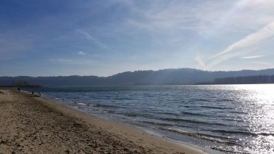
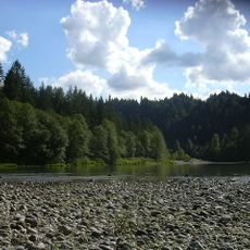
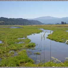
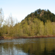
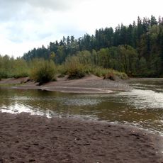
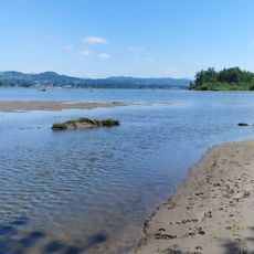
Cottonwood Beach, Sand beach on Columbia River in Washougal, United States.

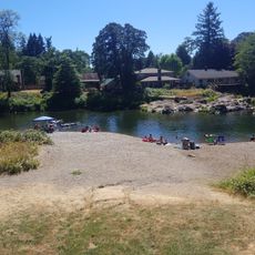
Cottonwood Beach is a sand beach along the Columbia River with a natural shoreline that stretches across a good length of the area. The site features two reservable picnic shelters equipped with tables, grills, running water, and electrical outlets for visitors and groups.

The beach became historically important when the Lewis and Clark expedition camped here for six days in March 1806 while returning from the Pacific. This location was the longest continuous camp they established in Clark County during their entire journey.

The site displays replicas of Chinook canoes and interpretive signs that reflect Native American life and early river exploration in this region. These elements show visitors how important this place was to the communities who lived and traveled here.

The beach is easy to access and has plenty of room for different activities, though weekends can be busier. It is better to visit on quieter weekdays if you prefer a more relaxed experience.

This location was the longest single campsite used by the Corps of Discovery in Clark County throughout their entire expedition, making it stand out among many other places they visited. This distinction shows how important this section of the river was to the explorers.

Location: Washougal

Address: Cottonwood Beach, Index St, Washougal, WA 98671, USA

Phone: +13603972000

Website: https://clark.wa.gov/public-works/captain-william-clark-regional-park-cottonwood-beach

GPS coordinates: 45.56521,-122.33869

Latest update: December 14, 2025 20:23

Photos
Around this place
Historic Columbia River Highway
United States of America

Historic Columbia River Highway

4.2 km
Vista House
United States of America

Vista House

7.9 km
Rooster Rock State Park
United States of America

Rooster Rock State Park

8.3 km
Crown Point
United States of America

Crown Point

7.9 km
Multnomah County Poor Farm
United States of America

Multnomah County Poor Farm

6.2 km
Oxbow Regional Park
United States of America

Oxbow Regional Park

8.7 km
United States of America

Chanticleer Point

6.4 km
Steigerwald Lake National Wildlife Refuge
United States of America

Steigerwald Lake National Wildlife Refuge

2.8 km
View Point Inn
United States of America

View Point Inn

7.9 km
Guy W. Talbot State Park
United States of America

Guy W. Talbot State Park

9.4 km
Lewis and Clark State Recreation Site
United States of America

Lewis and Clark State Recreation Site

4 km
Dabney State Recreation Area
United States of America

Dabney State Recreation Area

5.5 km
Blue Lake Regional Park

Blue Lake Regional Park

8.4 km
Stark Street Bridge
United States of America

Stark Street Bridge

5.8 km
Farrell Building
United States of America

Farrell Building

5.7 km
John Roffler House
United States of America

John Roffler House

5.8 km
Springdale School
United States of America

Springdale School

5.2 km
Louise Home Hospital and Residence Hall
United States of America

Louise Home Hospital and Residence Hall

6.7 km
Fairview-Columbia Library
United States of America

Fairview-Columbia Library

8.6 km
Troutdale Methodist Episcopal Church
United States of America

Troutdale Methodist Episcopal Church

4.9 km
Fred Harlow House
United States of America

Fred Harlow House

4.6 km
Troutdale Library
United States of America

Troutdale Library

6.8 km
Fairview City Jail
United States of America

Fairview City Jail

7.9 km
Troutdale Sandy River Bridge
United States of America

Troutdale Sandy River Bridge

4.2 km
Sandy Swimming Hole
United States of America

Sandy Swimming Hole

3.4 km
Sunrise Park
United States of America

Sunrise Park

6.1 km
Sundial Beach
United States of America

Sundial Beach

5.2 km
Camas Public Library
United States of America

Camas Public Library

5.5 km
Show the full map
Reviews

Visited this place? Tap the stars to rate it and share your experience / photos with the community! Try now! You can cancel it anytime.

« Cottonwood Beach - Sand beach on Columbia River in Washougal, United States » is provided by Around Us (aroundus.com). Images and texts are derived from Wikimedia project under a Creative Commons license. You are allowed to copy, distribute, and modify copies of this page, under the conditions set by the license, as long as this note is clearly visible.

Discover hidden gems everywhere you go!

From secret cafés to breathtaking viewpoints, skip the crowded tourist spots and find places that match your style. Our app makes it easy with voice search, smart filtering, route optimization, and insider tips from travelers worldwide. Download now for the complete mobile experience.

Around Us App Screenshot

A unique approach to discovering new places

Le Figaro

All the places worth exploring

France Info

A tailor-made excursion in just a few clicks

20 Minutes