Enable Location

We need your location to show you interesting places around you

Discover nearby places

Find interesting locations and hidden gems around you

Precise directions

Get accurate directions and distances to places

Your location is never shared with other users. It's only used when you tap the location button.

Historic Columbia River Highway

Log in to your account

Start exploring — it's free

Trusted by 62,932 travelers worldwide

Continue with Google
Continue with Apple
or

We will send you a code to connect

By continuing, you accept our Terms and Conditions and our Privacy Policy

Check your inbox

We've sent a pincode in your inbox. Please enter the code below.

Discussion Reviews 1 Photos
21.7k Popularity

Historic Columbia River Highway, National Historic Landmark road in Columbia River Gorge, Oregon, US

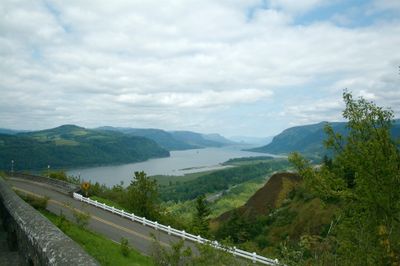
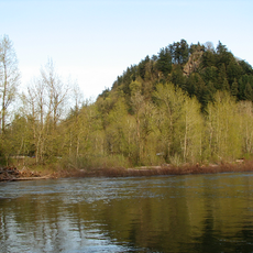
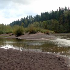
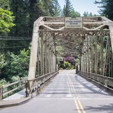
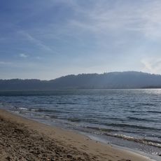
The Historic Columbia River Highway stretches roughly 120 kilometers through the Columbia River Gorge, linking Troutdale to The Dalles via multiple concrete bridges and switchbacks. The route follows the river course, winding through forested slopes and along cliff faces, with some sections preserved as paved roads and others as narrow trails.

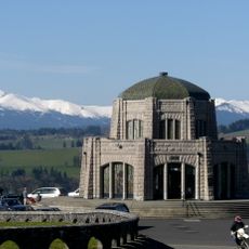
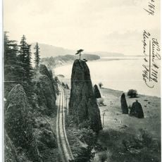
Engineer Samuel Lancaster planned the route between 1913 and 1922 as the first designed scenic roadway in North America, borrowing techniques from Alpine regions. Completion of Interstate 84 in the 1950s led to the abandonment of many sections, until preservation projects in the 1980s began restoring portions.

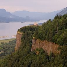
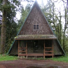
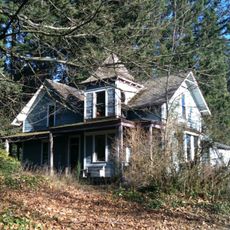
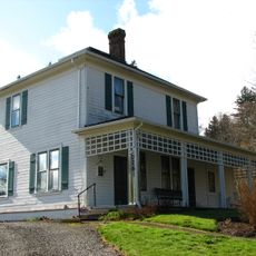
Local groups maintain the old sections so visitors can walk or cycle where early motorists once drove slowly to admire the gorge views. The route still links small towns along the river, allowing travelers to stop at viewpoints and waterfalls without modern highway noise.

Some sections remain open to slow vehicle traffic, while others are reserved for bicycles and pedestrians. Visitors should bring weather-appropriate clothing, as fog and rain are common in autumn and spring.

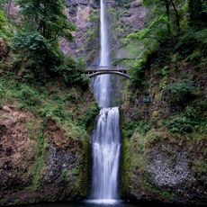
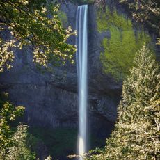
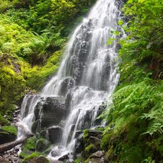
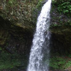
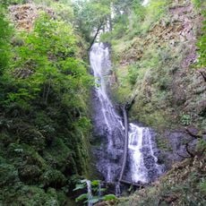
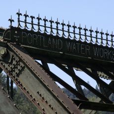
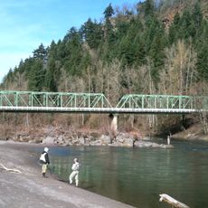
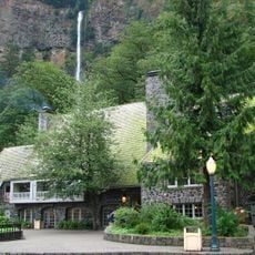
The bridges were designed with arches and decorative railings to blend into the landscape like natural rock formations. Some tunnels pass directly behind waterfalls, allowing travelers to feel the spray through the openings.

The community of curious travelers

AroundUs brings together thousands of curated places, local tips, and hidden gems, enriched daily by 60,000 contributors worldwide.

Start exploring
Location
Location
Location
Location
Location
GPS coordinates
45.53842,-122.37668
Latest update
December 5, 2025 22:28
Around this place
Multnomah Falls
United States of America

Multnomah Falls

20.8 km
Vista House
United States of America

Vista House

10.3 km
Rooster Rock State Park
United States of America

Rooster Rock State Park

11 km
Crown Point
United States of America

Crown Point

10.3 km
Latourell Falls
United States of America

Latourell Falls

12.4 km
Oxbow Regional Park
United States of America

Oxbow Regional Park

8.4 km
Bridal Veil Falls
United States of America

Bridal Veil Falls

15.4 km
Wahkeena Falls
United States of America

Wahkeena Falls

19.8 km
United States of America

Chanticleer Point

8.6 km
Fairy Falls
United States of America

Fairy Falls

20 km
Steigerwald Lake National Wildlife Refuge
United States of America

Steigerwald Lake National Wildlife Refuge

6.5 km
View Point Inn
United States of America

View Point Inn

10 km
Guy W. Talbot State Park
United States of America

Guy W. Talbot State Park

11.8 km
Camp Namanu
United States of America

Camp Namanu

14.7 km
Lewis and Clark State Recreation Site
United States of America

Lewis and Clark State Recreation Site

289 m
Dabney State Recreation Area
United States of America

Dabney State Recreation Area

3.1 km
Benson State Recreation Area
United States of America

Benson State Recreation Area

20.1 km
George W. Joseph State Natural Area
United States of America

George W. Joseph State Natural Area

12.2 km
Stark Street Bridge
United States of America

Stark Street Bridge

2.8 km
Coopey Falls
United States of America

Coopey Falls

16.6 km
Springdale School
United States of America

Springdale School

4.2 km
Andreas Graf House
United States of America

Andreas Graf House

13.5 km
Fred Harlow House
United States of America

Fred Harlow House

456 m
Lusted Road Bridge
United States of America

Lusted Road Bridge

14.2 km
Troutdale Sandy River Bridge
United States of America

Troutdale Sandy River Bridge

0 m
Cottonwood Beach
United States of America

Cottonwood Beach

4.2 km
Multnomah Falls Lodge and Footpath
United States of America

Multnomah Falls Lodge and Footpath

20.8 km
Pillars of Hercules
United States of America

Pillars of Hercules

14.7 km
Show the full map
Reviews
Share your experience

No review yet

Discussions
Start a discussion...

No discussion yet

« Historic Columbia River Highway - National Historic Landmark road in Columbia River Gorge, Oregon, US » is provided by Around Us (aroundus.com). Images and texts are derived from Wikimedia project under a Creative Commons license. You are allowed to copy, distribute, and modify copies of this page, under the conditions set by the license, as long as this note is clearly visible.

Discover hidden gems everywhere you go!

From secret cafés to breathtaking viewpoints, skip the crowded tourist spots and find places that match your style. Our app makes it easy with voice search, smart filtering, route optimization, and insider tips from travelers worldwide. Download now for the complete mobile experience.

Around Us App Screenshot

A unique approach to discovering new places

Le Figaro

All the places worth exploring

France Info

A tailor-made excursion in just a few clicks

20 Minutes

Around Us
Travel Guide & Maps
Download

Send to your phone

QR Code
1

Open the camera app on your mobile.

2

Point at the QR code with your camera. A notification will appear.

3

Tap the notification to open the link.