Oxbow Regional Park

Log in to your account

AroundUs is a community-driven map of interesting places, built by curious explorers like you. It grows with every review, story, and photo you share.
Connect to save your favorite spots, contribute locations, and create personalized routes.
Continue with Google
Continue with Apple
Continue with X
Continue with Facebook
Continue with email
By continuing, you accept our Terms and Conditions and our Privacy Policy
Create an account
Add to collection
Map
Suggest a change
Share

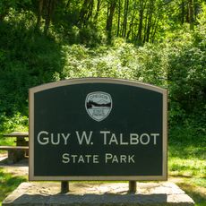
Oxbow Regional Park, Regional park along Sandy River in Oregon, United States

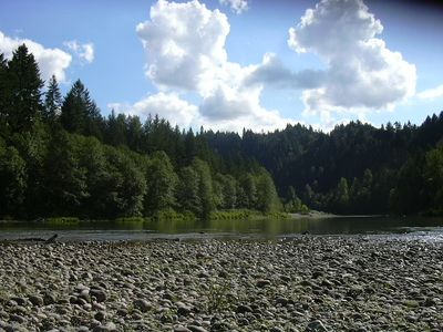
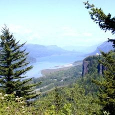
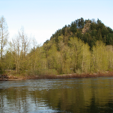
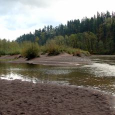
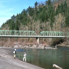
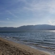
Oxbow Regional Park is a natural area along the Sandy River in Oregon with extensive forests, river banks, and hiking trails. The landscape is shaped by the freely flowing river, which winds through a mix of old trees and open riverbank areas.

The park was created to protect the Sandy River and its natural surroundings. The river landscape has developed naturally over thousands of years without being interrupted by dams.

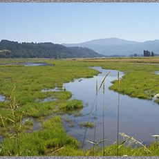
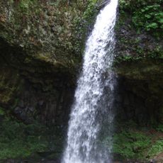
The park provides places where visitors can watch local animals in their natural home and learn how they live. The river and forest areas are spaces where people experience nature directly and understand how the landscape works.

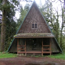
The park has camping spots with fire pits and picnic areas that give visitors places to stay overnight. Some areas are designed to be accessible for people with mobility needs, making it easier to reach different parts of the park.

The park is known for the striking sight of salmon migration, when fish move upstream in large numbers. Black bears and beavers are found here year-round, making the river a living ecosystem.

Location: Oregon

GPS coordinates: 45.49510,-122.28800

Latest update: December 8, 2025 20:03

Photos
Around this place
Historic Columbia River Highway
United States of America

Historic Columbia River Highway

8.4 km
Vista House
United States of America

Vista House

6.1 km
Rooster Rock State Park
United States of America

Rooster Rock State Park

6.8 km
Crown Point
United States of America

Crown Point

6 km
Latourell Falls
United States of America

Latourell Falls

7.2 km
United States of America

Chanticleer Point

5.1 km
Steigerwald Lake National Wildlife Refuge
United States of America

Steigerwald Lake National Wildlife Refuge

7.9 km
View Point Inn
United States of America

View Point Inn

5.2 km
Guy W. Talbot State Park
United States of America

Guy W. Talbot State Park

6.6 km
Camp Namanu
United States of America

Camp Namanu

6.5 km
Lewis and Clark State Recreation Site
United States of America

Lewis and Clark State Recreation Site

8.6 km
Dabney State Recreation Area
United States of America

Dabney State Recreation Area

5.5 km
George W. Joseph State Natural Area
United States of America

George W. Joseph State Natural Area

6.5 km
Stark Street Bridge
United States of America

Stark Street Bridge

6.1 km
Springdale School
United States of America

Springdale School

4.2 km
Louise Home Hospital and Residence Hall
United States of America

Louise Home Hospital and Residence Hall

10 km
Andreas Graf House
United States of America

Andreas Graf House

6.5 km
Troutdale Methodist Episcopal Church
United States of America

Troutdale Methodist Episcopal Church

8.9 km
Fred Harlow House
United States of America

Fred Harlow House

8.8 km
William Gedamke House
United States of America

William Gedamke House

10 km
Lusted Road Bridge
United States of America

Lusted Road Bridge

6.2 km
Troutdale Sandy River Bridge
United States of America

Troutdale Sandy River Bridge

8.4 km
Cottonwood Beach
United States of America

Cottonwood Beach

8.7 km
North American Bigfoot Center
United States of America

North American Bigfoot Center

8.1 km
Sunrise Park
United States of America

Sunrise Park

8.8 km
David and Marianne Ott House
United States of America

David and Marianne Ott House

9.2 km
Pillars of Hercules
United States of America

Pillars of Hercules

10 km
Mount Hood National Forest Headquarters
United States of America

Mount Hood National Forest Headquarters

10 km
Show the full map
Reviews

Visited this place? Tap the stars to rate it and share your experience / photos with the community! Try now! You can cancel it anytime.

« Oxbow Regional Park - Regional park along Sandy River in Oregon, United States » is provided by Around Us (aroundus.com). Images and texts are derived from Wikimedia project under a Creative Commons license. You are allowed to copy, distribute, and modify copies of this page, under the conditions set by the license, as long as this note is clearly visible.

Discover hidden gems everywhere you go!

From secret cafés to breathtaking viewpoints, skip the crowded tourist spots and find places that match your style. Our app makes it easy with voice search, smart filtering, route optimization, and insider tips from travelers worldwide. Download now for the complete mobile experience.

Around Us App Screenshot

A unique approach to discovering new places

Le Figaro

All the places worth exploring

France Info

A tailor-made excursion in just a few clicks

20 Minutes