Chest opened
+${chestReward.xp} XP
Explorer
NOUVEAU ×${chestReward.collectible.quantity}
tapez pour fermer
Chest locked

Open chests in the app

Around Us is built for your phone — chests unlock when you walk, explore and capture nearby places.

Enable Location

We need your location to show you interesting places around you

Discover nearby places

Find interesting locations and hidden gems around you

Precise directions

Get accurate directions and distances to places

Your location is never shared with other users. It's only used when you tap the location button.

Log in to your account

Start exploring — it's free

Trusted by 72,882 travelers worldwide

Continue with Google
Continue with Apple
or

We will send you a code to connect

By continuing, you accept our Terms and Conditions and our Privacy Policy

Check your inbox

We've sent a pincode in your inbox. Please enter the code below.

Camp on Pawnee Fork
Discussion Reviews Photo
1.2k Popularity

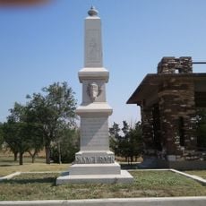
Camp on Pawnee Fork, Military fort in Kansas, United States

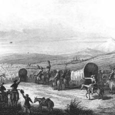
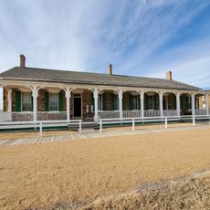
Camp on Pawnee Fork was a military garrison in Kansas located where Pawnee Fork and the Santa Fe Trail intersected, serving as a cavalry outpost. The site guarded a crucial section of the mail route and provided protection for travelers and postal coaches.

The post was established in 1859 when cavalry troops arrived to protect the mail route from raids by Kiowa and Comanche tribes. The camp was temporary in nature and later abandoned as military operations in the region shifted.

The fort served as a meeting place where soldiers, mail carriers, and Native Americans crossed paths during the period of westward expansion. Different groups moved through the same space, each with their own purposes and perspectives.

The site is located at an important intersection that makes its strategic value clear to visitors exploring the area. The flat terrain and access to water were essential factors for the post's operational effectiveness.

The post went through multiple name changes before being abandoned as military priorities shifted in the region. Another fort was subsequently established upstream and assumed a similar protective role.

The community of curious travelers

AroundUs brings together thousands of curated places, local tips, and hidden gems, enriched daily by 60,000 contributors worldwide.

Start exploring
Location
Inception
November 1859
GPS coordinates
38.17380,-99.16480
Latest update
December 14, 2025 18:46
Around this place
Big Well
United States of America

Big Well

64.3 km
Basilica of St. Fidelis
United States of America

Basilica of St. Fidelis

76 km
Brenham
United States of America

Brenham

65.8 km
Quivira National Wildlife Refuge
United States of America

Quivira National Wildlife Refuge

57.4 km
Pawnee Rock
United States of America

Pawnee Rock

19.4 km
Kansas Barbed Wire Museum
United States of America

Kansas Barbed Wire Museum

41.1 km
Great Bend Army Airfield
United States of America

Great Bend Army Airfield

32.5 km
Great Bend Zoo
United States of America

Great Bend Zoo

41.3 km
Fromme-Birney Round Barn
United States of America

Fromme-Birney Round Barn

78.1 km
Immaculate Heart of Mary Catholic Church
United States of America

Immaculate Heart of Mary Catholic Church

60.2 km
Stafford Reformed Presbyterian Church
United States of America

Stafford Reformed Presbyterian Church

54.3 km
Rush County Courthouse
United States of America

Rush County Courthouse

41.7 km
Hodgeman County Courthouse
United States of America

Hodgeman County Courthouse

64.5 km
Gano Grain Elevator and Scale House
United States of America

Gano Grain Elevator and Scale House

42 km
Hotel Roberts
United States of America

Hotel Roberts

69.9 km
S.P. Gebhart House
United States of America

S.P. Gebhart House

69.5 km
Bridge 650
United States of America

Bridge 650

71.4 km
Nagel House
United States of America

Nagel House

38.7 km
Farmers National Bank
United States of America

Farmers National Bank

54.9 km
Ness County Bank
United States of America

Ness County Bank

71.8 km
Stafford First United Methodist Church
United States of America

Stafford First United Methodist Church

54.6 km
Pratt County Courthouse
United States of America

Pratt County Courthouse

70 km
Santa Fe Trail
United States of America

Santa Fe Trail

68.1 km
T. S. Haun House
United States of America

T. S. Haun House

64.8 km
Earl H. Ellis VFW Post No. 1362
United States of America

Earl H. Ellis VFW Post No. 1362

70 km
Lone Star School, District 64
United States of America

Lone Star School, District 64

39.2 km
Fort Larned National Historic Site
United States of America

Fort Larned National Historic Site

4.8 km
Wetland Water Park
United States of America

Wetland Water Park

41.4 km
Show the full map
Reviews
Share your experience

No review yet

Discussions
Start a discussion...

No discussion yet

« Camp on Pawnee Fork - Military fort in Kansas, United States » is provided by Around Us (aroundus.com). Images and texts are derived from Wikimedia project under a Creative Commons license. You are allowed to copy, distribute, and modify copies of this page, under the conditions set by the license, as long as this note is clearly visible.

Discover hidden gems everywhere you go!

From secret cafés to breathtaking viewpoints, skip the crowded tourist spots and find places that match your style. Our app makes it easy with voice search, smart filtering, route optimization, and insider tips from travelers worldwide. Download now for the complete mobile experience.

Around Us App Screenshot

A unique approach to discovering new places

Le Figaro

All the places worth exploring

France Info

A tailor-made excursion in just a few clicks

20 Minutes

Around Us
Travel Guide & Maps
Download

Send to your phone

QR Code
1

Open the camera app on your mobile.

2

Point at the QR code with your camera. A notification will appear.

3

Tap the notification to open the link.