Chest opened
+${chestReward.xp} XP
Explorer
NOUVEAU ×${chestReward.collectible.quantity}
tapez pour fermer
Chest locked

Open chests in the app

Around Us is built for your phone — chests unlock when you walk, explore and capture nearby places.

Enable Location

We need your location to show you interesting places around you

Discover nearby places

Find interesting locations and hidden gems around you

Precise directions

Get accurate directions and distances to places

Your location is never shared with other users. It's only used when you tap the location button.

Log in to your account

Start exploring — it's free

Trusted by 72,880 travelers worldwide

Continue with Google
Continue with Apple
or

We will send you a code to connect

By continuing, you accept our Terms and Conditions and our Privacy Policy

Check your inbox

We've sent a pincode in your inbox. Please enter the code below.

Devils Well
Discussion Reviews Photo
2.9k Popularity

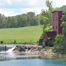
Devils Well, Natural sinkhole formation in Ozark National Scenic Riverways, Missouri.

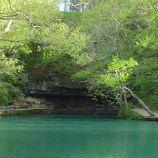
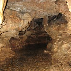
Devils Well is a sinkhole within the Ozark National Scenic Riverways containing an underground chamber with a lake inside. The lake measures approximately 400 feet long and 100 feet wide, situated roughly 100 feet below ground level.

The first documented exploration took place in 1954 when Bill Wallace and his brother Bob descended using a steel cable and hand-powered winch system. This early expedition laid the groundwork for understanding this underground structure.

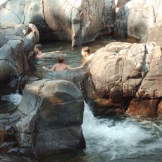
This well serves as a window into hidden ecosystems that most people never encounter in their daily lives. Visitors come to appreciate how rare species thrive in complete darkness and isolation underground.

Visitors can access an observation platform via a spiral metal staircase and use a switch to light up the underground waters during daylight hours. The stairs are steep and require moderate physical fitness to descend safely.

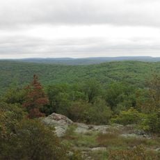
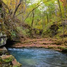
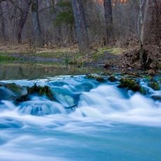
Water from this underground lake travels through a complex cave system and emerges seven miles away at Cave Spring on the Current River. This hidden subterranean journey shows how water shapes rock and connects the landscape underground.

The community of curious travelers

AroundUs brings together thousands of curated places, local tips, and hidden gems, enriched daily by 60,000 contributors worldwide.

Start exploring
Location
GPS coordinates
37.37600,-91.49120
Latest update
December 12, 2025 12:06
Around this place
Johnson's Shut-Ins State Park
United States of America

Johnson's Shut-Ins State Park

60.3 km
United States of America

Echo Bluff State Park

10.4 km
Maramec Spring
United States of America

Maramec Spring

64.6 km
Bell Mountain Wilderness
United States of America

Bell Mountain Wilderness

61.2 km
Greer Spring
United States of America

Greer Spring

66.8 km
Dillard Mill State Historic Site
United States of America

Dillard Mill State Historic Site

45.6 km
Current River State Park
United States of America

Current River State Park

7.7 km
Roger Pryor Pioneer Backcountry
United States of America

Roger Pryor Pioneer Backcountry

7.1 km
Jay Nixon State Park
United States of America

Jay Nixon State Park

67.4 km
Current River Cavern
United States of America

Current River Cavern

60.1 km
Allgood–Bailey Stadium
United States of America

Allgood–Bailey Stadium

68.8 km
Fort Wyman
United States of America

Fort Wyman

67.3 km
Alley Spring Roller Mill
United States of America

Alley Spring Roller Mill

25.1 km
Rolla Ranger Station Historic District
United States of America

Rolla Ranger Station Historic District

68.4 km
Walter Klepzig Mill and Farm
United States of America

Walter Klepzig Mill and Farm

38.1 km
Dent County Courthouse
United States of America

Dent County Courthouse

30.3 km
Phelps County Courthouse
United States of America

Phelps County Courthouse

68.1 km
Alton Club
United States of America

Alton Club

7.6 km
Big Spring Historic District
United States of America

Big Spring Historic District

64.9 km
Reed Log House
United States of America

Reed Log House

37.9 km
Alley Spring
United States of America

Alley Spring

25 km
Montauk State Park
United States of America

Montauk State Park

18.8 km
Montauk State Park Open Shelter
United States of America

Montauk State Park Open Shelter

19.3 km
Carter County Courthouse
United States of America

Carter County Courthouse

59.9 km
Lower Parker School
United States of America

Lower Parker School

13.7 km
Maramec Iron Works
United States of America

Maramec Iron Works

64.7 km
Old Mill at Montauk State Park
United States of America

Old Mill at Montauk State Park

19 km
Possum Trot Lookout
United States of America

Possum Trot Lookout

51.8 km
Show the full map
Reviews
Share your experience

No review yet

Discussions
Start a discussion...

No discussion yet

« Devils Well - Natural sinkhole formation in Ozark National Scenic Riverways, Missouri » is provided by Around Us (aroundus.com). Images and texts are derived from Wikimedia project under a Creative Commons license. You are allowed to copy, distribute, and modify copies of this page, under the conditions set by the license, as long as this note is clearly visible.

Discover hidden gems everywhere you go!

From secret cafés to breathtaking viewpoints, skip the crowded tourist spots and find places that match your style. Our app makes it easy with voice search, smart filtering, route optimization, and insider tips from travelers worldwide. Download now for the complete mobile experience.

Around Us App Screenshot

A unique approach to discovering new places

Le Figaro

All the places worth exploring

France Info

A tailor-made excursion in just a few clicks

20 Minutes

Around Us
Travel Guide & Maps
Download

Send to your phone

QR Code
1

Open the camera app on your mobile.

2

Point at the QR code with your camera. A notification will appear.

3

Tap the notification to open the link.