Enable Location

We need your location to show you interesting places around you

Discover nearby places

Find interesting locations and hidden gems around you

Precise directions

Get accurate directions and distances to places

Your location is never shared with other users. It's only used when you tap the location button.

Log in to your account

Start exploring — it's free

Trusted by 61,980 travelers worldwide

Continue with Google
Continue with Apple
or

We will send you a code to connect

By continuing, you accept our Terms and Conditions and our Privacy Policy

Check your inbox

We've sent a pincode in your inbox. Please enter the code below.

Erie L. Hackley

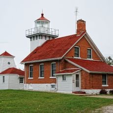
Erie L. Hackley, Wooden passenger ship in Lake Michigan, US

The Erie L. Hackley was a wooden passenger ship that operated on Lake Michigan carrying passengers and cargo between multiple ports. The vessel measured approximately 79 feet in length with a 17-foot beam and was later modified with higher forward bulwarks and a raised pilothouse to better handle open water conditions.

The ship was built in 1882 in Muskegon, Michigan by J.P. Arnold and initially operated as a ferry between Muskegon and North Muskegon. Over time it expanded its routes to serve various ports along the Wisconsin coast until it sank in 1903.

The ship became known locally as the 'Egg Harbor Express' because it carried passengers and goods regularly across Green Bay. This nickname reflected how much the communities depended on this transportation link.

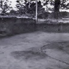
The wreck rests upright at a depth of about 110 feet near Green Island and is accessible only to experienced divers. Water visibility and conditions vary by season, so careful planning is necessary before any dive attempt.

The wreck was discovered in 1980 despite sinking in 1903, remaining hidden on the lake floor for many decades. Its machinery and cargo remain visible today, offering a glimpse into the vessel as it was in the 1880s.

The community of curious travelers

AroundUs brings together thousands of curated places, local tips, and hidden gems, enriched daily by 60,000 contributors worldwide.

Start exploring
GPS coordinates
45.06183,-87.45617
Latest update
December 14, 2025 09:41
Around this place
Peninsula State Park
United States of America

Peninsula State Park

21.2 km
United States of America

Potawatomi State Park

22.2 km
Green Island Light
United States of America

Green Island Light

3 km
Interstate Bridge
United States of America

Interstate Bridge

14.1 km
Sherwood Point Light
United States of America

Sherwood Point Light

18.8 km
Eagle Bluff Light
United States of America

Eagle Bluff Light

20.9 km
Alexander Noble House
United States of America

Alexander Noble House

18 km
Kangaroo Lake State Natural Area
United States of America

Kangaroo Lake State Natural Area

23.3 km
Bayshore Blufflands State Natural Area
United States of America

Bayshore Blufflands State Natural Area

15.1 km
Riverside Site
United States of America

Riverside Site

16.7 km
Chambers Island Light
United States of America

Chambers Island Light

17.2 km
Church of the Atonement
United States of America

Church of the Atonement

17.8 km
Cupola House
United States of America

Cupola House

13.9 km
Peshtigo Reef Light
United States of America

Peshtigo Reef Light

15.2 km
St. John the Baptist Catholic Church
United States of America

St. John the Baptist Catholic Church

13.4 km
F.J. Lauerman House
United States of America

F.J. Lauerman House

15 km
Dunlap Square Building
United States of America

Dunlap Square Building

14.4 km
First Street Historic District
United States of America

First Street Historic District

12.6 km
Bijou Theatre
United States of America

Bijou Theatre

14.3 km
Freeman and Jesse Thorp House and Cottages
United States of America

Freeman and Jesse Thorp House and Cottages

18.1 km
Independent Order of Odd Fellows-Lodge No. 189 Building
United States of America

Independent Order of Odd Fellows-Lodge No. 189 Building

13.5 km
Egg Harbor Fun Park
United States of America

Egg Harbor Fun Park

13.7 km
Potawatomi State Park Observation Tower
United States of America

Potawatomi State Park Observation Tower

20.8 km
Menominee Pier Light
United States of America

Menominee Pier Light

10.9 km
Egg Harbor Beach
United States of America

Egg Harbor Beach

13.6 km
Nicolet Bay Beach
United States of America

Nicolet Bay Beach

21.6 km
Menominee County Courthouse
United States of America

Menominee County Courthouse

13.3 km
Menekaunee, Wisconsin
United States of America

Menekaunee, Wisconsin

11.4 km
Show the full map
« Erie L. Hackley - Wooden passenger ship in Lake Michigan, US » is provided by Around Us (aroundus.com). Images and texts are derived from Wikimedia project under a Creative Commons license. You are allowed to copy, distribute, and modify copies of this page, under the conditions set by the license, as long as this note is clearly visible.

Discover hidden gems everywhere you go!

From secret cafés to breathtaking viewpoints, skip the crowded tourist spots and find places that match your style. Our app makes it easy with voice search, smart filtering, route optimization, and insider tips from travelers worldwide. Download now for the complete mobile experience.

Around Us App Screenshot

A unique approach to discovering new places

Le Figaro

All the places worth exploring

France Info

A tailor-made excursion in just a few clicks

20 Minutes

Around Us
Travel Guide & Maps
Download

Send to your phone

QR Code
1

Open the camera app on your mobile.

2

Point at the QR code with your camera. A notification will appear.

3

Tap the notification to open the link.