Chest opened
+${chestReward.xp} XP
Explorer
NOUVEAU ×${chestReward.collectible.quantity}
tapez pour fermer
Chest locked

Open chests in the app

Around Us is built for your phone — chests unlock when you walk, explore and capture nearby places.

Enable Location

We need your location to show you interesting places around you

Discover nearby places

Find interesting locations and hidden gems around you

Precise directions

Get accurate directions and distances to places

Your location is never shared with other users. It's only used when you tap the location button.

Log in to your account

Start exploring — it's free

Trusted by 72,886 travelers worldwide

Continue with Google
Continue with Apple
or

We will send you a code to connect

By continuing, you accept our Terms and Conditions and our Privacy Policy

Check your inbox

We've sent a pincode in your inbox. Please enter the code below.

Phantom Forest Conservation Area
Discussion Reviews Photo
1.2k Popularity

Phantom Forest Conservation Area, Conservation area in Des Peres, Missouri, United States.

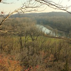
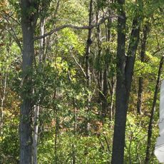
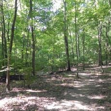
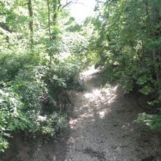
Phantom Forest Conservation Area is a 13-acre woodland in Des Peres featuring a half-mile dirt trail that winds through the forest. The trail connects to the adjacent Bittersweet Woods Conservation Area, extending the walking route across the suburban landscape of St. Louis County.

The Missouri Department of Conservation acquired this land in 1994 through a donation from Claire Moore following her husband Ray Moore's passing. This gift preserved the woodland as a protected natural area for future generations.

The forest takes its name from Ray Moore, the original illustrator of The Phantom comic strip, connecting artistic heritage to this natural space. This naming choice links a creative figure to a quiet woodland, showing how personal legacies shape the identity of places.

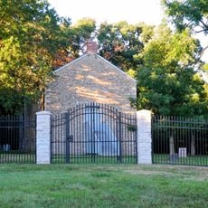
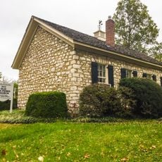
The area sits on Barrett Station Road between Manchester Road and Dougherty Ferry Road and welcomes visitors throughout the day. The flat dirt trail is easy to walk and connects to the neighboring conservation area, making it possible to combine both properties into a longer outing.

A small clearing deep within the forest holds a bench and a commemorative plaque honoring Claire Moore. This quiet memorial recognizes her personal commitment to preserving the land.

The community of curious travelers

AroundUs brings together thousands of curated places, local tips, and hidden gems, enriched daily by 60,000 contributors worldwide.

Start exploring
GPS coordinates
38.58546,-90.46610
Latest update
December 14, 2025 18:40
Around this place
Bellerive Country Club
United States of America

Bellerive Country Club

8.4 km
United States of America

Kirkwood City Council shooting

5.2 km
United States of America

St. Louis County Library

7.3 km
National Museum of Transportation
United States of America

National Museum of Transportation

1.5 km
The Magic House, St. Louis Children's Museum
United States of America

The Magic House, St. Louis Children's Museum

5.4 km
Castlewood State Park
United States of America

Castlewood State Park

7.6 km
Saint Louis Abbey
United States of America

Saint Louis Abbey

6.6 km
Lone Elk County Park
United States of America

Lone Elk County Park

8.8 km
Laumeier Sculpture Park
United States of America

Laumeier Sculpture Park

6.1 km
Kraus House
United States of America

Kraus House

2.1 km
St. Louis Missouri Temple
United States of America

St. Louis Missouri Temple

6 km
Hindu Temple of St. Louis
United States of America

Hindu Temple of St. Louis

4.3 km
Theodore A. Pappas House
United States of America

Theodore A. Pappas House

5.9 km
United States of America

Queeny Park

3.7 km
Cragwold
United States of America

Cragwold

4.1 km
Manchester United Methodist Church
United States of America

Manchester United Methodist Church

3.9 km
Kirkwood Public Library
United States of America

Kirkwood Public Library

5.4 km
Swing-A-Round Fun Town
United States of America

Swing-A-Round Fun Town

8.2 km
Congregation Shaare Emeth
United States of America

Congregation Shaare Emeth

8.2 km
Barretts Tunnels
United States of America

Barretts Tunnels

1.7 km
Emmenegger Nature Park
United States of America

Emmenegger Nature Park

4.7 km
United States of America

J. Milton Turner School

6 km
Temple Emanuel
United States of America

Temple Emanuel

6.4 km
Old Stone Church
United States of America

Old Stone Church

8.7 km
Olive Chapel African Methodist Episcopal Church
United States of America

Olive Chapel African Methodist Episcopal Church

4.9 km
Des Peres Presbyterian Church
United States of America

Des Peres Presbyterian Church

5.8 km
Eliot Unitarian Chapel
United States of America

Eliot Unitarian Chapel

5.5 km
Possum Woods Conservation Area
United States of America

Possum Woods Conservation Area

5.2 km
Show the full map
Reviews
Share your experience

No review yet

Discussions
Start a discussion...

No discussion yet

« Phantom Forest Conservation Area - Conservation area in Des Peres, Missouri, United States » is provided by Around Us (aroundus.com). Images and texts are derived from Wikimedia project under a Creative Commons license. You are allowed to copy, distribute, and modify copies of this page, under the conditions set by the license, as long as this note is clearly visible.

Discover hidden gems everywhere you go!

From secret cafés to breathtaking viewpoints, skip the crowded tourist spots and find places that match your style. Our app makes it easy with voice search, smart filtering, route optimization, and insider tips from travelers worldwide. Download now for the complete mobile experience.

Around Us App Screenshot

A unique approach to discovering new places

Le Figaro

All the places worth exploring

France Info

A tailor-made excursion in just a few clicks

20 Minutes

Around Us
Travel Guide & Maps
Download

Send to your phone

QR Code
1

Open the camera app on your mobile.

2

Point at the QR code with your camera. A notification will appear.

3

Tap the notification to open the link.