Historic Moravian Bethlehem Historic District

Log in to your account

AroundUs is a community-driven map of interesting places, built by curious explorers like you. It grows with every review, story, and photo you share.
Connect to save your favorite spots, contribute locations, and create personalized routes.
By continuing, you accept our Terms and Conditions and our Privacy Policy
Add to collection
Map
Suggest a change
Share

Historic Moravian Bethlehem Historic District, National Historic Landmark District in Bethlehem, United States

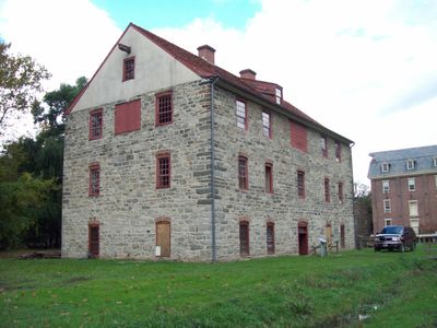
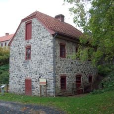
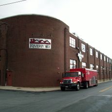
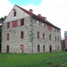
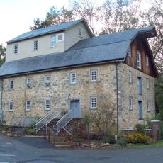
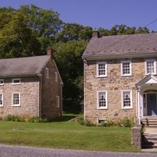
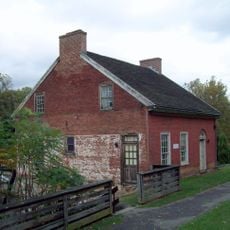
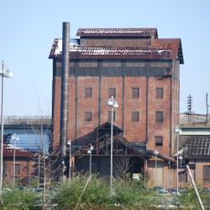
Historic Moravian Bethlehem Historic District is a preserved 18th-century settlement with multiple stone buildings and historical ruins spread across a central location downtown. The site contains several houses including the 1752 Apothecary, a historic mill, and a large cemetery with orderly burial rows.

The settlement was founded in 1741 by Moravian pilgrims who established a spiritual community model reflected in how the buildings were arranged. The district grew into an important religious and economic center in Pennsylvania and kept its historical character across centuries.

God's Acre cemetery reflects how the Moravian community valued equality, with all members buried the same way regardless of social rank. Walking through the grounds, you notice rows of identical simple stones that embody this principle of shared dignity.

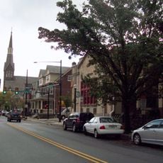
The area spreads across several city blocks downtown and can be explored on foot, with most structures visible from various street viewpoints. You can move through the grounds at your own pace and visit multiple buildings, with some interpreted through museum staff or information signs.

The site is part of an international UNESCO nomination that also includes Moravian settlements in Germany and Northern Ireland, showing how this religious group established similar communities across continents. This global connection highlights that the place did not develop in isolation but was part of a larger network of believers spreading a particular way of life.

Location: Bethlehem

GPS coordinates: 40.61889,-75.38083

Latest update: December 13, 2025 12:21

Photos
Around this place
Interstate 78
United States of America

Interstate 78

4.4 km
Martin Tower
United States of America

Martin Tower

1.8 km
Goodman Stadium
United States of America

Goodman Stadium

4 km
Stabler Arena
United States of America

Stabler Arena

4.3 km
Lost River Caverns
United States of America

Lost River Caverns

6 km
Lehigh Valley Silk Mills
United States of America

Lehigh Valley Silk Mills

1.9 km
Hill to Hill Bridge
United States of America

Hill to Hill Bridge

494 m
Central Park
United States of America

Central Park

3.4 km
Bethlehem Waterworks
United States of America

Bethlehem Waterworks

213 m
Burnside Plantation
United States of America

Burnside Plantation

1.5 km
Pembroke Village
United States of America

Pembroke Village

2.2 km
Cathedral Church of the Nativity
United States of America

Cathedral Church of the Nativity

864 m
Philip J. Fahy Memorial Bridge
United States of America

Philip J. Fahy Memorial Bridge

438 m
Gemeinhaus-Lewis David de Schweinitz Residence
United States of America

Gemeinhaus-Lewis David de Schweinitz Residence

39 m
Central Bethlehem Historic District
United States of America

Central Bethlehem Historic District

133 m
Bethlehem Steel Lehigh Plant Mill No. 2 Annex
United States of America

Bethlehem Steel Lehigh Plant Mill No. 2 Annex

417 m
The Tannery
United States of America

The Tannery

274 m
South Bethlehem Downtown Historic District
United States of America

South Bethlehem Downtown Historic District

865 m
Fountain Hill Historic District
United States of America

Fountain Hill Historic District

975 m
Illick's Mill
United States of America

Illick's Mill

2.5 km
Bethlehem Silk Mill
United States of America

Bethlehem Silk Mill

950 m
Elmwood Park Historic District
United States of America

Elmwood Park Historic District

1.4 km
Michael and Margaret Heller House
United States of America

Michael and Margaret Heller House

5.3 km
Gristmiller's House
United States of America

Gristmiller's House

302 m
National Museum of Industrial History
United States of America

National Museum of Industrial History

1.1 km
Minsi Trail Bridge
United States of America

Minsi Trail Bridge

1.9 km
Movies
United States of America

Movies

5 km
Astor Theatre
United States of America

Astor Theatre

4.1 km
Show the full map
Reviews

Visited this place? Tap the stars to rate it and share your experience / photos with the community! Try now! You can cancel it anytime.

« Historic Moravian Bethlehem Historic District - National Historic Landmark District in Bethlehem, United States » is provided by Around Us (aroundus.com). Images and texts are derived from Wikimedia project under a Creative Commons license. You are allowed to copy, distribute, and modify copies of this page, under the conditions set by the license, as long as this note is clearly visible.

Discover hidden gems everywhere you go!

From secret cafés to breathtaking viewpoints, skip the crowded tourist spots and find places that match your style. Our app makes it easy with voice search, smart filtering, route optimization, and insider tips from travelers worldwide. Download now for the complete mobile experience.

Around Us App Screenshot

A unique approach to discovering new places

Le Figaro

All the places worth exploring

France Info

A tailor-made excursion in just a few clicks

20 Minutes