Enable Location

We need your location to show you interesting places around you

Discover nearby places

Find interesting locations and hidden gems around you

Precise directions

Get accurate directions and distances to places

Your location is never shared with other users. It's only used when you tap the location button.

Central Bethlehem Historic District

Log in to your account

Start exploring — it's free

Trusted by 61,562 travelers worldwide

Continue with Google
Continue with Apple
or

We will send you a code to connect

By continuing, you accept our Terms and Conditions and our Privacy Policy

Check your inbox

We've sent a pincode in your inbox. Please enter the code below.

Central Bethlehem Historic District, Historic district in Bethlehem, Pennsylvania.

Description

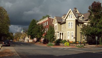
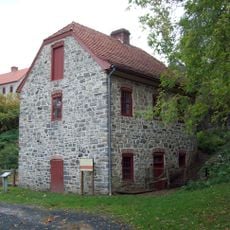
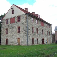
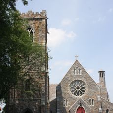
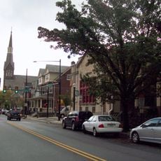
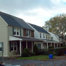
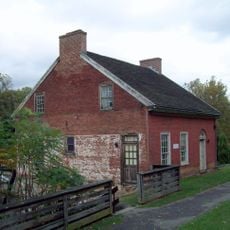
The Central Bethlehem Historic District is a neighborhood containing around 165 preserved buildings made primarily of brick and stone, typically rising two and a half stories. The structures date from different periods and document the evolution from a religious community to an industrial town.

History

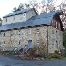
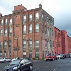
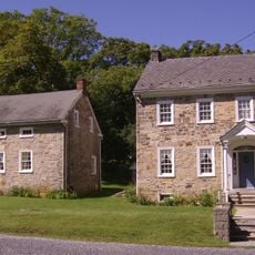
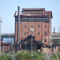
The area started in 1741 as a Moravian settlement and gradually transformed into an industrial center during the 1800s. This shift is visible in the architecture, which ranges from early religious buildings to later factory and commercial structures.

Culture

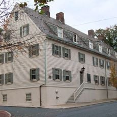
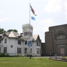
The communal buildings of the Moravian faith stand as physical reminders of how this religious community organized daily life together. Walking through the district, you can observe how the architecture reflects the values of shared living that defined this settlement.

Practical

The district spreads across downtown and is easy to explore on foot, with boundaries marked by Main Street, Nevada Street, East Broad Street, and the Lehigh River. Most buildings are visible from public streets, though some are private residences or closed businesses.

Did you know?

The Nisky Hill Cemetery is one of the few places where you can still visit the earliest phase of the Moravian settlement. This burial ground reveals how central the faith was to those who established the community.

Location
GPS coordinates
40.61830,-75.38220
Latest update
December 14, 2025 18:05

AroundUs brings together thousands of curated places, local tips, and hidden gems, enriched daily by 60,000 contributors worldwide. Discover all places nearby (Pennsylvania).

Around this place
Interstate 78
United States of America

Interstate 78

4.3 km
Martin Tower
United States of America

Martin Tower

1.8 km
Goodman Stadium
United States of America

Goodman Stadium

4 km
Stabler Arena
United States of America

Stabler Arena

4.3 km
Lehigh Valley Silk Mills
United States of America

Lehigh Valley Silk Mills

1.8 km
Hill to Hill Bridge
United States of America

Hill to Hill Bridge

372 m
Central Park
United States of America

Central Park

3.3 km
Bethlehem Waterworks
United States of America

Bethlehem Waterworks

136 m
America On Wheels
United States of America

America On Wheels

6 km
Historic Moravian Bethlehem Historic District
United States of America

Historic Moravian Bethlehem Historic District

133 m
Burnside Plantation
United States of America

Burnside Plantation

1.6 km
Pembroke Village
United States of America

Pembroke Village

2.4 km
Cathedral Church of the Nativity
United States of America

Cathedral Church of the Nativity

775 m
Philip J. Fahy Memorial Bridge
United States of America

Philip J. Fahy Memorial Bridge

446 m
Gemeinhaus-Lewis David de Schweinitz Residence
United States of America

Gemeinhaus-Lewis David de Schweinitz Residence

98 m
Bethlehem Steel Lehigh Plant Mill No. 2 Annex
United States of America

Bethlehem Steel Lehigh Plant Mill No. 2 Annex

409 m
The Tannery
United States of America

The Tannery

213 m
South Bethlehem Downtown Historic District
United States of America

South Bethlehem Downtown Historic District

887 m
Fountain Hill Historic District
United States of America

Fountain Hill Historic District

867 m
Illick's Mill
United States of America

Illick's Mill

2.6 km
Bethlehem Silk Mill
United States of America

Bethlehem Silk Mill

980 m
Elmwood Park Historic District
United States of America

Elmwood Park Historic District

1.6 km
Michael and Margaret Heller House
United States of America

Michael and Margaret Heller House

5.3 km
Gristmiller's House
United States of America

Gristmiller's House

298 m
National Museum of Industrial History
United States of America

National Museum of Industrial History

1.1 km
Minsi Trail Bridge
United States of America

Minsi Trail Bridge

2 km
Movies
United States of America

Movies

5 km
Astor Theatre
United States of America

Astor Theatre

4 km
Show the full map
« Central Bethlehem Historic District - Historic district in Bethlehem, Pennsylvania » is provided by Around Us (aroundus.com). Images and texts are derived from Wikimedia project under a Creative Commons license. You are allowed to copy, distribute, and modify copies of this page, under the conditions set by the license, as long as this note is clearly visible.

Discover hidden gems everywhere you go!

From secret cafés to breathtaking viewpoints, skip the crowded tourist spots and find places that match your style. Our app makes it easy with voice search, smart filtering, route optimization, and insider tips from travelers worldwide. Download now for the complete mobile experience.

Around Us App Screenshot

A unique approach to discovering new places

Le Figaro

All the places worth exploring

France Info

A tailor-made excursion in just a few clicks

20 Minutes

Around Us
Travel Guide & Maps
Download

Send to your phone

QR Code
1

Open the camera app on your mobile.

2

Point at the QR code with your camera. A notification will appear.

3

Tap the notification to open the link.