Chest opened
+${chestReward.xp} XP
Explorer
NOUVEAU ×${chestReward.collectible.quantity}
tapez pour fermer
Chest locked

Open chests in the app

Around Us is built for your phone — chests unlock when you walk, explore and capture nearby places.

Enable Location

We need your location to show you interesting places around you

Discover nearby places

Find interesting locations and hidden gems around you

Precise directions

Get accurate directions and distances to places

Your location is never shared with other users. It's only used when you tap the location button.

Log in to your account

Start exploring — it's free

Trusted by 72,882 travelers worldwide

Continue with Google
Continue with Apple
or

We will send you a code to connect

By continuing, you accept our Terms and Conditions and our Privacy Policy

Check your inbox

We've sent a pincode in your inbox. Please enter the code below.

Ørkenen Sur
Discussion Reviews Photo
4.1k Popularity

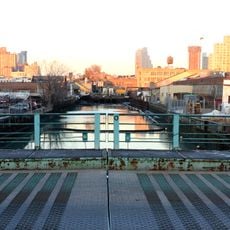
Ørkenen Sur, Shantytown in Red Hook, Brooklyn, US

Ørkenen Sur was a settlement built on a railroad dump site in Red Hook, where residents constructed dwellings from oil barrels, tar paper, and salvaged materials. The camp housed up to 500 people in makeshift structures on a confined plot of land.

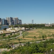
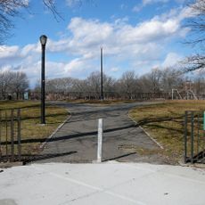
The settlement emerged between 1921 and 1934, primarily housing Norwegian sailors who lost their jobs during the Great Depression. Authorities closed the camp in 1934 and transformed the site into parks and recreational facilities.

The settlement maintained its own social structure with a mayor, barber, and pastor, reflecting Norwegian maritime traditions in the American context. This organization showed how residents preserved cultural practices despite hardship.

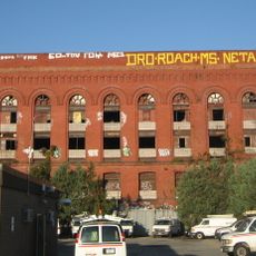
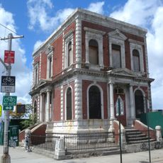
The site is now part of public green spaces in Red Hook and can be explored on foot. It helps to consult local museums or historical records before visiting to understand more about the specific history of the location.

Pastor Karl Holm named the settlement after the biblical desert wandering and visited the site approximately 300 times to support residents. This consistent presence offered comfort to many people during their hardest times.

The community of curious travelers

AroundUs brings together thousands of curated places, local tips, and hidden gems, enriched daily by 60,000 contributors worldwide.

Start exploring
Location
GPS coordinates
40.67113,-74.01148
Latest update
December 11, 2025 11:07
Around this place
Governors Island
United States of America

Governors Island

2.1 km
Gowanus Canal
United States of America

Gowanus Canal

850 m
Industry City
United States of America

Industry City

1.7 km
Fort Jay
United States of America

Fort Jay

2.3 km
Old Stone House
United States of America

Old Stone House

2.3 km
Morbid Anatomy Museum
United States of America

Morbid Anatomy Museum

1.8 km
Congregation Baith Israel Anshei Emes
United States of America

Congregation Baith Israel Anshei Emes

2.1 km
Carroll Street Bridge
United States of America

Carroll Street Bridge

2 km
Gowanus Batcave
United States of America

Gowanus Batcave

2 km
Sunset Park Material Recovery Facility
United States of America

Sunset Park Material Recovery Facility

1 km
Red Hook Park
United States of America

Red Hook Park

663 m
New York and Long Island Coignet Stone Company Building
United States of America

New York and Long Island Coignet Stone Company Building

2 km
Liggett Hall
United States of America

Liggett Hall

2.1 km
Governor's House
United States of America

Governor's House

2.2 km
Rocky Sullivan's
United States of America

Rocky Sullivan's

233 m
Carroll Gardens Historic District
United States of America

Carroll Gardens Historic District

2 km
Church of the Sacred Hearts of Jesus and Mary
United States of America

Church of the Sacred Hearts of Jesus and Mary

1.8 km
The Block House
United States of America

The Block House

2 km
Weir Greenhouse
United States of America

Weir Greenhouse

1.9 km
Urban Air Trampoline and Adventure Park
United States of America

Urban Air Trampoline and Adventure Park

2.1 km
Parker Building, New York City
United States of America

Parker Building, New York City

1.7 km
Union Street Bridge
United States of America

Union Street Bridge

2.2 km
John Rankin House
United States of America

John Rankin House

1.6 km
Lehigh Valley Railroad Barge No. 79
United States of America

Lehigh Valley Railroad Barge No. 79

835 m
William B. Cronyn House
United States of America

William B. Cronyn House

2.1 km
Admiral's House
United States of America

Admiral's House

2.1 km
Storehouse No. 2, U.S. Navy Fleet Supply Base
United States of America

Storehouse No. 2, U.S. Navy Fleet Supply Base

1.4 km
RKO Prospect Theatre
United States of America

RKO Prospect Theatre

2.2 km
Show the full map
Reviews
Share your experience

No review yet

Discussions
Start a discussion...

No discussion yet

« Ørkenen Sur - Shantytown in Red Hook, Brooklyn, US » is provided by Around Us (aroundus.com). Images and texts are derived from Wikimedia project under a Creative Commons license. You are allowed to copy, distribute, and modify copies of this page, under the conditions set by the license, as long as this note is clearly visible.

Discover hidden gems everywhere you go!

From secret cafés to breathtaking viewpoints, skip the crowded tourist spots and find places that match your style. Our app makes it easy with voice search, smart filtering, route optimization, and insider tips from travelers worldwide. Download now for the complete mobile experience.

Around Us App Screenshot

A unique approach to discovering new places

Le Figaro

All the places worth exploring

France Info

A tailor-made excursion in just a few clicks

20 Minutes

Around Us
Travel Guide & Maps
Download

Send to your phone

QR Code
1

Open the camera app on your mobile.

2

Point at the QR code with your camera. A notification will appear.

3

Tap the notification to open the link.