Chest opened
+${chestReward.xp} XP
Explorer
NOUVEAU ×${chestReward.collectible.quantity}
tapez pour fermer

See the monuments around you in AR Open chests in the app

Around Us is built for your phone — point your camera at the streets and discover the monuments and places around you in augmented reality. Around Us is built for your phone — chests unlock when you walk, explore and capture nearby places.

Enable Location

We need your location to show you interesting places around you

Discover nearby places

Find interesting locations and hidden gems around you

Precise directions

Get accurate directions and distances to places

Your location is never shared with other users. It's only used when you tap the location button.

Log in to your account

Start exploring — it's free

Trusted by 86,966 travelers worldwide

Continue with Google
Continue with Apple
or

We will send you a code to connect

By continuing, you accept our Terms and Conditions and our Privacy Policy

Check your inbox

We've sent a pincode in your inbox. Please enter the code below.

Discussion Reviews Photo
1.7k Popularity

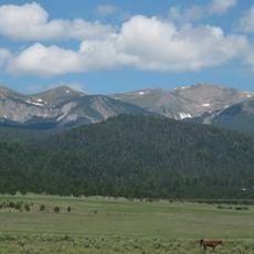
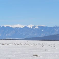
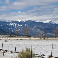
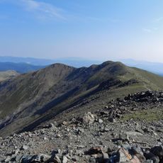
Columbine-Hondo Wilderness, Protected wilderness in Sangre de Cristo Mountains, New Mexico.

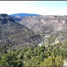
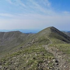
Columbine-Hondo Wilderness is a protected area in the Sangre de Cristo Mountains spanning across Carson National Forest, featuring diverse terrain from forested slopes to high alpine zones. The land contains steep ridges, mountain valleys, and streams that flow through the landscape.

The area long attracted interest from those seeking mineral and timber resources before gaining protected status in 2014. This official designation ended any plans for commercial extraction in the region.

The area contains trails from the New Mexico Gold Rush period, when prospectors searched these mountains for precious metals, leaving minimal impact on the forest.

Access is provided through multiple marked trails offering varying difficulty levels that lead into alpine zones. Visitors should prepare for changing weather conditions and bring plenty of water and supplies.

The area contains the headwaters of both the Red River and Rio Hondo, two major water systems of the region. These sources lie near an ancient volcanic caldera that shaped the area's geology.

The community of curious travelers

AroundUs brings together thousands of curated places, local tips, and hidden gems, enriched daily by 60,000 contributors worldwide.

Start exploring
Location
Inception
December 19, 2014
Operator
United States Forest Service
GPS coordinates
36.62717,-105.52188
Latest update
September 11, 2026 22:33
Around this place
Wheeler Peak
United States of America

Wheeler Peak

7.6 mi
D. H. Lawrence Ranch
United States of America

D. H. Lawrence Ranch

5.1 mi
Rio Grande del Norte National Monument
United States of America

Rio Grande del Norte National Monument

11 mi
John Dunn Bridge
United States of America

John Dunn Bridge

12.2 mi
Latir Peak Wilderness
United States of America

Latir Peak Wilderness

12 mi
Venado Peak
United States of America

Venado Peak

11.5 mi
Wild Rivers Recreation Area
United States of America

Wild Rivers Recreation Area

9.1 mi
Wheeler Peak Wilderness
United States of America

Wheeler Peak Wilderness

6.2 mi
Mount Walter
United States of America

Mount Walter

7.5 mi
Taos Pueblo
United States of America

Taos Pueblo

13.2 mi
United States of America

Pueblo of Taos Historical Marker

13.1 mi
United States of America

Wheeler Peak Historical Marker

7.6 mi
United States of America

Elizabethtown Historical Marker

13.2 mi
United States of America

D H Lawrence Ranch University of New Mexico Historical Marker

5.1 mi
United States of America

Shortcut

7.3 mi
United States of America

Wild Rivers Visitor Center

9.1 mi
United States of America

John Dunn Bridge and Day Use Area

12.2 mi
United States of America

Hlauuma (North House)

13 mi
United States of America

Hlaukwima (South House)

13.1 mi
United States of America

San Geronimo Chapel

13.1 mi
United States of America

Questa Apple

6.3 mi
United States of America

Wild Rivers Visitor Center

9.2 mi
United States of America

Sculpture

8.1 mi
United States of America

La Junta Point

9.4 mi
United States of America

Chawalauna Overlook

9.8 mi
United States of America

Scenic viewpoint

11.7 mi
United States of America

Waterfall

0.8 mi
United States of America

Salto Del Agua Waterfall

6.6 mi
Show the full map
Reviews
Share your experience

No review yet

Discussions
Start a discussion...

No discussion yet

« Columbine-Hondo Wilderness - Protected wilderness in Sangre de Cristo Mountains, New Mexico » is provided by Around Us (aroundus.com). Images and texts are derived from Wikimedia project under a Creative Commons license. You are allowed to copy, distribute, and modify copies of this page, under the conditions set by the license, as long as this note is clearly visible.

Discover hidden gems everywhere you go!

From secret cafés to breathtaking viewpoints, skip the crowded tourist spots and find places that match your style. Our app makes it easy with voice search, smart filtering, route optimization, and insider tips from travelers worldwide. Download now for the complete mobile experience.

Around Us App Screenshot

A unique approach to discovering new places

Le Figaro

All the places worth exploring

France Info

A tailor-made excursion in just a few clicks

20 Minutes

Around Us
Travel Guide & Maps
Download

Send to your phone

QR Code
1

Open the camera app on your mobile.

2

Point at the QR code with your camera. A notification will appear.

3

Tap the notification to open the link.