Baldy Mountain

Log in to your account

AroundUs is a community-driven map of interesting places, built by curious explorers like you. It grows with every review, story, and photo you share.
Connect to save your favorite spots, contribute locations, and create personalized routes.
By continuing, you accept our Terms and Conditions and our Privacy Policy
Add to collection
Map
Suggest a change
Share

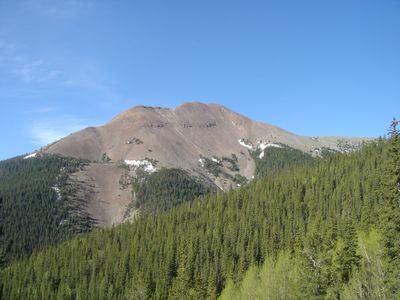
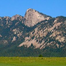
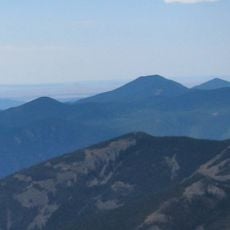
Baldy Mountain, Mountain summit in Colfax County, New Mexico.

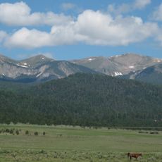
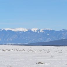
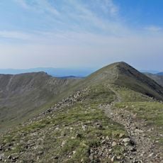
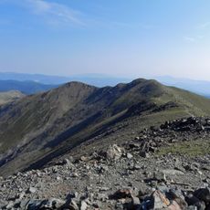
Baldy Mountain rises to 3,792 meters (12,441 feet) within the Sangre de Cristo Range and features steep slopes with significant vertical relief. The peak is surrounded by forested terrain and crossed by several trails that wind through different elevation zones.

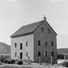
The Baldy Mining District was established in 1866 and became a major center for copper, gold, and silver extraction. Mining operations left behind extensive workings scattered across the mountain.

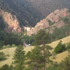
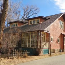
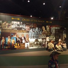
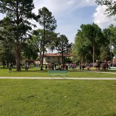
The mountain is part of Philmont Scout Ranch, where the Boy Scouts of America maintains several camps in the eastern valleys. Visitors can see the presence of this youth organization in the landscape and the maintained camp areas.

A four-wheel drive road leads to the radio tower on the western slopes, while the summit trail requires a significant vertical climb. Plan for extended hiking time and be prepared for changing weather conditions at higher elevations.

The mountain houses the remains of the Mystic Lode copper mine near its peak, making it interesting for those exploring mining history. These abandoned structures tell the story of intensive mining activity that took place over a century ago.

Location: New Mexico

GPS coordinates: 36.62978,-105.21319

Latest update: December 7, 2025 19:23

Photos
Around this place
Wheeler Peak
United States of America

Wheeler Peak

19.9 km
St. James Hotel
United States of America

St. James Hotel

29.6 km
D. H. Lawrence Ranch
United States of America

D. H. Lawrence Ranch

34.4 km
Tooth of Time
United States of America

Tooth of Time

27.3 km
Cimarron Canyon State Park
United States of America

Cimarron Canyon State Park

10.8 km
Eagle Nest Lake State Park
United States of America

Eagle Nest Lake State Park

11.2 km
Mabel Dodge Luhan House
United States of America

Mabel Dodge Luhan House

40 km
Taos Downtown Historic District
United States of America

Taos Downtown Historic District

40.6 km
Kit Carson House
United States of America

Kit Carson House

40.6 km
Mount Phillips
United States of America

Mount Phillips

17.7 km
Villa Philmonte
United States of America

Villa Philmonte

30.3 km
Eagle Nest Dam
United States of America

Eagle Nest Dam

11 km
Latir Peak Wilderness
United States of America

Latir Peak Wilderness

30.3 km
Taos Inn
United States of America

Taos Inn

40.5 km
Nicolai Fechin House
United States of America

Nicolai Fechin House

40.1 km
Wheeler Peak Wilderness
United States of America

Wheeler Peak Wilderness

19.5 km
La Morada de Nuestra Senora de Guadalupe
United States of America

La Morada de Nuestra Senora de Guadalupe

40 km
Vietnam Veterans Memorial State Park
United States of America

Vietnam Veterans Memorial State Park

22.2 km
Taos Art Museum
United States of America

Taos Art Museum

40.2 km
Governor Charles Bent House
United States of America

Governor Charles Bent House

40.5 km
Mount Walter
United States of America

Mount Walter

19.6 km
Taos Pueblo
United States of America

Taos Pueblo

36.7 km
Casa del Gavilan
United States of America

Casa del Gavilan

30.2 km
Cimarron Historic District
United States of America

Cimarron Historic District

29.6 km
Bernard J. Beimer House
United States of America

Bernard J. Beimer House

39.9 km
Hernández-Manby House
United States of America

Hernández-Manby House

40.5 km
National Scouting Museum
United States of America

National Scouting Museum

30.3 km
Villa Philmonte
United States of America

Villa Philmonte

30.3 km
Show the full map
Reviews

Visited this place? Tap the stars to rate it and share your experience / photos with the community! Try now! You can cancel it anytime.

« Baldy Mountain - Mountain summit in Colfax County, New Mexico » is provided by Around Us (aroundus.com). Images and texts are derived from Wikimedia project under a Creative Commons license. You are allowed to copy, distribute, and modify copies of this page, under the conditions set by the license, as long as this note is clearly visible.

Discover hidden gems everywhere you go!

From secret cafés to breathtaking viewpoints, skip the crowded tourist spots and find places that match your style. Our app makes it easy with voice search, smart filtering, route optimization, and insider tips from travelers worldwide. Download now for the complete mobile experience.

Around Us App Screenshot

A unique approach to discovering new places

Le Figaro

All the places worth exploring

France Info

A tailor-made excursion in just a few clicks

20 Minutes