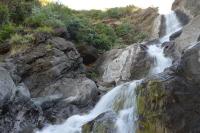
Zim Zim Falls, Waterfall in Knoxville Wildlife Area, California, US
Zim Zim Falls is a waterfall within the Knoxville Wildlife Area that drops roughly 100 feet in a single flow through a rocky canyon. The water feeds into Zim Zim Creek, a small stream that threads through the surrounding landscape of Berryessa-Snow Mountain National Monument.
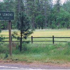
The lands containing this waterfall became open to the public in 2005 when the Knoxville Wildlife Area expanded significantly. This expansion granted visitors access to previously restricted areas of the surrounding wilderness.
Local visitors come to this spot to experience the sound and sight of water falling through the canyon. The falls serve as a gathering point for those seeking a quiet moment in nature away from populated areas.
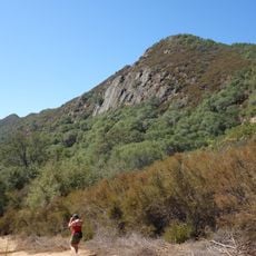
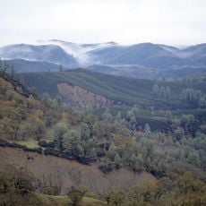
Reaching this waterfall requires at least two hours of hiking over terrain that changes in elevation and ground conditions throughout. Sturdy footwear and a water bottle are essential, as shaded rest spots are few along the trail.
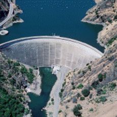
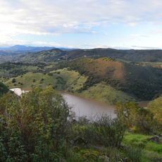
The water from this falls travels through Zim Zim Creek and then into Eticuera Creek before reaching Lake Berryessa miles away. Few visitors realize they are witnessing the beginning of a journey that connects this remote spot to a major lake.
Location: California
GPS coordinates: 38.78051,-122.31893
Latest update: December 14, 2025 17:02
Monticello Dam
35.1 km
Valle de Napa
31.2 km
Petrified Forest
37.4 km
Culinary Institute of America at Greystone
32.9 km
Cobb Mountain
36.7 km
Robert Louis Stevenson State Park
28.4 km
Bothe-Napa Valley State Park
30.8 km
Schramsberg Vineyards
32 km
St. Helena High School
33.8 km
Anderson Marsh State Historic Park
32.2 km
Boggs Mountain Demonstration State Forest
32.5 km
Stebbins Cold Canyon Reserve
35.9 km
Elmshaven
30.5 km
Blue Ridge Berryessa Natural Area
7.8 km
Loch Lomond Vernal Pool Ecological Reserve
36.1 km
Cache Creek Wilderness
22.3 km
Pacific Union College Church
25.7 km
Sam Brannan Cottage
31.4 km
Rector Reservoir
37.8 km
Pope Street Bridge
32.2 km
Atkinson House
37.3 km
James H. Francis House
32.2 km
Grace Episcopal Church
33.6 km
Chateau Pacheteau
33.1 km
Swartz Creek Bridge on Aetna Springs Road
19.6 km
St. Helena Historic Commercial District
33.4 km
Richie Block
33.4 km
Maxwell Creek Bridge on Hardin Road
20.4 kmVisited this place? Tap the stars to rate it and share your experience / photos with the community! Try now! You can cancel it anytime.
Discover hidden gems everywhere you go!
From secret cafés to breathtaking viewpoints, skip the crowded tourist spots and find places that match your style. Our app makes it easy with voice search, smart filtering, route optimization, and insider tips from travelers worldwide. Download now for the complete mobile experience.
A unique approach to discovering new places❞
— Le Figaro
All the places worth exploring❞
— France Info
A tailor-made excursion in just a few clicks❞
— 20 Minutes