Enable Location

We need your location to show you interesting places around you

Discover nearby places

Find interesting locations and hidden gems around you

Precise directions

Get accurate directions and distances to places

Your location is never shared with other users. It's only used when you tap the location button.

Cache Creek Wilderness

Log in to your account

Start exploring — it's free

Trusted by 63,002 travelers worldwide

Continue with Google
Continue with Apple
or

We will send you a code to connect

By continuing, you accept our Terms and Conditions and our Privacy Policy

Check your inbox

We've sent a pincode in your inbox. Please enter the code below.

Cache Creek Wilderness
Discussion Reviews 1 Photos
2.4k Popularity

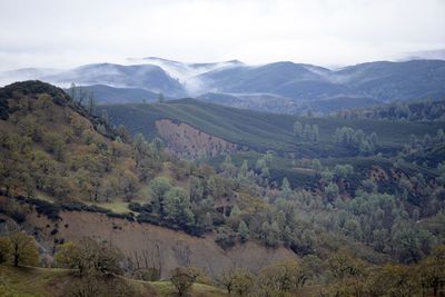
Cache Creek Wilderness, Protected wilderness area near Clear Lake, California, United States.

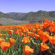
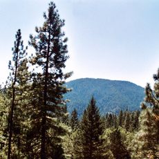
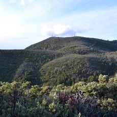
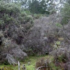
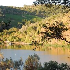
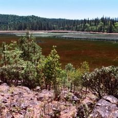
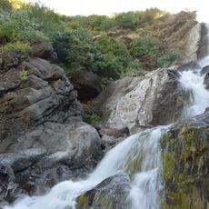
Cache Creek Wilderness is a protected natural area in Lake County featuring steep hillsides, open grasslands, rocky cliffs, and flowing streams. The landscape combines different terrain types where forests, meadows, and water systems come together across the preservation.

The area received official protection status in 2006 when Congress designated it as a national wilderness. This designation came to preserve the natural resources and varied habitats found throughout the region.

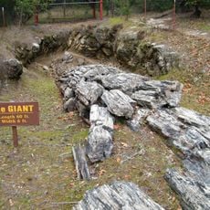
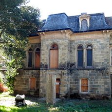
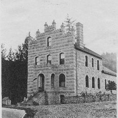
The landscape bears traces of settlements that existed long before modern times in this region. Walking through the area, visitors can find archaeological sites that tell stories of the people who once lived here.

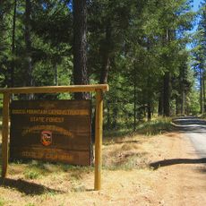
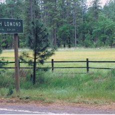
Visitors can enter the wilderness through several trailheads such as Redbud, Judge Davis, and High Bridge locations. The terrain demands good hiking preparation since steep slopes and varied paths make the experience physically demanding.

The region supports one of California's largest populations of a rare deer species along with year-round resident bald eagles. For wildlife watchers, these animal encounters often become memorable highlights of a visit.

The community of curious travelers

AroundUs brings together thousands of curated places, local tips, and hidden gems, enriched daily by 60,000 contributors worldwide.

Start exploring
Location
GPS coordinates
38.91830,-122.50600
Latest update
December 13, 2025 11:42
Around this place
Chateau Montelena
United States of America

Chateau Montelena

35.9 km
Castello di Amorosa
United States of America

Castello di Amorosa

40.2 km
Petrified Forest
United States of America

Petrified Forest

41.9 km
Mount Konocti
United States of America

Mount Konocti

23.5 km
Berryessa Snow Mountain National Monument
United States of America

Berryessa Snow Mountain National Monument

19.2 km
Cobb Mountain
United States of America

Cobb Mountain

23.8 km
Robert Louis Stevenson State Park
United States of America

Robert Louis Stevenson State Park

30.7 km
Bothe-Napa Valley State Park
United States of America

Bothe-Napa Valley State Park

40.9 km
Schramsberg Vineyards
United States of America

Schramsberg Vineyards

41 km
Clear Lake State Park
United States of America

Clear Lake State Park

28.1 km
Anderson Marsh State Historic Park
United States of America

Anderson Marsh State Historic Park

11.5 km
Boggs Mountain Demonstration State Forest
United States of America

Boggs Mountain Demonstration State Forest

19.3 km
Boggs Lake Ecological Reserve
United States of America

Boggs Lake Ecological Reserve

23.7 km
Blue Ridge Berryessa Natural Area
United States of America

Blue Ridge Berryessa Natural Area

20.9 km
Loch Lomond Vernal Pool Ecological Reserve
United States of America

Loch Lomond Vernal Pool Ecological Reserve

19.4 km
Pacific Union College Church
United States of America

Pacific Union College Church

39.1 km
Sacramento Valley Museum
United States of America

Sacramento Valley Museum

39.5 km
Zim Zim Falls
United States of America

Zim Zim Falls

22.3 km
Francis Ford Coppola Winery
United States of America

Francis Ford Coppola Winery

42.4 km
Sam Brannan Cottage
United States of America

Sam Brannan Cottage

37.9 km
Lakeport Carnegie Library
United States of America

Lakeport Carnegie Library

37.9 km
California Coast Ranges Biosphere Reserve
United States of America

California Coast Ranges Biosphere Reserve

37 km
Old Lake County Courthouse
United States of America

Old Lake County Courthouse

38.2 km
James H. Francis House
United States of America

James H. Francis House

38.6 km
Chateau Pacheteau
United States of America

Chateau Pacheteau

40 km
Swartz Creek Bridge on Aetna Springs Road
United States of America

Swartz Creek Bridge on Aetna Springs Road

29.6 km
Maxwell Creek Bridge on Hardin Road
United States of America

Maxwell Creek Bridge on Hardin Road

37.2 km
Garnett Creek Bridge on Greenwood Avenue
United States of America

Garnett Creek Bridge on Greenwood Avenue

37 km
Show the full map
Reviews
Share your experience

No review yet

Discussions
Start a discussion...

No discussion yet

« Cache Creek Wilderness - Protected wilderness area near Clear Lake, California, United States » is provided by Around Us (aroundus.com). Images and texts are derived from Wikimedia project under a Creative Commons license. You are allowed to copy, distribute, and modify copies of this page, under the conditions set by the license, as long as this note is clearly visible.

Discover hidden gems everywhere you go!

From secret cafés to breathtaking viewpoints, skip the crowded tourist spots and find places that match your style. Our app makes it easy with voice search, smart filtering, route optimization, and insider tips from travelers worldwide. Download now for the complete mobile experience.

Around Us App Screenshot

A unique approach to discovering new places

Le Figaro

All the places worth exploring

France Info

A tailor-made excursion in just a few clicks

20 Minutes

Around Us
Travel Guide & Maps
Download

Send to your phone

QR Code
1

Open the camera app on your mobile.

2

Point at the QR code with your camera. A notification will appear.

3

Tap the notification to open the link.