Chest opened
+${chestReward.xp} XP
Explorer
NOUVEAU ×${chestReward.collectible.quantity}
tapez pour fermer
Chest locked

Open chests in the app

Around Us is built for your phone — chests unlock when you walk, explore and capture nearby places.

Enable Location

We need your location to show you interesting places around you

Discover nearby places

Find interesting locations and hidden gems around you

Precise directions

Get accurate directions and distances to places

Your location is never shared with other users. It's only used when you tap the location button.

Log in to your account

Start exploring — it's free

Trusted by 72,890 travelers worldwide

Continue with Google
Continue with Apple
or

We will send you a code to connect

By continuing, you accept our Terms and Conditions and our Privacy Policy

Check your inbox

We've sent a pincode in your inbox. Please enter the code below.

Wolf Creek Falls
Discussion Reviews Photo
1.3k Popularity

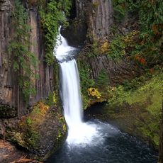
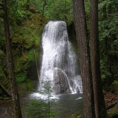
Wolf Creek Falls, Cascading waterfall in Umpqua National Forest, Oregon.

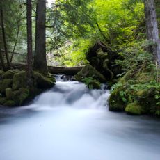
Wolf Creek Falls is a two-tier waterfall in Umpqua National Forest where water cascades from rocky cliffs into a deep green pool. The setting features dense forest and natural rock formations shaped by flowing water over time.

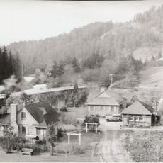
The waterfall sits in a forest area that experienced significant logging throughout the 1800s. This logging activity reshaped the landscape surrounding the water flow.

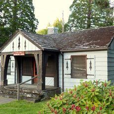
The Wolf Creek Falls area serves as an educational center where visitors learn about regional geology, wildlife patterns, and forest ecosystems of Southern Oregon.

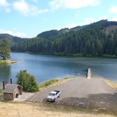
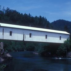
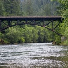
To reach the waterfall, follow a trail that is about 1.2 miles long starting from a recreation area where you will find a pedestrian bridge. The path climbs gradually and is manageable for most visitors.

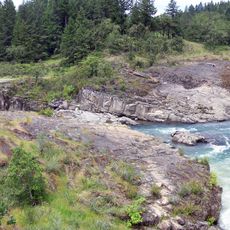
During winter months, the waterfall carries its greatest volume of water, while summer reveals fine patterns in the bedrock that are usually hidden. These changing views show how water gradually shapes rock over long periods.

The community of curious travelers

AroundUs brings together thousands of curated places, local tips, and hidden gems, enriched daily by 60,000 contributors worldwide.

Start exploring
Location
GPS coordinates
43.21828,-122.94758
Latest update
December 14, 2025 18:14
Around this place
Toketee Falls
United States of America

Toketee Falls

42 km
Wildlife Safari
United States of America

Wildlife Safari

39.8 km
Boulder Creek Wilderness
United States of America

Boulder Creek Wilderness

37.8 km
Colliding Rivers
United States of America

Colliding Rivers

15.3 km
Cooper Creek Reservoir
United States of America

Cooper Creek Reservoir

32.5 km
North Umpqua Trail
United States of America

North Umpqua Trail

13 km
Tiller Ranger Station
United States of America

Tiller Ranger Station

32.4 km
Yakso Falls
United States of America

Yakso Falls

18.8 km
Methodist Episcopal Church South
United States of America

Methodist Episcopal Church South

32.3 km
Floed–Lane House
United States of America

Floed–Lane House

32.3 km
Milo Academy Bridge
United States of America

Milo Academy Bridge

32.3 km
Horse Creek Bridge
United States of America

Horse Creek Bridge

35.3 km
Neal Lane Bridge
United States of America

Neal Lane Bridge

34.8 km
Roseburg National Guard Armory
United States of America

Roseburg National Guard Armory

31.9 km
Rochester Covered Bridge
United States of America

Rochester Covered Bridge

39.4 km
Judge James Watson Hamilton House
United States of America

Judge James Watson Hamilton House

32.1 km
Cavitt Creek Bridge
United States of America

Cavitt Creek Bridge

6.7 km
Glide Ranger Station
United States of America

Glide Ranger Station

15.3 km
U.S. Post Office
United States of America

U.S. Post Office

32.3 km
Stearns Hardware Store
United States of America

Stearns Hardware Store

36.3 km
Oakland Historic District
United States of America

Oakland Historic District

36.3 km
Kohlhagen Building
United States of America

Kohlhagen Building

32.1 km
Oregon State Soldier's Home Hospital
United States of America

Oregon State Soldier's Home Hospital

34.1 km
English Settlement School
United States of America

English Settlement School

36 km
Sutherlin Bank Building
United States of America

Sutherlin Bank Building

35.2 km
Mott Bridge
United States of America

Mott Bridge

22.1 km
Douglas County Museum
United States of America

Douglas County Museum

33.6 km
Red Mountain Lookout
United States of America

Red Mountain Lookout

32.5 km
Show the full map
Reviews
Share your experience

No review yet

Discussions
Start a discussion...

No discussion yet

« Wolf Creek Falls - Cascading waterfall in Umpqua National Forest, Oregon » is provided by Around Us (aroundus.com). Images and texts are derived from Wikimedia project under a Creative Commons license. You are allowed to copy, distribute, and modify copies of this page, under the conditions set by the license, as long as this note is clearly visible.

Discover hidden gems everywhere you go!

From secret cafés to breathtaking viewpoints, skip the crowded tourist spots and find places that match your style. Our app makes it easy with voice search, smart filtering, route optimization, and insider tips from travelers worldwide. Download now for the complete mobile experience.

Around Us App Screenshot

A unique approach to discovering new places

Le Figaro

All the places worth exploring

France Info

A tailor-made excursion in just a few clicks

20 Minutes

Around Us
Travel Guide & Maps
Download

Send to your phone

QR Code
1

Open the camera app on your mobile.

2

Point at the QR code with your camera. A notification will appear.

3

Tap the notification to open the link.