Mount Ara, Stratovolcanic mountain in Kotayk Province, Armenia
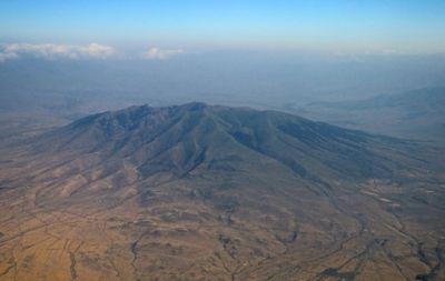
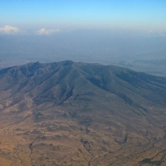
Mount Ara is a polygenetic stratovolcanic cone on the border of Kotayk and Aragatsotn provinces, 33 km north of Yerevan. It rises to 2577 m and has a destroyed crater with a base diameter of 9 km at 1900 m. The volcano is built from lava and agglomerate layers with intrusions of andesite and dacite; its north and east slopes are forested.
Mount Ara is a polygenetic stratovolcano built from lava and agglomerate layers with intrusions of andesite and dacite. One K-Ar date gives an age of about 1.3 million years. Its crater is destroyed, and two subsidiary cones, Nokhut and Shakhvard, stand on its flanks; a flank cone south of Arailer erupted andesite, and lava flows reached the Hrazdan River.
The mountain's name comes from Ara the Beautiful, the legendary Armenian king who, according to tradition, camped his troops at its foot before fighting Queen Semiramis. Seen from Yerevan, the peaks are said to resemble a reclining man. Residents of Yeghvard call the highest summit stone Aghlorakar, Ara's nose.
Multiple hiking trails cross the forested sections on the northern and eastern slopes, with conditions varying by season. Spring offers the best trekking conditions and the safest path access.
Conizonia kalashiani is a beetle, not a plant, and it is endemic to Arailer. The mountain also hosts Armenohelops armeniacus and Cylindronotus erivanus, and its bird list includes the Golden Eagle, Lesser Spotted Eagle, Caucasian Black Grouse and Red-billed Chough, which led to the area being recognised as an Important Bird Area.
The community of curious travelers
AroundUs brings together thousands of curated places, local tips, and hidden gems, enriched daily by 92,586 contributors worldwide.