Nahuelbuta National Park, National park in La Araucanía, Chile
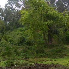
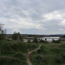
Nahuelbuta National Park covers 6,832 hectares atop the highest part of the Cordillera de Nahuelbuta, mainly in Malleco Province, Araucanía, with a smaller part in Arauco Province, Bío-Bío. It protects forests of monkey puzzle trees, some estimated at nearly 2,000 years old, along with coigüe, ñirre, roble and lenga. The park has 15 trails and 30 roads; the most popular route starts at Pehuenco and ends at Cerro Piedra del Águila, 1,379 meters above sea level.
The park was established in 1939 to protect the ancient ecosystem and prehistoric-looking forests from logging. This designation marked a turning point in safeguarding the region's natural landscape from further environmental damage.
The name Nahuelbuta comes from Mapudungun nawelfütra, meaning 'great puma' (often rendered 'big tiger'). The park lies in the Nahuelbuta Range, and its monkey puzzle forests are part of the Mapuche landscape. Visitors can see lichens hanging from the branches of the araucarias.
Access is by three roads: from Angol 36 km (22 km gravel, then dirt, about an hour), from Cañete 12 km paved through the Cayucupil valley plus 30 km gravel, and from Antihuala 60 km of dirt through El Chacay forest land, about two and a half hours. In autumn and winter the Angol route needs 4x4 and chains; in midwinter the last 8 km from Cañete need four-wheel drive and chains. The Pehuenco administration office opens only in spring and summer; the Los Portones ranger office, 5 km away on the eastern boundary, works all year.
The area is home to rare species like Darwin's fox, small deer, and carnivorous plants adapted to the mountain environment. These specialized communities developed through the park's isolated location and altitude, making wildlife encounters unusual and memorable.
The community of curious travelers
AroundUs brings together thousands of curated places, local tips, and hidden gems, enriched daily by 94,043 contributors worldwide.