Cerro Azul, Stratovolcano in Maule Region, Chile
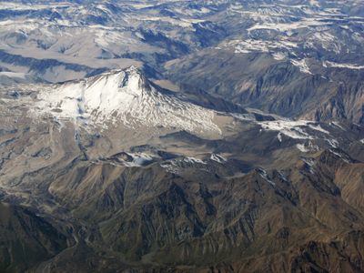
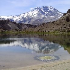
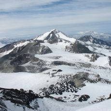
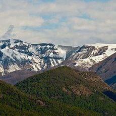
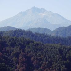
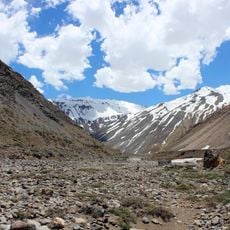
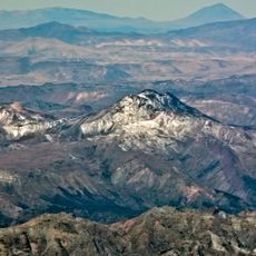
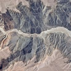
Cerro Azul is a stratovolcano in the Maule Region that rises to 3,788 meters above sea level and features a summit crater at its peak. The volcano's structure shows multiple secondary cones and vents distributed across its slopes, built up from layered deposits of volcanic ash and lava.
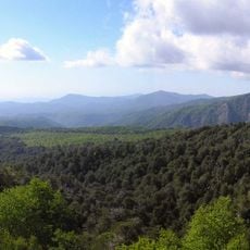
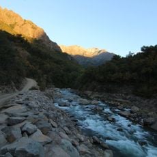
The volcano has been active multiple times in recent centuries, leaving distinct marks on the landscape through major eruptions. These events shaped the geology of south-central Chile and have been remembered by people living in the region.
Local shepherds in the Maule Region maintain stories about past eruptions that have been passed down through generations. These accounts reflect how the volcano shapes the identity and memory of people who live near it.
Access requires permits and professional guidance due to geological hazards and changing weather in the area. It is essential to check local regulations before visiting and to bring appropriate gear along with experienced guides.
The structure reveals a complex system of secondary and flank craters that point to a long history of varying eruptive processes. This pattern shows how different types of volcanic activity over time changed the mountain's shape and appearance.
GPS coordinates: -35.65673,-70.76311
Latest update: December 8, 2025 13:41
Radal Siete Tazas National Park
27.9 km
Descabezado Grande
7.5 km
Planchón-Peteroa
49.6 km
Altos de Lircay National Reserve
17.4 km
Volcán Planchón
51.4 km
Nevado de Longaví
70.1 km
Estadio Fiscal de Linares
78 km
Los Bellotos del Melado National Reserve
38.2 km
Abanico Formation
80.2 km
Puente ferroviario Maule
85.3 km
Jardín botánico de la Universidad de Talca
85 km
Museo de Arte y Artesanía de Linares
78.3 km
Aduana de Los Queñes
73.3 km
San Pedro de Tarara
38.3 km
Iglesia del Corazón de María, Linares
78.7 km
Museo Histórico de Yerbas Buenas
74.7 km
Lomas Blancas
74 km
Memorial de Linares
78.3 km
Salto La Leona
32.7 km
Iglesia de San José
68.9 km
Siete Tazas
32.5 km
Puentes carreteros Maule
85.3 km
Parroquia Corazón de María de Linares
78.7 km
Mercado Central Municipal de Talca
85.2 km
Escuelas Concentradas de Talca. Escuela Superior de Hombres Carlos Salinas.
85.3 km
Escuelas Concentradas de Talca. Escuela Superior de Niñas Presidente José Manuel Balmaceda y Fernández.
85.3 km
Puente ferroviario sobre el río Pangue
81 km
Sector de la Plaza de Armas de Yerbas Buenas
74.9 kmVisited this place? Tap the stars to rate it and share your experience / photos with the community! Try now! You can cancel it anytime.
Discover hidden gems everywhere you go!
From secret cafés to breathtaking viewpoints, skip the crowded tourist spots and find places that match your style. Our app makes it easy with voice search, smart filtering, route optimization, and insider tips from travelers worldwide. Download now for the complete mobile experience.
A unique approach to discovering new places❞
— Le Figaro
All the places worth exploring❞
— France Info
A tailor-made excursion in just a few clicks❞
— 20 Minutes