Huabal District, district in Cajamarca, Peru
Location: Jaén Province
Elevation above the sea: 1,785 m
Shares border with: Bellavista District, Las Pirias District, Jaén District, San José del Alto District
GPS coordinates: -5.61170,-78.90067
Latest update: March 7, 2025 19:36
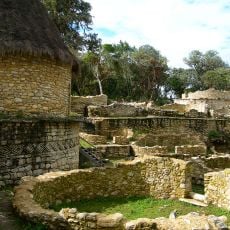
Kuelap
140.6 km
Gocta Cataracts
121.2 km
Cutervo National Park
66.9 km
Pómac Forest Historical Sanctuary
136.4 km
Alto Mayo Protection Forest
133.1 km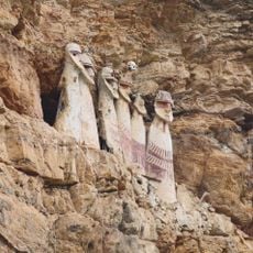
Sarcophagi of Carajía
115 km
Batán Grande
137.7 km
Laquipampa Wildlife Refuge
104.5 km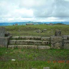
Pacopampa
81.4 km
Yacurí National Park
116 km
Yumbilla Falls
115.8 km
Teleférico de Kuelap
139.2 km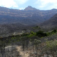
Private Conservation Area Chaparrí
131.1 km
Pongo de Rentema
40 km
Pagaibamba Protection Forest
90.4 km
Cañón del Sonche
131.8 km
Church of Our Lady of the Pillar
140.9 km
Bosques Nublados de Udima Wildlife Refuge
139 km
Carachupa
76.4 km
Señor de Burgos Church, Amazonas
133.5 km
Ñaupe River
110.6 km
El Tintero
140.6 km
Cataratas Numparket
64.2 km
Atumpucro
144.1 km
Río Sonche
124.4 km
Río Serranoyacu
143 km
Cueva de las Tres Naranjas
61.3 km
Cueva de Atunpampa
119.1 kmReviews
Visited this place? Tap the stars to rate it and share your experience / photos with the community! Try now! You can cancel it anytime.
Discover hidden gems everywhere you go!
From secret cafés to breathtaking viewpoints, skip the crowded tourist spots and find places that match your style. Our app makes it easy with voice search, smart filtering, route optimization, and insider tips from travelers worldwide. Download now for the complete mobile experience.

A unique approach to discovering new places❞
— Le Figaro
All the places worth exploring❞
— France Info
A tailor-made excursion in just a few clicks❞
— 20 Minutes