
Chorro La Estrella, Wasserfall in Kolumbien
Location: Colombia
Elevation above the sea: 91 m
GPS coordinates: -1.09306,-69.64556
Latest update: March 8, 2025 01:24

Pico da Neblina
456.4 km
Chiribiquete National Park
404.5 km
Amacayacu National Park
273.1 km
The Hub on Causeway
416 km
Piedra del Cocuy
407.7 km
Pico da Neblina National Park
440.9 km
Pico 31 de Março
456.8 km
Puente Nanay
495 km
Serranía La Neblina National Park
461.3 km
Piedra del Cocuy Natural Monument
407.7 km
Chiribiquete's rock shelters
439.2 km
Centro histórico de Iquitos
495.8 km
Santa Rosa Island
350.6 km
Mamirauá Sustainable Development Reserve
460 km
Bellavista-Nanay
494.9 km
Morro dos Seis Lagos Biological Reserve
364.3 km
BAP América
496 km
Central Amazon Ecological Corridor
314.4 km
Forte de São José de Marabitanas
395.3 km
Cué-cué/Marabitanas Indigenous Territory
375.3 km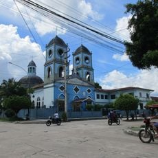
Iglesia de la Inmaculada Concepción
496.2 km
Chineria Island
347.5 km
Natural Reserve Palmari
362.9 km
Auatí-Paraná Extractive Reserve
359.8 km
French Alliance of Iquitos
497.1 km
Parroquia de Santa Rosa de Lima (Mazán)
467.6 km
Ilha Aramacá
362 km
Ilhas Arariá
361.4 kmReviews
Visited this place? Tap the stars to rate it and share your experience / photos with the community! Try now! You can cancel it anytime.
Discover hidden gems everywhere you go!
From secret cafés to breathtaking viewpoints, skip the crowded tourist spots and find places that match your style. Our app makes it easy with voice search, smart filtering, route optimization, and insider tips from travelers worldwide. Download now for the complete mobile experience.

A unique approach to discovering new places❞
— Le Figaro
All the places worth exploring❞
— France Info
A tailor-made excursion in just a few clicks❞
— 20 Minutes