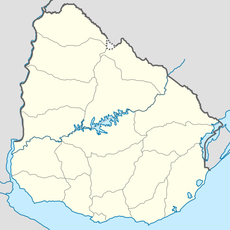
Cerro Catedral, Mountain summit in Maldonado Department, Uruguay
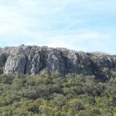
Cerro Catedral is a granite mountain in the Maldonado region that reaches approximately 514 meters in height. Its upper section displays distinctive rock formations in a bare area with sparse plant growth.
The mountain was surveyed in 1973 by the Military Geographic Service and confirmed as the highest point in Uruguay. This measurement settled earlier questions about the country's tallest elevations.
The name "Catedral" comes from the shapes of the granite blocks near the summit, which resemble a cathedral and are common in southern Uruguay. The hill is also called Cerro Cordillera. Since 1973 a geodesic marker has stood at the exact highest point, and walkers reach it on foot from the dirt Camino al Cerro Catedral, near routes 109 and 39.
Access is on foot from the dirt Camino al Cerro Catedral, reached from Routes 109 and 39; the road conditions improved after the Sierra de Carapé wind farm was built. Strong winds blow year-round and frosts are frequent, with snow rare. The summit is hard to pick out from a distance, so follow the track rather than the skyline.
Since 2014 the Sierra de Carapé wind farm has surrounded the hill, running since late 2015 with 90 MW installed; some turbines stand taller than the summit itself. The access roads and Route 109 were improved for the project.
The community of curious travelers
AroundUs brings together thousands of curated places, local tips, and hidden gems, enriched daily by 92,632 contributors worldwide.