Enable Location

We need your location to show you interesting places around you

Discover nearby places

Find interesting locations and hidden gems around you

Precise directions

Get accurate directions and distances to places

Your location is never shared with other users. It's only used when you tap the location button.

Ch'iyar Qirini

Log in to your account

Start exploring — it's free

Trusted by 60,651 travelers worldwide

Continue with Google
Continue with Apple
or

We will send you a code to connect

By continuing, you accept our Terms and Conditions and our Privacy Policy

Check your inbox

We've sent a pincode in your inbox. Please enter the code below.

Ch'iyar Qirini

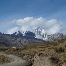
Ch'iyar Qirini, Mountain summit in Cordillera Real, Bolivia.

Description

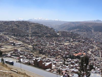
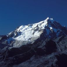
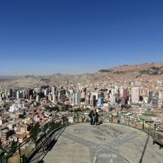
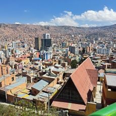
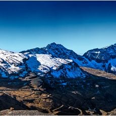
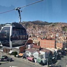
Ch'iyar Qirini is a mountain summit in the Cordillera Real that rises to 5,363 meters with steep slopes and rocky formations dominating the landscape. The peak stands near the border of El Alto Municipality in the high-altitude Andean environment.

History

Indigenous populations of the Cordillera Real have traveled the paths around this peak for centuries, establishing traditional routes through the high mountains. These ancient pathways shaped human movement in the region and show the long presence of people in this extreme terrain.

Culture

The name comes from Aymara language: ch'iyara means black and qiri means scale, reflecting the local linguistic heritage of this Andean region. These language roots remain present in the area today and connect visitors to the indigenous past of the place.

Practical

Reaching this summit requires a sturdy vehicle to navigate the unpaved road from Ruta 41 across rough terrain. Access depends on weather conditions and becomes more difficult during the rainy season, so visitors should plan for dry periods and be prepared for the high-altitude environment.

Did you know?

Two lakes called Qillwani lie north of the peak and provide visual landmarks in this high mountain landscape. These water bodies demonstrate how the high Andes are shaped by glacial melt and alpine hydrology.

GPS coordinates
-16.34116,-68.11567
Latest update
December 14, 2025 20:01

AroundUs brings together thousands of curated places, local tips, and hidden gems, enriched daily by 60,000 contributors worldwide. Discover all places nearby (Bolivia).

« Ch'iyar Qirini - Mountain summit in Cordillera Real, Bolivia » is provided by Around Us (aroundus.com). Images and texts are derived from Wikimedia project under a Creative Commons license. You are allowed to copy, distribute, and modify copies of this page, under the conditions set by the license, as long as this note is clearly visible.

Discover hidden gems everywhere you go!

From secret cafés to breathtaking viewpoints, skip the crowded tourist spots and find places that match your style. Our app makes it easy with voice search, smart filtering, route optimization, and insider tips from travelers worldwide. Download now for the complete mobile experience.

Around Us App Screenshot

A unique approach to discovering new places

Le Figaro

All the places worth exploring

France Info

A tailor-made excursion in just a few clicks

20 Minutes

Around Us
Travel Guide & Maps
Download

Send to your phone

QR Code
1

Open the camera app on your mobile.

2

Point at the QR code with your camera. A notification will appear.

3

Tap the notification to open the link.