Enable Location

We need your location to show you interesting places around you

Discover nearby places

Find interesting locations and hidden gems around you

Precise directions

Get accurate directions and distances to places

Your location is never shared with other users. It's only used when you tap the location button.

Ouro Preto do Oeste

Log in to your account

Start exploring — it's free

Trusted by 62,621 travelers worldwide

Continue with Google
Continue with Apple
or

We will send you a code to connect

By continuing, you accept our Terms and Conditions and our Privacy Policy

Check your inbox

We've sent a pincode in your inbox. Please enter the code below.

Ouro Preto do Oeste, Municipality in Rondônia, Brazil

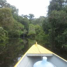
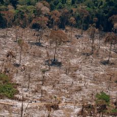
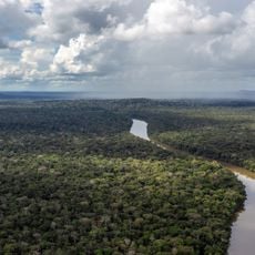
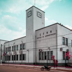
Ouro Preto do Oeste is a municipality in Rondônia featuring agricultural areas and remaining stretches of Amazon forest across its territory. The administrative center provides core services and infrastructure that support the surrounding community.

The settlement began as one of the first organized colonization efforts in Rondônia during the region's early development. This foundational project influenced how communities and agriculture expanded across western Brazil.

Local families practice farming and traditional handicrafts that shape daily routines throughout the town. These activities remain visible in community spaces and markets where people gather to work and trade.

The town operates on Amazon Time and is best explored during daylight hours when public spaces and markets are active. Core services focus on local needs rather than tourism facilities, so visitors should plan accordingly.

The name translates literally to Black Gold of the West, reflecting the agricultural abundance that drew early settlers to this remote part of the Amazon. This poetic name captures the hopes and economic dreams that pioneers brought to the frontier.

The community of curious travelers

AroundUs brings together thousands of curated places, local tips, and hidden gems, enriched daily by 60,000 contributors worldwide.

Start exploring
Location
Elevation above the sea
184 m
Shares border with
Jaru, Teixeirópolis, Ji-Paraná, Nova União, Vale do Paraíso
GPS coordinates
-10.74806,-62.21583
Latest update
December 7, 2025 20:45
« Ouro Preto do Oeste - Municipality in Rondônia, Brazil » is provided by Around Us (aroundus.com). Images and texts are derived from Wikimedia project under a Creative Commons license. You are allowed to copy, distribute, and modify copies of this page, under the conditions set by the license, as long as this note is clearly visible.

Discover hidden gems everywhere you go!

From secret cafés to breathtaking viewpoints, skip the crowded tourist spots and find places that match your style. Our app makes it easy with voice search, smart filtering, route optimization, and insider tips from travelers worldwide. Download now for the complete mobile experience.

Around Us App Screenshot

A unique approach to discovering new places

Le Figaro

All the places worth exploring

France Info

A tailor-made excursion in just a few clicks

20 Minutes

Around Us
Travel Guide & Maps
Download

Send to your phone

QR Code
1

Open the camera app on your mobile.

2

Point at the QR code with your camera. A notification will appear.

3

Tap the notification to open the link.