Enable Location

We need your location to show you interesting places around you

Discover nearby places

Find interesting locations and hidden gems around you

Precise directions

Get accurate directions and distances to places

Your location is never shared with other users. It's only used when you tap the location button.

Iranduba

Log in to your account

Start exploring — it's free

Trusted by 62,839 travelers worldwide

Continue with Google
Continue with Apple
or

We will send you a code to connect

By continuing, you accept our Terms and Conditions and our Privacy Policy

Check your inbox

We've sent a pincode in your inbox. Please enter the code below.

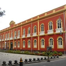
Iranduba, Administrative division near Manaus, Brazil.

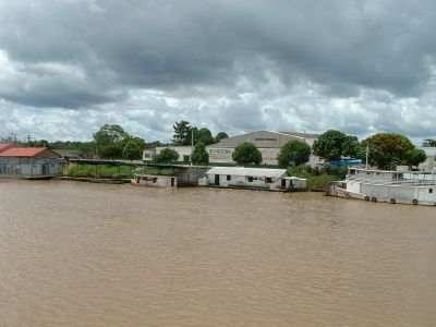
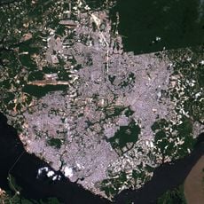
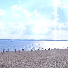
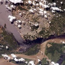
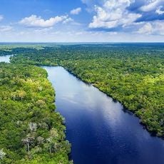
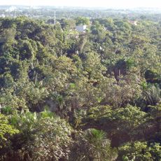
Iranduba is a municipality in Amazonas state located on the banks of Rio Negro and Solimões rivers, forming a key connection to the Amazon region. The area covers 2,215 square kilometers where river landscapes and settlements coexist.

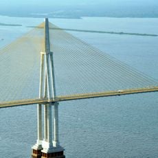
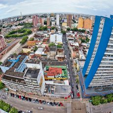
The region developed as an important transportation hub along Amazon river routes. The completion of the Manaus-Iranduba Bridge in 2011 transformed accessibility by connecting the area directly to the state capital.

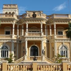
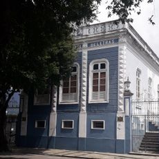
The municipality blends traditional ways of life with influences from other Brazilian regions, visible in local festivals and community gatherings. This mix shapes how people live together and define their identity.

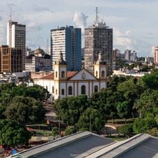
The area is reachable via the cable-stayed bridge from Manaus or by water, with regular boat services running throughout the day. Visitors should prepare for tropical humidity and timing visits during drier months works best.

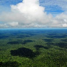
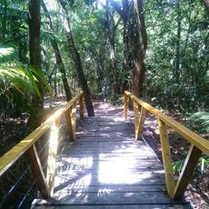
The area protects a large portion of the Rio Negro Right Bank Environmental Protection Area, encompassing over one million hectares of Amazon rainforest. This protected zone preserves one of the region's most vital ecosystems.

The community of curious travelers

AroundUs brings together thousands of curated places, local tips, and hidden gems, enriched daily by 60,000 contributors worldwide.

Start exploring
Location
Inception
1981
Elevation above the sea
17 m
Shares border with
Manaus, Careiro da Várzea, Manacapuru, Manaquiri, Novo Airão
GPS coordinates
-3.28500,-60.18861
Latest update
December 7, 2025 10:06
« Iranduba - Administrative division near Manaus, Brazil » is provided by Around Us (aroundus.com). Images and texts are derived from Wikimedia project under a Creative Commons license. You are allowed to copy, distribute, and modify copies of this page, under the conditions set by the license, as long as this note is clearly visible.

Discover hidden gems everywhere you go!

From secret cafés to breathtaking viewpoints, skip the crowded tourist spots and find places that match your style. Our app makes it easy with voice search, smart filtering, route optimization, and insider tips from travelers worldwide. Download now for the complete mobile experience.

Around Us App Screenshot

A unique approach to discovering new places

Le Figaro

All the places worth exploring

France Info

A tailor-made excursion in just a few clicks

20 Minutes

Around Us
Travel Guide & Maps
Download

Send to your phone

QR Code
1

Open the camera app on your mobile.

2

Point at the QR code with your camera. A notification will appear.

3

Tap the notification to open the link.